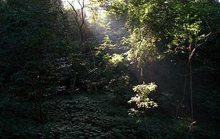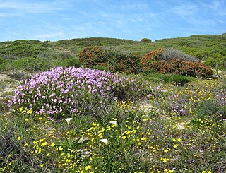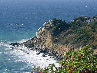
The Rondevlei Nature Reserve is located in Grassy Park, Zeekoevlei and Lavenderhill, suburbs of Cape Town, South Africa. The bird sanctuary covers approximately 290 hectares of mostly permanent wetland and consists of a single large brackish lagoon. The nature reserve is among the most important wetlands for birds in South Africa despite being situated directly alongside the Zeekoevlei. A number of islands on the vlei act as vital breeding sites. Rondevlei is home to about 230 bird species, a variety of small mammals and reptiles like caracal, porcupine, Cape fox, grysbuck, steenbuck and mongoose, as well as a hippopotamus population which was re-introduced in 1981 as a means to control an alien grass species from South America, which had covered the shoreline and was threatening to engulf the vlei itself. It boasts unusual and threatened ecosystems like strandveld, sand plains fynbos, Cape lowland wetland vegetation and indigenous coastal fynbos vegetation with unique plants found nowhere else in the world.

Helderberg refers to a planning district of the City of Cape Town metropolitan municipality, the mountain after which it is named, a wine-producing area in the Western Cape province of South Africa, or a small census area in Somerset West.
East London Coast Nature Reserve is a protected area in Eastern Cape Province, South Africa that is managed by Eastern Cape Parks. It covers an area of 3,424 hectares and incorporates 12 smaller nature reserves and protected areas.

Areas of forest which grow in KwaZulu-Natal, South Africa mostly on south facing slopes in higher rainfall areas, and along the humid coastal areas. Different types of forest can be identified by their species composition which depends mostly on the altitude, latitude and substrate in which they grow. South facing slopes are favourable for the development of forest as they are more shaded, and therefore cooler and retain more moisture than the northern slopes. The extra moisture on the south slopes is not only favoured by forest trees, but also helps to prevent or subdue wildfires. Fires can also be blocked by cliff faces and rocks or boulders on these slopes, and by streams or rivers at the base of the slopes. The coastal regions are conducive to forest formation, because of high rainfall and humidity which are favoured by forest trees and also help to prevent or subdue fires. The rivers of the coastal areas are also broader than further inland, which may often prevent fires from spreading long distances, and fires generally burn uphill and therefore more often away from areas at low altitude.

Mimusops afra is a species of tree in family Sapotaceae. This tree is found in coastal dune vegetation in Southern Africa from the Eastern Cape, through KwaZulu-Natal to southern Mozambique.

Aloiampelos ciliaris, the common climbing-aloe, is a thin-leaved and generally rapidly-growing succulent plant from Southern Africa.

Sideroxylon inerme is a southern and eastern African coastal tree, with dense foliage, black berries and small, foetid, greenish flowers. The tree's generic name means "Iron-wood" in Greek, referring to its very hard timber.

Cape Flats Dune Strandveld is an endangered vegetation type. This is a unique type of Cape Strandveld that is endemic to the coastal areas around Cape Town, including the Cape Flats.
Zandvlei Estuary Nature Reserve is a 300-hectare (740-acre) nature reserve and recreational area located in Muizenberg near Cape Town, South Africa.
Witzands Aquifer Nature Reserve is a 3,000-hectare (7,400-acre) protected natural area in Cape Town, South Africa, located on the city's northern outskirts. This reserve protects an important part of Cape Town's natural and cultural heritage, including the Atlantis Aquifer. It is adjacent to the Koeberg Nature Reserve.

Wolfgat Nature Reserve is a coastal nature reserve in Mitchells Plain on False Bay in the Western Cape, South Africa.

Macassar Dunes Conservation Area is a 1,116-hectare (2,760-acre) coastal nature reserve in Macassar, within the City of Cape Town, South Africa.

Kogelberg Nature Reserve is a nature reserve of 3,000 ha comprising the Kogelberg Mountain Range, to the east of Cape Town, South Africa.

Cape Martian Reserve, also known as Cape Martyan Reserve, is a nature reserve located on the southern coast of the Crimean Peninsula, near the Ukrainian city of Yalta and the Nikitsky Botanical Gardens. Established to protect its unique ecosystem and biodiversity, the reserve is home to many plant and animal species, some of which are specific to the Mediterranean climate of the region. Given its ecological importance, it plays a role in conservation and scientific research. Its picturesque landscapes overlooking the Black Sea also make it a point of interest for nature enthusiasts.

The 950 hectares Chirinda Forest Botanical Reserve is situated on the slopes of Mount Selinda, 30 km south of Chipinge, in the Chipinge Highlands of Manicaland, Zimbabwe, and is administered by the Forestry Commission. The reserve is situated at between 900 and 1,200 m in altitude, and receives some 1,370 mm (54 in) to 1,466 mm (57.7 in) of annual rainfall. 606 hectares of its higher levels, above 1,076 m (3,530 ft), is covered by moist evergreen forest, specifically Zanzibar-Inhambane transitional rain forest, of which it represents the southernmost occurrence. The headwaters of three streams, namely the Zona, Chinyika and Musangazi, drain the two broad highlands which it encloses. The boundaries of the reserve are not strictly enforced, so that cattle grazing and plant harvesting are ongoing. The reserve is surrounded by communal settlements, commercial timber plantations and small-scale commercial farming units. The naturalist Charles Swynnerton was appointed manager of the nearby Gungunyana farm in 1900, and a number of plant, bird and insect names commemorate his collecting activities of the next two decades. Chirinda means "lookout" or "vantage point" in the chiNdau language, or perhaps "place of refuge".

The Cape Morgan Nature Reserve, nestled within the expansive East London Coast Nature Reserve, is a coastal forest reserve in the Wild Coast region of the Eastern Cape. On its western side, lies the Morgan Bay estuary, while it is flanked on the eastern side by the Cwili estuary. Nearby are the villages of Morgan Bay and Kei Mouth. Southwest of the reserve is the Morgan Bay beach. Its shoreline is enclosed by the Kei section of the Amathole Marine Protected Area.
The Cape Henderson Nature Reserve, part of the greater East London Coast Nature Reserve, is a coastal forest reserve in the Wild Coast region of the Eastern Cape, South Africa.
The Kwelera National Botanical Garden is located at the Kwelera Nature Reserve on the Wild Coast of the Eastern Cape. It lies at the mouth of the Kwelera River. The garden is the 10th national botanical garden established in South Africa and the first in the Eastern Cape.
The Gulu Nature Reserve, part of the greater East London Coast Nature Reserve, is a coastal forest reserve in the Wild Coast region of the Eastern Cape, South Africa. The reserve lies between the Gxulu River estuary, located on its western side, and the Igoda River estuary on the eastern side.


