
Cajamarca is a town and municipality in the Tolima Department of Colombia. The population of the municipality was 17,309 as of the 2018 census. The municipality has two populated centres, the town centre of Cajamarca and the locality of Anaime. It is located along the Pan-American Highway.

Sonsón is a municipality in the Colombian department of Antioquia. Sonsón is located in Eastern Antioquia. It is one of the seats of the Roman Catholic Diocese of Sonsón–Rionegro. Sonsón celebrates "Las Fiestas Del Maíz"- during the month of August, being the most traditional, historical and representative festival in western Colombia. The population was estimated to be 33,598 in 2020.

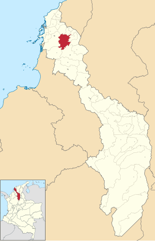
Titiribí is a town and municipality in the Colombian department of Antioquia. Located at an elevation of 1,550 m above sea level, it is part of the sub-region of Southwestern Antioquia.

Venecia is a town and municipality in Antioquia Department, Colombia. According to the 2018 census, the population comprised 10,280 people.

Rionegro is a city and municipality in Antioquia Department, Colombia, located in the subregion of Eastern Antioquia. The official name of the city is Ciudad Santiago de Arma de Rionegro. Rio Negro means "Black River" in Spanish, as the city received its name after a river that looks black because of the shadows cast by trees. The river traverses the city and it is the most prominent geographical feature of the municipality. Rionegro is also sometimes called the Cuna de la democracia as it was one of the most important cities during the era of the Colombia's struggle for independence and the 1863 constitution was written in the city.
Mahates is a river town and municipality located in the Bolívar Department, northern Colombia. The town of Mahates was founded on April 17, 1533 by Spanish conquistador Pedro de Heredia.

Chimá is a town and municipality located in the Córdoba Department, northern Colombia. According to 2018 estimates, the population of Chimá was 13,492, with a population density of 40 persons per square kilometer.

Cotorra is a town and municipality located in the Córdoba Department, northern Colombia. According to 2018 estimates, the population of Cotorra was 16,215, with a population density of 180 persons per square kilometer.

La Apartada is a town and municipality located in the Córdoba Department, northern Colombia. According to 2020 estimates, the population of La Apartada was 13,742, with a population density of 57 persons per square kilometer.

Momil is a town and municipality located in the Córdoba Department, northern Colombia.

Purísima is a town and municipality located in the Córdoba Department, northern Colombia.

San Juan de Caimito, also known as Caimito. Is a town and municipality located in the Sucre Department, northern Colombia.

La Unión is a town and municipality located in the Sucre Department, northern Colombia.

Morroa is a town and municipality located in the Sucre Department, northern Colombia.

Aguadas is a town and municipality in the Colombian department of Caldas. It is bordered to the north by Abejorral, to the east by Sonsón, to the southeast by Salamina, to the south by Pacora, to the west by Caramanta and Valparaiso, and to the northwest by La Pintada. The municipality of Aguadas, located in the northern part of the department, was founded in 1808 by José Narciso Estrada. In addition to the fame of Aguadeño hats, which are very similar to palm-straw Panama hats. Aguadas offers visitors its historic center, which was declared a national monument in 1982. It has a temperate climate thanks to the variety of climates ranging from warm to moor.

Paéz is a municipality in the Cauca Department, Colombia. The town of Belalcazar, is the main urban center of the Municipality. It was founded in 1905 by Valencia, Mosquera and Lemus. The town is located by the steps of the Nevado del Huila Volcano, the municipality borders to the northeast with the Tolima Department, to the west with the Huila Department, southwest with the municipality of Inza, to the west with the municipalities of Silvia and Jambalo and to the north with the municipality of Toribio covering a total area of 1,258 km2 (486 sq mi).

Oporapa is a town and municipality in the Huila Department, Colombia.

Tello is a town and municipality in the Huila Department, Colombia. It is characterized by its extensive plain between the Magdalena River and the foot of the Cordillera Oriental mountain range up to its peaks, with the Fortalecillas and Villavieja rivers located nearby. Its territorial extension is 589 km², its altitude is 575 meters above sea level and its climate is warm with an average temperature of 26°C.

Obando is a town and municipality located in the Department of Valle del Cauca, Colombia.

Fresno el Viejo is a municipality located in the province of Valladolid, Castile and León, Spain. According to the 2017 census (INE), the municipality has a population of 927 inhabitants.


