La Pêche | |
|---|---|
 | |
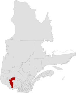
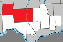 Location within Les Collines-de-l'Outaouais RCM. | |
 La Pêche Location in western Quebec. | |
| Coordinates: 45°41′N75°59′W / 45.683°N 75.983°W Coordinates: 45°41′N75°59′W / 45.683°N 75.983°W [1] | |
| Country | |
| Province | |
| Region | Outaouais |
| RCM | Les Collines-de-l'Outaouais |
| Constituted | January 1, 1975 |
| Government | |
| • Mayor | Guillaume Lamoureux |
| • Federal riding | Pontiac |
| • Prov. riding | Gatineau |
| Area | |
| • Total | 616.50 km2 (238.03 sq mi) |
| • Land | 584.65 km2 (225.73 sq mi) |
| Population (2011) [3] | |
| • Total | 7,619 |
| • Density | 13.0/km2 (34/sq mi) |
| • Pop 2006-2011 | |
| • Dwellings | 4,490 |
| Time zone | UTC−5 (EST) |
| • Summer (DST) | UTC−4 (EDT) |
| Postal code(s) | |
| Area code(s) | 819 |
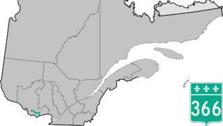
| Highways | |
| Website | www |
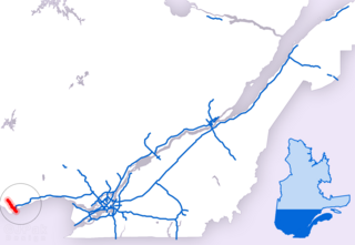
La Pêche (French pronunciation: [la pɛːʃ] , Quebec French pronunciation: [la paɪ̯ʃ] ) is a municipality along both sides of the Gatineau River in Les Collines-de-l'Outaouais Regional County Municipality in the Outaouais region of Quebec, Canada, about 30 kilometres (19 mi) north of downtown Gatineau. It comprises the following villages and communities:
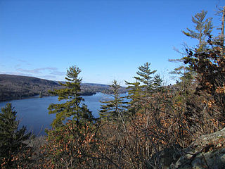
The Gatineau River is a river in western Quebec, Canada, which rises in lakes north of the Baskatong Reservoir and flows south to join the Ottawa River at the city of Gatineau, Quebec. The river is 386 km (239.8 mi) long and drains an area of 23,700 km².

Les Collines-de-l'Outaouais is a regional county municipality in the Outaouais region of western Quebec, Canada. The region nearly encircles the City of Gatineau which is to the south. Its administrative seat is in Chelsea, Quebec.

Outaouais ; is a region of western Quebec, Canada. It includes the city of Gatineau, the Pontiac region, and the town of Maniwaki, and is located on the north side of the Ottawa River opposite Canada's capital, Ottawa. It has a land area of 30,760.05 square kilometres (11,876.52 sq mi) and a 2011 census population of 372,000 inhabitants.
- Duclos
- East-Aldfield
- Edelweiss
- Farrellton
- Lac-des-Loups (Wolf Lake)
- Lascelles, Rupert and Alcove
- Sainte-Cécile-de-Masham
- Saint-François-de-Masham
- Saint-Louis-de-Masham
- Wakefield

Rupert is a village located about 10 kilometers NNW of Wakefield, Quebec, at the convergence of the Shouldice Road and Maple Drive.

Alcove is a small community in Quebec, Canada, part of the Municipality of La Pêche. It is located along Highway 105 and the Gatineau River approximately 35 minutes north of Ottawa, immediately north of Wakefield and south of Farrellton.

Wakefield is one of many villages of the Municipality La Pêche, with the village centre on the western shore of the Gatineau River, at the confluence of the La Pêche River in the Outaouais region of the province of Quebec in Canada. It is thirty-five kilometres northwest of Ottawa, Ontario. The village, named after the city of Wakefield in West Yorkshire, England, is now the southern edge of the municipality of La Pêche, and was founded in 1830 by Irish, Scottish, and English immigrants. Wakefield is approximately a twenty-five-minute drive north of the Macdonald-Cartier Bridge that divides Gatineau and Ottawa (Ontario), along the Autoroute 5, a modern four lane divided highway which has recently been extended to the village. Wakefield is unique in that it is a primarily Anglophone town in a primarily Francophone Province.
Bordering on the north side of the Gatineau Park, La Pêche provides multiple access points to this park.

Gatineau Park is located in the Outaouais region of Quebec, Canada. Administered by the National Capital Commission as part of the National Capital Region, Gatineau Park is a 361 square kilometres (139 sq mi) wedge of land extending north and west from the city of Gatineau. With a perimeter of 179.2 kilometres (111.3 mi), the park includes parts of the municipalities of Chelsea, Pontiac, La Pêche, and the City of Gatineau. The main entrance to the park is 4 kilometres (2.5 mi) north of downtown Ottawa, Ontario.
La Pêche was declared Quebec's first and Canada's second fair trade town on November 9, 2007.

The Fair Trade Towns campaign is the result of a grass-roots citizens movement that started in the UK in 2001. It allows citizens to get together in order to self-proclaim their town as a region that complies with a few general Fair Trade criteria, that can be adapted from country to country but which retain their main elements.