Lac de Louvie

Last updated
Lac de Louvie
Lac Louvie.jpg
Reliefkarte Wallis blank.png
Red pog.svg
Lac de Louvie
Switzerland relief location map.jpg
Red pog.svg
Lac de Louvie
Alps location map.png
Red pog.svg
Lac de Louvie
Location Fionnay, Valais
Coordinates 46°03′00″N7°18′30″E / 46.05000°N 7.30833°E / 46.05000; 7.30833
Basin  countriesSwitzerland
Surface area12 ha (30 acres) [1]
Surface elevation2,214 m (7,264 ft) [2]
Lac de Louvie

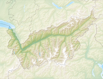
Lac de Louvie is a lake above Fionnay in the canton of Valais, Switzerland.

Contents

Lake with the Grand Combin in the background Le lac de Louvie, avec le Grand Combin derriere.jpg
Lake with the Grand Combin in the background

The Lac de Louvie is paradise for all nature lovers such as trail runners and hikers. It is situated at 2,213 metres (7,260 ft) above sea level and is a 2-hour walk from Fionnay.
See also

Related Research Articles

<span class="mw-page-title-main">Jura (department)</span> Department of France in Bourgogne-Franche-Comté

Jura is a department in the eastern French region of Bourgogne-Franche-Comté. The department takes its name from the Jura Mountains. Its prefecture is Lons-le-Saunier; subprefectures are Dole and Saint-Claude. In 2019, Jura had a population of 259,199. Its INSEE code is 39. It has a short portion of the border of Switzerland.

<span class="mw-page-title-main">Lake Geneva</span> Lake in Switzerland and France

Lake Geneva is a deep lake on the north side of the Alps, shared between Switzerland and France. It is one of the largest lakes in Western Europe and the largest on the course of the Rhône. Sixty percent of the lake belongs to Switzerland and forty percent to France.

<span class="mw-page-title-main">Valais</span> Canton of Switzerland

Valais, more formally, the Canton of Valais, is one of the 26 cantons forming the Swiss Confederation. It is composed of thirteen districts and its capital and largest city is Sion.

<span class="mw-page-title-main">Lake Neuchâtel</span> Lake in Switzerland

Lake Neuchâtel is a lake primarily in Romandy, the French-speaking part of Switzerland. The lake lies mainly in the canton of Neuchâtel, but is also shared by the cantons of Vaud, Fribourg, and Bern. It comprises one of the lakes in the Three Lakes Region, along with lakes Biel/Bienne and Morat/Murten.

<span class="mw-page-title-main">Grande Dixence Dam</span> Dam in Hérémence, Switzerland

The Grande Dixence Dam is a concrete gravity dam on the Dixence at the head of the Val d'Hérémence in the canton of Valais in Switzerland. At 285 m (935 ft) high, it is the tallest gravity dam in the world, seventh tallest dam overall, and the tallest dam in Europe. It is part of the Cleuson-Dixence Complex. With the primary purpose of hydroelectric power generation, the dam fuels four power stations, totaling the installed capacity to 2,069 MW, generating approximately 2,000 GWh annually, enough to power 400,000 Swiss households.

<span class="mw-page-title-main">Doubs (river)</span> River in Switzerland and France

The Doubs is a 453-kilometre (281 mi) river in far eastern France which strays into western Switzerland. It is a left-bank tributary of the Saône. It rises near Mouthe in the western Jura mountains, at 946 metres (3,104 ft) and its mouth is at Verdun-sur-le-Doubs, a village and commune in Saône-et-Loire at about 175 m (574 ft) above sea level. It is the tenth-longest river in France.

<span class="mw-page-title-main">Lac de Joux</span> Lake in Vaud, Switzerland

Lac de Joux is a lake in the Vallée de Joux in the Canton of Vaud, Switzerland. With a surface area of 9.5 km2, it is the largest lake in Switzerland lying above 1,000 metres. Lac de Joux is located in the Jura Mountains.

<span class="mw-page-title-main">Lac d'Émosson</span> Lake of hydroelectric dam in Switzerland

The Lac d'Émosson is a reservoir in the canton of Valais, Switzerland. It is located in the municipalities of Salvan and Finhaut. The closest small city in Switzerland is Martigny. The lake has a surface area of 3.27 km2 and an elevation of 1,930 m. The maximum depth is 180 meters. The purpose of the Émosson Dam is hydroelectric power generation. Water from the reservoir first powers the 189 MW Vallorcine Power Station downstream and just over the border in Vallorcine, France. Water is then sent through a headrace tunnel to the 190 MW La Bâtiaz Power Station, 12 km (7 mi) to the east in Martigny, Switzerland. The drop between the dam and La Bâtiaz Power Station is 1,400 m (4,593 ft).

<span class="mw-page-title-main">Mauvoisin Dam</span> Dam in Valais, Switzerland

Mauvoisin Dam is a concrete variable radius arch dam across the Val de Bagnes on the Dranse de Bagnes stream, in the canton of Valais, Switzerland. Initial construction on the dam commenced in 1951 and was completed in 1957, with the reservoir filling by 1958. In 1991, the dam was raised to increase the capacity of the reservoir for winter storage. The dam's primary purpose is hydroelectric power generation.

<span class="mw-page-title-main">Wildhorn</span> Mountain in Switzerland

The Wildhorn is a mountain of the Alps, straddling the border between the Swiss cantons of Bern and Valais. At 3,250 metres (10,663 ft) above sea level, it is the highest summit of the Bernese Alps west of the Gemmi Pass. It forms a large glaciated massif, about 10 km wide, extending between the Sanetsch Pass and the Rawil Pass. Along with the Muverans, the Diablerets and the Wildstrubel, the Wildhorn is one of the four distinct mountain massifs of the Bernese Alps that lie west of the Gemmi Pass. The massif of the Wildhorn is at the centre between the valleys of the Saane, Simme and the Rhone (Valais). It comprises several distinct summits, including the Arpelistock, Le Sérac, the Geltenhorn, the Sex Noir, the Sex Rouge, the Schnidehorn and the Six des Eaux Froides. The main crest is between the glaciers named Tungelgletscher and Glacier du Wildhorn. South of the main summit is the almost equally high summit of Mont Pucel. The Wildhorn is surrounded by several large mountain lakes: the Lac de Sénin, the Lauenensee, the Iffigsee, the Lac de Tseuzier and the Lac des Audannes. The Tungelgletscher, on the north-east face, was measured as 1.9 km in length in 1973.

<span class="mw-page-title-main">Lac de Sauvabelin</span> Artificial lake in Switzerland

Lac de Sauvabelin is an artificial lake in the Sauvabelin forest, above Lausanne, Switzerland.

<span class="mw-page-title-main">Laruns</span> Commune in Nouvelle-Aquitaine, France

Laruns is a commune in the Pyrénées-Atlantiques department in south-western France.

<span class="mw-page-title-main">Mont Fort</span> Mountain in Switzerland

Mont Fort is a mountain of the Pennine Alps, in the Swiss canton of Valais. It lies on the range between the valleys of Nendaz and Bagnes, north of the Rosablanche. With a height of 3,328 metres (10,919 ft) above sea level, Mont Fort is the highest summit north of the Col de Louvie.

<span class="mw-page-title-main">Rosablanche</span> Mountain in Switzerland

The Rosablanche is a mountain of the Swiss Pennine Alps, overlooking the Lac des Dix in the canton of Valais. It lies on the range between the valleys of Bagnes (west) and Hérémence (east), north of Le Pleureur.

<span class="mw-page-title-main">Lac d'Aiguebelette</span> Lake in Savoie, France

The Lac d'Aiguebelette is a natural lake north of the Chartreuse Mountains in the French Alps and just west of the Chaîne de l'Épine in the Jura Mountains. It is located within five communes in the Savoie department: Aiguebelette-le-Lac, Lépin-le-Lac, Saint-Alban-de-Montbel, Novalaise and Nances.

<span class="mw-page-title-main">Giétro Glacier</span> Glacier in Switzerland

The Giétro Glacier or Giétroz Glacier is a 4 km long valley glacier located in south-western Switzerland. The 1818 Giétro Glacier catastrophe, which led to a lake outburst flood, is one of the most famous and most disastrous historical cases in the Swiss Alps.

<span class="mw-page-title-main">Prehistoric pile dwellings around the Alps</span> UNESCO World Heritage Site in Europe

Prehistoric pile dwellings around the Alps are a series of prehistoric pile dwelling settlements in and around the Alps built from about 5000 to 500 BC on the edges of lakes, rivers or wetlands. In 2011, 111 sites located variously in Switzerland (56), Italy (19), Germany (18), France (11), Austria (5) and Slovenia (2) were added to the UNESCO World Heritage Site list. In Slovenia, these were the first World Heritage Sites to be listed for their cultural value.

<span class="mw-page-title-main">Fionnay</span> Village in the Swiss Alps

Fionnay is a village in the Swiss Alps, located in the canton of Valais. The village is situated in the western part of the canton, in the valley of Bagnes, south-east of Martigny. It is part of the municipality of Val de Bagnes.

References

  1. Area retrieved from Google Earth (July 2013)
  2. Height retrieved from the Swisstopo topographic maps