
Jura is a department in the eastern French region of Bourgogne-Franche-Comté. The department takes its name from the Jura Mountains. Its prefecture is Lons-le-Saunier; subprefectures are Dole and Saint-Claude. In 2019, Jura had a population of 259,199. Its INSEE code is 39. It has a short portion of the border of Switzerland.

Lake Geneva is a deep lake on the north side of the Alps, shared between Switzerland and France. It is one of the largest lakes in Western Europe and the largest on the course of the Rhône. Sixty percent of the lake belongs to Switzerland and forty percent to France.
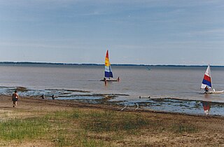
Lake Saint Pierre is a lake in Quebec, Canada, a widening of the Saint Lawrence River between Sorel-Tracy and Trois-Rivières. It is located downstream, and northeast, of Montreal; and upstream, and southwest, of Quebec City. The end of the lake delimits the beginning of the estuary of Saint Lawrence.

Lake Neuchâtel is a lake primarily in Romandy, the French-speaking part of Switzerland. The lake lies mainly in the canton of Neuchâtel, but is also shared by the cantons of Vaud, Fribourg, and Bern. It comprises one of the lakes in the Three Lakes Region, along with lakes Biel/Bienne and Morat/Murten.

The Doubs is a 453-kilometre (281 mi) river in far eastern France which strays into western Switzerland. It is a left-bank tributary of the Saône. It rises near Mouthe in the western Jura mountains, at 946 metres (3,104 ft) and its mouth is at Verdun-sur-le-Doubs, a village and commune in Saône-et-Loire at about 175 m (574 ft) above sea level. It is the tenth-longest river in France.

The Dents du Midi are a three-kilometre-long mountain range in the Chablais Alps in the canton of Valais, Switzerland. Overlooking the Val d'Illiez and the Rhône valley to the south, they face the Lac de Salanfe, an artificial reservoir, and are part of the geological ensemble of the Giffre massif. Their seven peaks are, from north-east to south-west: the Cime de l'Est, the Forteresse, the Cathédrale, the Éperon, the Dent Jaune, the Doigts and the Haute Cime. They are mainly composed of limestone rock, with gritty limestone rock in the upper parts.

Lake of Gruyère is an artificial lake in the La Gruyère region of the Canton of Fribourg, Switzerland.
The Des Lacs National Wildlife Refuge is located in the U.S. state of North Dakota and extends from the Canada–United States border to near the town of Kenmare, North Dakota along Des Lacs Lake. The refuge was established in 1935 and includes 19,500 acres (78.9 km2). The refuge is considered to be one of the most important bird sanctuaries in the U.S., with tens of thousands of birds using the refuge for migration and breeding. The refuge is also home to elk, moose, bison and pronghorn.

Lac de Joux is a lake in the Vallée de Joux in the Canton of Vaud, Switzerland. With a surface area of 9.5 km2, it is the largest lake in Switzerland lying above 1,000 metres. Lac de Joux is located in the Jura Mountains.

The Lac d'Émosson is a reservoir in the canton of Valais, Switzerland. It is located in the municipalities of Salvan and Finhaut. The closest small city in Switzerland is Martigny. The lake has a surface area of 3.27 km2 and an elevation of 1,930 m. The maximum depth is 180 meters. The purpose of the Émosson Dam is hydroelectric power generation. Water from the reservoir first powers the 189 MW Vallorcine Power Station downstream and just over the border in Vallorcine, France. Water is then sent through a headrace tunnel to the 190 MW La Bâtiaz Power Station, 12 km (7 mi) to the east in Martigny, Switzerland. The drop between the dam and La Bâtiaz Power Station is 1,400 m (4,593 ft).

Lac de Moiry is a reservoir in the municipality of Grimentz, Switzerland.
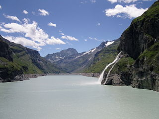
Lac de Mauvoisin is a reservoir in the canton of Valais, Switzerland. The reservoir is formed by the Mauvoisin Dam, which is 250 metres (820 ft) high. The dam is the 11th highest in the world, and the 6th highest arch dam. It was built in 1951–1957, and raised by 13.5 metres (44 ft) in 1991.

Mille Lacs National Wildlife Refuge is a 0.57 acre National Wildlife Refuge in central Minnesota. The refuge consists solely of two small islands in Mille Lacs Lake, and is the smallest National Wildlife Refuge in the United States. It was created on May 14, 1915, to preserve breeding habitat for several bird species. The islands are one of only four breeding colonies of common terns, a threatened species in Minnesota. Other native species breeding within the refuge include ring-billed and herring gulls and double-crested cormorants.

Lac de Taney is a lake in Valais, Switzerland. Its surface area is 17 ha.
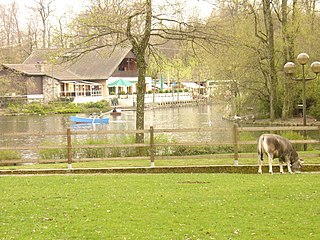
Lac de Sauvabelin is an artificial lake in the Sauvabelin forest, above Lausanne, Switzerland.
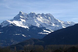
The Chablais Alps are a mountain range in the Western Alps. They are situated between Lake Geneva and the Mont Blanc Massif. The Col des Montets separates them from the Mont Blanc Massif in the south, and the Rhône valley separates them from the Bernese Alps in the east.
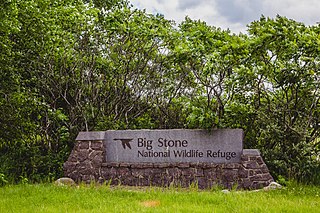
Straddling the headwaters of the Minnesota River in west-central Minnesota, Big Stone National Wildlife Refuge is within the heart of the tallgrass prairie's historic range. Today, less than one-percent of tallgrass prairie remains.

Prehistoric pile dwellings around the Alps are a series of prehistoric pile dwelling settlements in and around the Alps built from about 5000 to 500 BC on the edges of lakes, rivers or wetlands. In 2011, 111 sites located variously in Switzerland (56), Italy (19), Germany (18), France (11), Austria (5) and Slovenia (2) were added to the UNESCO World Heritage Site list. In Slovenia, these were the first World Heritage Sites to be listed for their cultural value.

Lac-Matapédia is an unorganized territory in the Bas-Saint-Laurent region of Quebec, Canada. It is named after and located on the northern shores of Lake Matapedia in the Matapédia Valley.


