Lake Geneva is a deep lake on the north side of the Alps, shared between Switzerland and France. It is one of the largest lakes in Western Europe and the largest on the course of the Rhône. Sixty per cent of the lake belongs to Switzerland and forty per cent to France.

Gatineau Park is a federal park located in the Outaouais region of Quebec, Canada. Administered by the National Capital Commission as part of the National Capital Region, Gatineau Park is a 361 square kilometres (139 sq mi) wedge of land extending north and west from the city of Gatineau. With a perimeter of 179.2 kilometres (111.3 mi), the park includes parts of the municipalities of Chelsea, Pontiac, La Pêche, and the City of Gatineau. The main entrance to the park is 4 kilometres (2.5 mi) north of downtown Ottawa, Ontario.

The Saint-Charles River is the main watercourse crossing Quebec City, Quebec, Canada.
Lake Der-Chantecoq is situated close to the commune of Saint-Dizier in the departments of Marne and Haute-Marne. It is the largest artificial lake in France, covering 48 km2 (19 sq mi) with 350 million m³ of water. The lake is named after the Der plain, in which it is located, and the submerged village Chantecoq.

The Langue de Barbarie is a thin, sandy peninsula, adjacent to the Atlantic Ocean, located in western Senegal, in the neighbourhood of the city of Saint-Louis. The peninsula separates the ocean from the final section of the Senegal River.
Lac d'Icogne is a reservoir in the municipality of Lens near the village of Crans-sur-Sierre in the canton of Valais, Switzerland. The lake has a volume of 0.04 million m³ and a surface area of 7 ha.
Chermizy-Ailles is a commune in the Aisne department in Hauts-de-France in northern France.

Neuville-sur-Ailette is a commune in the Aisne department in Hauts-de-France in northern France.
The canton of Moÿ-de-l'Aisne is a former administrative division in northern France. It was disbanded following the French canton reorganisation which came into effect in March 2015. It consisted of 17 communes, which joined the canton of Ribemont in 2015. It had 7,898 inhabitants (2012).
The canton of Ribemont is an administrative division in northern France. At the French canton reorganisation which came into effect in March 2015, the canton was expanded from 15 to 52 communes:

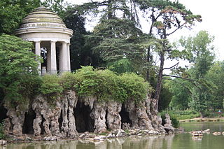
Norman Switzerland is a part of Normandy, France, in the border region of the departments Calvados and Orne. Its name comes from its rugged and verdant relief resembling the Swiss Alps, with gorges carved by the river Orne and its tributaries, and by erosion in the Armorican Massif between Putanges-Pont-Écrepin and Thury-Harcourt. The river has created a rugged landscape.

The Ailette is a 59.5 km (37.0 mi) long river in the Aisne department in eastern France. Its source is at Sainte-Croix. It flows generally west-northwest. It is a left tributary of the Oise into which it flows between Manicamp and Quierzy, 30 km (19 mi) northeast of Compiègne.

Pointe-Taillon National Park(Parc national de la Pointe-Taillon) is a provincial park in Quebec, Canada. It is located on the north shore of Lac Saint-Jean, northwest of Saguenay (city), northwest of Alma, near the village of Saint-Henri-de-Taillon, on the banks of Lac Saint-Jean. The park covers an area of 97.5 km (60.58 mi) has as a 45 km (28 mi) cycling network.
The Lake Masketsi is located in the unorganized territory of Lac-Masketsi, in the Mekinac Regional County Municipality, in Mauricie, in Quebec, in Canada.

Lac-Témiscouata National Park is a provincial park located in Quebec, Canada south of the Saint Lawrence River, near the border with New Brunswick. It contains Lake Témiscouata, which is "the second-largest lake south of the Saint Lawrence River" within some unspecified area, perhaps within Quebec, with a length of around 40 km (25 mi). Touladi River can also be found within the park's boundaries.
The canton of Villeneuve-sur-Aisne is an administrative division of the Aisne department, in northern France. It was created at the French canton reorganisation which came into effect in March 2015. Its seat is in Villeneuve-sur-Aisne.

LakeStukely is a 4 square kilometres (1.5 sq mi) natural lake located in the Eastern region of Quebec, Canada. Its waters border the municipalities of Orford, Bonsecours, Eastman and a large part of Mount Orford National Park. It lies at the head of the Saumon River watershed, giving it a fairly long retention time for its size.

The Lake of Orient or Seine Reservoir Lake is a lake in northeastern France, located in the Aube department of the Grand Est region. With a surface area of 23 km2 (8.9 sq mi) and a normal capacity of 205 km3 (49 cu mi), it is the third-largest artificial lake in mainland France, after Lake Der-Chantecoq and Lake Serre-Ponçon, and ahead of Lake Sainte-Croix.

Lakes Amance and du Temple are the two human-made lakes that together form the Aube reservoir. They are located in the Aube department, in the Grand Est region of France. The former is Europe's largest lake reserved for motorboating, and the latter is Europe's largest non-nautical lake. While their normal capacity is 170 hm3, with a total surface area of 23.2 km2 they could, if combined as a single lake, be the third largest man-made lake in France, matching the size of Lac d'Orient. Completed and commissioned in 1989, they are among the last of the great Seine lakes to have been built. Like the neighboring Lac d'Orient, they are part of the Orient Forest Regional Natural Park, created in 1970, twenty years before the project was completed.