The Lake District, also known as the Lakes or Lakeland, is a mountainous region and national park in Cumbria, North West England. It is famous for its landscape, including its lakes, coast, and the Cumbrian mountains; and for its literary associations with Beatrix Potter, John Ruskin, and the Lake Poets.

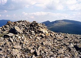
Scafell Pike is a mountain in the Lake District region of Cumbria, England. It has an elevation of 978 metres (3,209 ft) above sea level, making it the highest and the most prominent mountain in England. The mountain is part of the Scafell massif, an inactive volcano, and is one of the Southern Fells.

Pillar is a mountain in the western part of the English Lake District. Situated between the valleys of Ennerdale to the north and Wasdale to the south, it is the highest point of the Pillar group. At 892 metres (2,927 ft) it is the eighth-highest mountain in the Lake District. The fell takes its name from Pillar Rock, a prominent feature on the Ennerdale side, regarded as the birthplace of rock climbing in the district.

Ennerdale Water is the most westerly lake in the Lake District National Park in Cumbria, England. It is a glacial lake, with a maximum depth of 150 feet, and is ½ mile to a mile wide and 2+1⁄2 miles long.

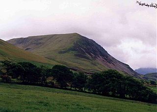
Kirk Fell is a fell in the Western part of the English Lake District. It is situated between Great Gable and Pillar on the long ring of fells surrounding the valley of Ennerdale, and also stands over Wasdale to the south. However, it is separated from its two higher neighbours by the low passes of Black Sail and Beck Head, giving it a high relative height and making it a Marilyn, the thirteenth highest in the Lake District.

Knott is a mountain in the northern part of the English Lake District. It is the highest point of the Back o'Skiddaw region, an area of wild and unfrequented moorland to the north of Skiddaw and Blencathra. Other tops in this region include High Pike, Carrock Fell and Great Calva. The fell's slopes are mostly smooth, gentle, and covered in grass, with a few deep ravines. It stands a long way from a road and requires a long walk across the moor top get to it; this, as well as the fact that it is hidden from the rest of the Lake District by the two aforementioned giants, make it one of the most unfrequented tops in the Lakes. When it is climbed it is most often from Mungrisdale or from the north via Great Sca Fell. The word Knott is of Cumbric origin, and means simply "hill".

Glenmore Forest Park is a remnant of the Caledonian Forest near Aviemore in the Badenoch and Strathspey district of Highland, Scotland. Owned and managed by Forestry and Land Scotland, it lies within the Cairngorms National Park, and is one of six forest parks in the country. The forest park, which was established in 1948, covers 35.7 km2, of which 21.1 km2 is designated as a national nature reserve (NNR). Glenmore surrounds Loch Morlich, and is below the rise of the Cairngorms to the south; to the north the park extends to the summit of Meall a' Bhuachaille. The forest forms part of an expanse of Caledonian Forest that stretches from Glen Feshie to Abernethy, and which as a whole forms the largest single area of this habitat remaining in Scotland. It is home to much wildlife including Scottish crossbills, crested tits, capercaillie, narrow-headed ants, red squirrels and red deer.

Dodd is a small fell in the Lake District, Cumbria, England, four kilometres north-west of Keswick. It forms part of the Skiddaw range in the northern part of the national park and the slopes are heavily wooded.

Red Pike is a fell in the High Stile range in the western English Lake District, which separates Ennerdale from the valley of Buttermere and Crummock Water. It is 2,476 ft (755 m) high. The direct ascent of Red Pike from Buttermere is very popular and the ridge walk from Red Pike to Haystacks is regarded as one of the finest in the area, with excellent views of the Scafells, Great Gable and Pillar.

High Crag stands at the southern end of the High Stile ridge which divides the valleys of Ennerdale and Buttermere in the west of the English Lake District. It is often climbed as part of a popular ridge walk, from Black Sail youth hostel, or from Buttermere via Scarth Gap. Panoramas of the Great Gable and the Scafells are visible.

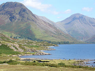
Yewbarrow is a fell, in the English Lake District, which lies immediately north of the head of Wast Water. It is 628 metres high and in shape resembles the upturned hull of a boat or a barrow. Yewbarrow is on the left in the classic view of Great Gable and Wast Water.

Haycock is a mountain in the western part of the English Lake District. It rises between Scoat Fell and Caw Fell to the south of Ennerdale and the north of Wasdale. Haycock is an imposing dome-shaped fell, its popularity with walkers diminished somewhat by its remoteness. It can be climbed from either valley and offers fine mountain views.

Great Borne is a fell in the English Lake District with a height of 616 m (2,021 ft). It is a rather secluded hill situated at the western end of the long ridge which divides the Ennerdale and Buttermere valleys.

Ennerdale is a valley in Cumbria, England. Ennerdale Water, fed by the River Liza, is the most westerly lake in the Lake District National Park.

Fellbarrow is a low hill in the north west of the English Lake District. It is not far from the town of Cockermouth, near to Loweswater and can most easily be climbed from Low Lorton or Thackthwaite. From the summit there are views across the Lorton valley to Grasmoor and Whiteside.

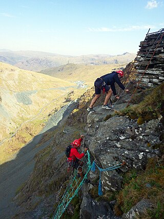
Honister Crag SSSI is a Site of Special Scientific Interest in Cumbria, England. It is designated for both biological and geological interest. The site covers an area of 302.9 ha on Honister Crag, from which it takes its name, and Fleetwith Pike, an adjacent fell.

Taynish National Nature Reserve is situated southwest of the village of Tayvallich in the council area of Argyll and Bute on the west coast of Scotland. The reserve encompasses almost all of the Taynish peninsula, which is around 5 km long and 1 km wide. The woodlands at Taynish are often described as a 'temperate rainforest', benefiting from the mild and moist climate brought about by the Gulf Stream. Taynish is owned and managed by NatureScot and was declared a national nature reserve (NNR) in 1977. The reserve was formerly also a biosphere reserve, but this status was withdrawn in 2014.
Pillar and Ennerdale Fells is a Site of Special Scientific Interest (SSSI) in Ennerdale, Cumbria, England. Protected for its biological interest, the site is named after Pillar, which at 892 metres (2,927 ft) is the eighth-highest mountain in the Lake District, and other fells in the same range. The area is 425.25 ha.

Hack Fall Wood, otherwise known as Hackfall, is a Site of Special Scientific Interest, or SSSI, of 44.8687 hectares, lying north-east of the village of Grewelthorpe, North Yorkshire, England. During the 18th century it was landscaped in the picturesque style by landowner William Aislabie, who created views by engineering streams and pools, planting trees and building follies. J. M. W. Turner and William Sawrey Gilpin painted it, and pictures of it featured on Catherine the Great's 1773 Wedgwood dinner service. Some 19th century writers called it "one of the most beautiful woods in the country."


