Lake Itasy

Last updated
Lake Itasy
Lac Itasy
Itasy lake.jpg
Madagascar physical map.svg
Red pog.svg
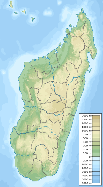
Lake Itasy
Location of Lake Itasy in Madagascar
Location Itasy Region, Madagascar
Coordinates 19°4′S46°47′E / 19.067°S 46.783°E / -19.067; 46.783
Primary outflows Lily River
Surface area3,500 hectares (8,600 acres)
Surface elevation1,221 metres (4,006 ft)

Lake Itasy is a lake in central Madagascar. It is located in Itasy Region. It is situated in the municipalities of Ampefy, Soavinandriana, Manazary and Analavory. [1]

Lake Itasy has an area of 3,500 hectares. It is the fourth largest lake on Madagascar, after lakes Alaotra, Kinkony, and Ihotry. [2]

The lake has an average depth of 4 meters, and reaches up to 10 meters deep. The water level varies seasonally. There are marshy areas in the southern and eastern parts of the lake. [3]

Lake Itasy lies in the volcanic Itasy Massif. The volcanic activity in the region is relatively recent, and lake was formed when lava flows blocked a river, forming a lake behind it. The landscape around the lake is covered with Strombolian scoria cones and trachyte domes. The volcanic landscape around the lake has many smaller lakes (maars) and peat bogs. [2]

The Andranomena and Mariandrano rivers empty into the lake from the east. [3] The Lily River is the lake's outflow, draining westwards from the northwestern corner of the lake. The Lily is a tributary of the Sakay River, which is a tributary of the Tsiribihina River. The Tsiribihina flows westwards to empty into the Mozambique Channel. [2]

Flora and fauna

There are reedbeds along the edges of the lake, composed mostly of species of the reed Phragmites and the sedge Cyperus , which grow up to two meters high. There are also floating mats of the non-native water-hyacinth Eichhornia . [3]

44 species of birds have been observed at the lake, including ten Madagascar endemic species. Native birds include Meller's duck (Anas melleri), Madagascar grebe (Tachybaptus pelzelnii), Madagascar flufftail (Sarothrura insularis), Madagascar pond heron (Ardeola idae), Madagascar snipe (Gallinago macrodactyla), and Madagascar marsh harrier (Circus macrosceles). The lake is designated an Important Bird Area. [3]

The environment of the lake and its tributary rivers have been altered by pollution, erosion and siltation, habitat destruction, and the introduction of exotic species. The native fish Ptychochromoides itasy , last observed in the lake in the 1970s, was thought extinct until a population was discovered in the Sakay River. [4]

Related Research Articles

<span class="mw-page-title-main">Geography of Madagascar</span> Overview of the geography of Madagascar

Madagascar is a large island in the Indian Ocean off the eastern coast of Southern Africa, east of Mozambique. It has a total area of 587,040 square kilometres (226,660 sq mi) with 581,540 square kilometres (224,530 sq mi) of land and 5,500 square kilometres (2,100 sq mi) of water. Madagascar is the fourth-largest island and the second-largest island country in the world. The highest point is Maromokotro, in the Tsaratanana Massif region in the north of the island, at 2,876 metres (9,436 ft). The capital Antananarivo is in the Central Highlands near the centre of the island. It has the 25th largest exclusive economic zone of 1,225,259 km2 (473,075 sq mi). Madagascar is 400 kilometres east of mainland Africa.

<span class="mw-page-title-main">River Towy</span> River in Wales

The River Towy is one of the longest rivers flowing entirely within Wales. Its total length is 120 km (75 mi). It is noted for its sea trout and salmon fishing.

<span class="mw-page-title-main">California Central Valley grasslands</span> Temperate grasslands, savannas, and shrublands ecoregion in California, United States

The California Central Valley grasslands is a temperate grasslands, savannas, and shrublands ecoregion in California's Central Valley. It a diverse ecoregion containing areas of desert grassland, prairie, savanna, riparian forest, marsh, several types of seasonal vernal pools, and large lakes such as now-dry Tulare Lake, Buena Vista Lake, and Kern Lake.

<span class="mw-page-title-main">Kakamega Forest</span> Rainforest in Kakamega & Nandi Counties, Kenya

Kakamega Forest is a tropical rainforest situated in the Kakamega and Nandi County of Kenya, northwest of the capital Nairobi, and near to the border with Uganda. It is Kenya's only tropical rainforest and is said to be Kenya's last remnant of the ancient Guineo-Congolian rainforest that once spanned the continent.

<span class="mw-page-title-main">Onilahy River</span> River in Anosy, Madagascar

Onilahy is a river in Atsimo-Andrefana and Anosy, southern Madagascar. It flows down from the hills near Betroka to the Mozambique Channel. It empties at St. Augustin, and into the Bay of Saint-Augustin.

<span class="mw-page-title-main">Vicente Pérez Rosales National Park</span>

Vicente Pérez Rosales National Park is located in Los Lagos Region, Llanquihue Province, of Chile. Its western entrance is close to the Ensenada locality, 82 km (51 mi) northeast of the provincial capital of Puerto Montt, and 64 km (40 mi) from Puerto Varas along Ruta CH-225. This national park covers about 2,530 km2 (977 sq mi) and is almost entirely in the Andes mountain chain. The adjacent national parks Vicente Pérez Rosales and Puyehue National Park in Chile, and Nahuel Huapi National Park and Lanín National Park in Argentina, provide a continuous protected area of close to 15,000 km2 (5,792 sq mi).

<span class="mw-page-title-main">Sakalava rail</span> Species of bird

The Sakalava rail is a species of bird in the family Rallidae. It is endemic to western Madagascar. This bird is small with brown upperpart feathers, grey underparts, a yellow bill and red legs.

<span class="mw-page-title-main">Wildlife of Rwanda</span>

The wildlife of Rwanda comprising its flora and fauna, in prehistoric times, consisted of montane forest in one third the territory of present-day Rwanda. However, natural vegetation is now mostly restricted to the three national parks and four small forest reserves, with terraced agriculture dominating the rest of the country.

Ptychochromoides itasy is a species of cichlid fish from central Madagascar. Until rediscovered in a pond at a tributary of the Tsiribihina River in late 2010, it was only known from Lake Itasy where last seen in the 1970s. The reason for its extirpation from Lake Itasy was likely habitat degradation and competition/predation by introduced species.

<span class="mw-page-title-main">Colt Creek State Park</span> State park in Florida, United States

Colt Creek State Park is a Florida State Park in Central Florida, 16 miles (26 km) north of Lakeland off of State Road 471. This 5,067 acre park nestled within the Green Swamp Wilderness Area and named after one of the tributaries that flows through the property was opened to the public on January 20, 2007. Composed mainly of pine flatwoods, cypress domes and open pasture land, this piece of pristine wilderness is home to many animal species including the American bald eagle, Southern fox squirrel, gopher tortoise, white-tailed deer, wild turkey and bobcat.

<span class="mw-page-title-main">Itasy Region</span> Region in Madagascar

Itasy is a region in central Madagascar. It borders Analamanga region in northeast, Vakinankaratra in south and Bongolava in northwest. The capital of the region is Miarinarivo, and the population was 897,962 in 2018. It is the smallest of all the 22 regions in area with 6,993 km2 (2,700 sq mi), and is the most densely populated region after Analamanga.

Bemarivo Reserve is a wildlife reserve 12 km from Besalampy in the region of Melaky in the north-west of Madagascar. It was created in 1956 and covers an area of 12,080 hectares. The reserve is known for its fauna especially endemic birds.

<span class="mw-page-title-main">Comoros forests</span> Ecoregion in the Comoros islands

The Comoros forests is a terrestrial ecoregion which covers the Comoro Islands, which lie in the Mozambique Channel between Madagascar and East Africa. These include four main islands: Grande Comore, Anjouan and Mohéli, of the Union of the Comoros, and Mayotte, a department and region of France.

<span class="mw-page-title-main">Tsiribihina River</span> River in Madagascar

The Tsiribihina is a river of western Madagascar.

<span class="mw-page-title-main">Sakay River</span> River in Madagascar

The Sakay River is a waterway in Bongolava, Madagascar, and passes through the towns of Ankadinondry Sakay and Mahasolo.

Analavelona, also known as Analavelona Massif, is a mountain in southwestern Madagascar. The massif is home to an enclave of montane subhumid forest, which is considered a sacred forest by the local people and notable for its biodiversity.

<span class="mw-page-title-main">Sakeny River</span> River in Madagascar

The Sakeny River is a river in Western Madagascar. It is a tributary of the Tsiribihina River.

<span class="mw-page-title-main">Makay Massif</span> Mountain range in Madagascar

The Makay Massif is a mountain range in western Madagascar.

<span class="mw-page-title-main">Mahavavy Sud River</span> River in Madagascar

The Mahavavy Sud, also known as the Mahavavy South, is a river in western Madagascar. It flows from south to north through the regions of Melaky, Betsiboka, Bongolava and Boeny. It has a length of approximately 1000 km, and drains a basin of 16,475 km2. It is distinct from the Mahavavy Nord several hundred km to the north.

<span class="mw-page-title-main">Lily River</span> River in Itasy Region, Madagascar

The Lily River is a river in central Madagascar. It is the main outflow of Lake Itasy, and flows northwestward to join the Sakay River, a tributary of the Tsiribihina.

References

  1. Lac Itasy
  2. 1 2 3 Battistini, R., Richard-Vindard, G. (eds) (1972) Biogeography and Ecology in Madagascar. Monographiae Biologicae, vol 21. Springer, Dordrecht. https://doi.org/10.1007/978-94-015-7159-3_5
  3. 1 2 3 4 BirdLife International (2023) Bird Areas factsheet: Lake Itasy. Accessed 16 January 2023.
  4. Ravelomanana, T. & Sparks, J.S. 2020. Ptychochromoides itasy (amended version of 2016 assessment). The IUCN Red List of Threatened Species 2020: e.T44513A177066939. https://dx.doi.org/10.2305/IUCN.UK.2020-3.RLTS.T44513A177066939.en. Accessed 17 January 2023.