
A scow is a type of flat-bottomed barge. Some scows are rigged as sailing scows. In the 19th and early 20th centuries, scows carried cargo in coastal waters and inland waterways, having an advantage for navigating shallow water or small harbours. Scows were in common use in the American Great Lakes and other parts of the U.S., in southern England, and in New Zealand. In Canada, scows have traditionally been used to transport cattle to the islands of New Brunswick's Saint John River. In modern times their main purpose is for recreation and racing.

Whangārei is the northernmost city in New Zealand and the regional capital of Northland Region. It is part of the Whangarei District, a local body created in 1989 from the former Whangarei City, Whangarei County and Hikurangi Town councils, to administer both the city proper and its hinterland. The city population was estimated to be 54,400 in June 2020, an increase from 47,000 in 2001.

The Northland Region is the northernmost of New Zealand's 16 local government regions. New Zealanders sometimes refer to it as the Winterless North because of its mild climate. The main population centre is the city of Whangārei, and the largest town is Kerikeri. At the 2018 New Zealand census Northland recorded a surprising population growth spurt of 18.1% since the previous 2013 census, placing it as the fastest growing region of New Zealand, ahead of other strong growth regions such as the Bay of Plenty and Waikato.

The Three Kings Islands are a group of 13 uninhabited islands about 55 kilometres (34 mi) northwest of Cape Reinga, New Zealand, where the South Pacific Ocean and Tasman Sea converge. They measure 6.85 km2 (2.64 sq mi) in area. The islands are on a submarine plateau, the Three Kings Bank, and are separated from the New Zealand mainland by an 8 km wide, 200 to 300 m deep submarine trough. Therefore, despite relative proximity to the mainland, the islands are listed with the New Zealand Outlying Islands. The islands are an immediate part of New Zealand, but not part of any region or district, but instead Area Outside Territorial Authority, like all the other outlying islands except the Solander Islands.
The Poor Knights Islands are a group of islands off the east coast of the Northland Region of the North Island of New Zealand. They lie 50 kilometres (31 mi) to the northeast of Whangarei, and 22 kilometres (14 mi) offshore halfway between Bream Head and Cape Brett. Uninhabited since the 1820s, they are a nature reserve and popular underwater diving spot, with boat tours typically departing from Tutukaka. The Poor Knights Islands Marine Reserve surrounds the island.
Kaikohe is a town in the Far North District of New Zealand, situated on State Highway 12 about 260 km from Auckland. It is the largest inland town and highest community above sea level in the Northland Region. With a population of over 4000 people it is a shopping and service centre for an extensive farming district and is sometimes referred to as "the hub of the north".

Blue Lake is a large geothermal pond located about 16 mi (26 km) south of Wendover, Utah at 40°30′07″N114°01′56″W. The lake is 60 feet (18 m) deep, approximately 9 acres (3.6 ha) in size and at an elevation of 4,300 feet (1,300 m) above sea level. It is located on the Utah Test and Training Range, which is controlled by the United States Air Force, but the lake and its immediate surroundings are publicly accessible wetlands that are managed by the United States Bureau of Land Management (BLM). The BLM permits public access and use but does not permit the erection of permanent structures.
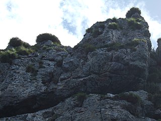
The word pā can refer to any Māori village or defensive settlement, but often refers to hillforts – fortified settlements with palisades and defensive terraces – and also to fortified villages. Pā sites occur mainly in the North Island of New Zealand, north of Lake Taupo. Over 5,000 sites have been located, photographed and examined, although few have been subject to detailed analysis. No pā have been yet located from the early colonization period when early Polynesian-Māori colonizers lived in the lower South Island. Variations similar to pā occur throughout central Polynesia, in the islands of Fiji, Tonga and the Marquesas Islands.

Lake Ōmāpere is the largest lake in the Northland Region of New Zealand. It is located to the North of Kaikohe.

The New Zealand longfin eel is a species of freshwater eel that is endemic to New Zealand. It is the largest freshwater eel in New Zealand and the only endemic species – the other eels found in New Zealand are the native shortfin eel, also found in Australia, and the naturally introduced Australian longfin eel. Longfin eels are long-lived, migrating to the Pacific Ocean near Tonga to breed at the end of their lives. They are good climbers as juveniles and so are found in streams and lakes a long way inland. An important traditional food source for Māori, longfin eels are threatened and declining but still commercially fished.
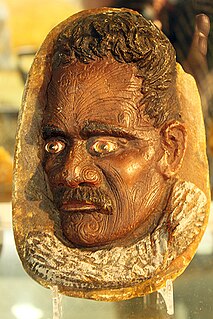
Kauri gum is a fossilised resin extracted from kauri trees, which is made into crafts such as jewellery. Kauri forests once covered much of the North Island of New Zealand, before the arrival of people caused deforestation, causing several areas to revert to sand dunes, scrubs, and swamps. Even afterward, ancient kauri fields continued to provide a source for the gum and the remaining forests.

Northland is an affluent suburb in west-central Wellington, New Zealand. Not far from Victoria University it also includes low-priced accommodation popular with young students. It borders the suburbs of Highbury, Kelburn, Thorndon, Wilton, Wadestown and Karori. Northland is populated by a mix of university students, young professionals and families. Part of the area was known as Creswick until the late 19th century when new roads and building sites were developed by the landowner, C J Pharazyn, who marketed the whole area as Northland. At that time it was described in the now defunct Evening Post as "Wellington's best suburb".

The geology of New Zealand is noted for its volcanic activity, earthquakes and geothermal areas because of its position on the boundary of the Australian Plate and Pacific Plates. New Zealand is part of Zealandia, a microcontinent nearly half the size of Australia that broke away from the Gondwanan supercontinent about 83 million years ago. New Zealand's early separation from other landmasses and subsequent evolution have created a unique fossil record and modern ecology.

Lake Rototoa is located at the northern end of the south head of the Kaipara Harbour in the Rodney District of Auckland Region, New Zealand. With a surface area of 1.39 km2 and a maximum depth of 26 m, it is the largest and deepest of a series of sand-dune lakes found along the western coastline of the North Island.
The Kaipara tidal power station is a proposed tidal power project to be located in the Kaipara Harbour. The project is being developed by Crest Energy, with an ultimate size of 200MW at a cost of $600 million.

Whangārei Harbour is a large harbour on the east coast of the North Island of New Zealand.

Kiwi Property Group Limited is a New Zealand NZX-listed company, formerly a real estate investment trust, that owns many properties throughout New Zealand; including the Sylvia Park Business and Shopping Centre, and the Vero Centre. It is also New Zealand's largest-listed property fund.
The Kaimaumau wetland is a wetland by the Rangaunu Harbour, in Northland, New Zealand. At approximately 1,860 hectares, it is one of the largest remaining wetlands in Northland. It comprises the Otiaita and Waihauhau swamps, Motutangi Swamp Scientific Reserve, and Lake Waikaramu. The wetland is currently threatened by peat mining and by water loss from avocado growing.
Lake Heather is a dune lake in the Far North District of New Zealand. It is located west of the town of Awanui, and between the larger Lake Ngatu and Lake Rotoroa.
