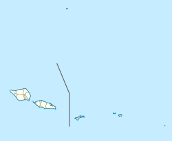
The Samoan Islands are an archipelago covering 3,030 km2 (1,170 sq mi) in the central South Pacific, forming part of Polynesia and of the wider region of Oceania. Administratively, the archipelago comprises all of the Independent State of Samoa and most of American Samoa. The land masses of the two Samoan jurisdictions are separated by 64 km (40 mi) of ocean at their closest points.

Savaiʻi is the largest and highest island both in Samoa and in the Samoan Islands chain. The island is also the sixth largest in Polynesia, behind the three main islands of New Zealand and the Hawaiian Islands of Hawaii and Maui. Though it’s larger than the country’s second main island Upolu it’s by far not as populous.
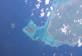
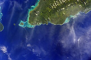
Manono is an island of Samoa, situated in the Apolima Strait between the main islands of Savai'i and Upolu, 3.4 km west-northwest off Lefatu Cape, the westernmost point of Upolu. By population just like by area it’s Samoa’s third largest island.
Samoa is made up of eleven itūmālō. These are the traditional eleven districts that were established well before European arrival. Each district has its own constitutional foundation (faavae) based on the traditional order of title precedence found in each district's faalupega.
Aʻana is a district of Samoa. It is on the western third of Upolu island, with a small exclave surrounded by Aiga-i-le-Tai. It has an area of 193 km² and a population of 23,265. The main centre is Leulumoega.
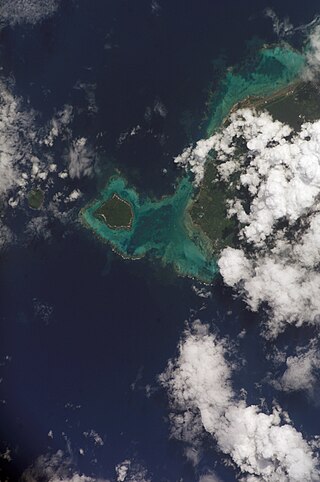
Aiga-i-le-Tai is a district of Samoa which includes the small islands of Manono, Apolima and tiny uninhabited Nu'ulopa lying in the Apolima Strait between the country's two main islands of Upolu and Savai'i.

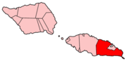
Ātua is an ancient political district of Samoa, consisting of most of the eastern section of Upolu and the island Tutuila. Within Samoa’s traditional polity, Ātua is ruled by the Tui Ātua together with the group of six senior orators of Lufilufi and 13 senior matai from throughout Ātua, comprising the Fale Ātua. The fono (meeting) of Atua's rulers takes place in Lufilufi on the great malae of Lalogafu'afu'a.
Poloa is a village in American Samoa. It is located at the west side of Tutuila in the Alataua District. The village has 193 residents in 2010. The main denominations in the area are Methodist and Christian. Poloa has one elementary school. It is located in Lealataua County.
Auala is a small village on the northwest coast of Savai'i island in Samoa. The village is in the electoral constituency of Vaisigano East which forms part of the larger political district of Vaisigano. The village's population was 507 in 2016, a decrease from 573 in 2011.

Vavau is a small village on south east end of Upolu island in Samoa. The village is part of the Lotofaga Electoral Constituency which is within the larger political district of Atua.

Falefā is located on the north eastern coast of Upolu island in Samoa. It was the ancient capital during the ‘Malo’ (‘government’) of Tupu Tafa'ifa (King) Fonoti. After having defeated his siblings Va'afusuaga and Samalaulu for control of Samoa, King Fonoti chose to rule from his new seat in Falefa, an honour remembered in its faalupega to this day.

Lotofaga is a village on the south coast of Upolu island in Samoa. Lotofaga is also the name of the larger Lotofaga Electoral Constituency which includes Lotofaga village and two other villages, Vavau and Matatufu. The population of Lotofaga village is 971.

The Aleipata Islands are a group of four uninhabited islands off the eastern end of Upolu Island, Samoa. The islands are eroded volcanic tuff rings, and consist of a small northern pair on Upolu's barrier reef, and a larger southern pair outside it. Collectively the islands have an area of about 1.7 km2 (0.66 sq mi). Administratively, the islands are part of the Atua district. The islands are important for Samoa's biodiversity and are protected by the Aleipata Marine Protected Area.

Fa'amatai is the indigenous political ('chiefly') system of Samoa, central to the organization of Samoan society. It is the traditional indigenous form of governance in both Samoas, comprising American Samoa and the Independent State of Samoa. The term comprises the prefix fa'a and the word matai.
The 2009 Samoa earthquake and tsunami took place on 29 September 2009 in the southern Pacific Ocean adjacent to the Kermadec-Tonga subduction zone. The submarine earthquake occurred in an extensional environment and had a moment magnitude of 8.1 and a maximum Mercalli intensity of VI (Strong). It was the largest earthquake of 2009. The earthquake initiated with a normal-faulting event with a magnitude of 8.1. Within two minutes of the earthquake rupture, two large magnitude 7.8 earthquakes occurred on the subduction zone interface. The two magnitude 7.8 earthquakes had a combined magnitude equivalent to 8.0. The event can be considered a doublet earthquake.
Poutasi is a village on the south east coast of Upolu island in Samoa. The population is 395. The village is part of Falealili Electoral Constituency in the larger political district of Atua. Poutasi was extensively damaged by the 2009 Samoa earthquake and tsunami.
Lufilufi is a historical village situated on the north coast of Upolu island in Samoa. The village is part of the electoral constituency Anoamaa East which is within the larger political district of Atua. The village's population is 949.
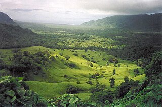
Falefa Valley is situated inland on the east side of Upolu Island in Samoa. The valley forms part of the traditional domain of Falefa with the southern part at Le Mafa pass forming the natural boundary between Falefa and neighbouring Lotofaga. The area has been excavated and studied by archaeologists, in particular a New Zealand team led by Roger Curtis Green and Janet Davidson. Towards the north of the valley is Falefa village. The valley is situated in the political district of Atua. To the north east is the smaller district of Va'a-o-Fonoti which includes an extensive conservation area.
Ulutogia is a village on the east coast of Upolu island in Samoa. The village is part of the electoral constituency Aleipata Itupa i Luga which is part of the political district of Atua. It has a population of 202.
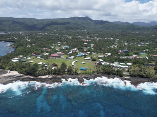
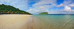
Vailoatai is a village in southwestern Tutuila, the main island of American Samoa. It is located on the eastern end of Leone Bay. The village is known for its beautiful malae, nested along the island's rugged southern coast and lined by the fale tali mālō of its village chiefs.