Lamut | |
|---|---|
| Municipality of Lamut | |
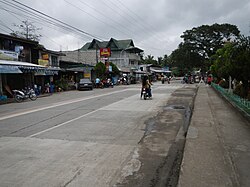 Downtown area | |
 Flag  Seal | |
 Map of Ifugao with Lamut highlighted | |
 Interactive map of Lamut | |
 Lamut Location within the Philippines | |
| Coordinates: 16°39′06″N121°13′04″E / 16.6517°N 121.2178°E | |
| Country | Philippines |
| Region | Cordillera Administrative Region |
| Province | Ifugao |
| District | Lone district |
| Founded | 1959 |
| Barangays | 18 (see Barangays) |
| Government | |
| • Type | Sangguniang Bayan |
| • Mayor | Victomar H. Bunnol |
| • Vice Mayor | Everda Desiree D. Dulinayan |
| • Representative | Solomon R. Chungalao |
| • Municipal Council | Members |
| • Electorate | 18,352 voters (2025) |
| Area | |
• Total | 159.65 km2 (61.64 sq mi) |
| Elevation | 246 m (807 ft) |
| Highest elevation | 415 m (1,362 ft) |
| Lowest elevation | 203 m (666 ft) |
| Population (2024 census) [3] | |
• Total | 26,520 |
| • Density | 166.1/km2 (430.2/sq mi) |
| • Households | 6,224 |
| Economy | |
| • Income class | 4th municipal income class |
| • Poverty incidence | 7.6 |
| • Revenue | ₱ 186.6 million (2022) |
| • Assets | ₱ 367.7 million (2022) |
| • Expenditure | ₱ 142.2 million (2022) |
| • Liabilities | ₱ 42.81 million (2022) |
| Service provider | |
| • Electricity | Ifugao Electric Cooperative (IFELCO) |
| Time zone | UTC+8 (PST) |
| ZIP code | 3605 |
| PSGC | |
| IDD : area code | +63 (0)74 |
| Native languages | Ifugao Tuwali Ilocano Tagalog |
| Website | lamut |
Lamut, officially the Municipality of Lamut is a municipality in the province of Ifugao, Philippines. According to the 2024 census, it has a population of 26,520 people. [5]
Contents
- History
- Geography
- Barangays
- Climate
- Demographics
- Economy
- Government
- Local government
- Elected officials
- Education
- Primary and elementary schools
- Secondary schools
- Technical and vocational school
- References
- External links
The town is the gateway to Ifugao. IFSU Main Campus is located in Nayon and IPSHS is located in Mabato-bato.