Related Research Articles

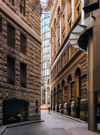
An alley or alleyway is a narrow lane, path, or passageway, often reserved for pedestrians, which usually runs between, behind, or within buildings in the older parts of towns and cities. It is also a rear access or service road, or a path, walk, or avenue in a park or garden.

Perth railway station is the largest station on the Transperth network, serving the central business district of Perth, Western Australia. It serves as an interchange between the Airport, Armadale, Fremantle, Midland, and Thornlie lines as well as Transwa's Australind service. It is also directly connected to Perth Underground railway station, which has the Yanchep and Mandurah lines.
The Mitchell Freeway is a 41.5-kilometre-long (25.8 mi) freeway in the northern suburbs of Perth, Western Australia, linking central Perth with the city of Joondalup. It is the northern section of State Route 2, which continues south as Kwinana Freeway and Forrest Highway. Along its length are interchanges with several major roads, including the Graham Farmer Freeway and Reid Highway. The southern terminus of the Mitchell Freeway is at the Narrows Bridge, which crosses the Swan River, and the northern terminus is at Romeo Road in Alkimos.
Murray Street is one of four main east-west roads within the Perth central business district (CBD).

A coffee palace was an often large and elaborate residential hotel that did not serve alcohol, most of which were built in Australia in the late 19th century.
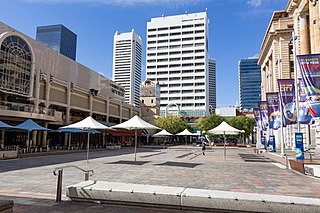
Forrest Place is a pedestrianised square located within the central business district of Perth, Western Australia. The street was created in 1923, and has a history of being a focal point for significant political meetings and demonstrations.

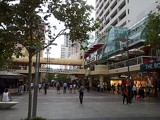
Hay Street is a major road through the central business district of Perth, Western Australia and adjacent suburbs. The street was named after Robert William Hay, the Permanent Under Secretary for Colonies. Sections of the road were called Howick Street and Twiss Street until 1897. One block in the central business section is now a pedestrian mall with extremely limited vehicular traffic, so that it is necessary to make a significant detour in order to drive the entire length of Hay Street.

William Street is a suburban distributor and one of two major cross-streets in the central business district of Perth, Western Australia. Commencing in western Mount Lawley, its route takes it through the Northbridge café and nightclub district as well as the CBD.

78 Records was a music store located in the central business district of Perth, Western Australia. The store also sold DVDs, clothing and tickets to music and comedy events.

Perth is a suburb in the Perth metropolitan region, Western Australia that includes both the central business district of the city, and a suburban area spreading north to the northern side of Hyde Park. It does not include the separate suburbs of Northbridge or Highgate. Perth is split between the City of Perth and the City of Vincent local authorities, and was named after the city of the same name in Scotland.

The Melbourne central business district in Australia is home to numerous lanes and arcades. Often called "laneways", these narrow streets and pedestrian paths date mostly from the Victorian era, and are a popular cultural attraction for their cafes, bars and street art.

Stormie Mills is a street/visual artist operating out of Perth, Western Australia. Mills' portfolio has been published in two books, Proximamente (2008) and Dwi Yma (2013).
Tourism in Perth, the capital city of Western Australia, is an important part of the Australian state's economy, contributing to the prosperity of businesses in the city, as well as other regions of the state.

Northbridge is an inner city suburb of Perth, Western Australia, historically separated from Perth's central business district by the Fremantle and Joondalup railway lines. It is part of the City of Perth local government area.
Enoch Pearson Barratt, and sometimes Barrett, was an Australian nursery proprietor who established one of the earliest commercial nurseries in Western Australia.

The Melbourne Hotel is a heritage listed landmark hotel in Perth, Western Australia. The hotel is located on the corner of Hay Street and Milligan Street.

Milligan Street is a street in Perth, Western Australia that runs from St Georges Terrace to north of Wellington Street. The northern section provides access to the Perth Arena carpark and Telethon Avenue; there are also dedicated Transperth bus roads connecting to the northern end, south of the Fremantle railway line.

Yagan Square is a public space and a component of the Perth City Link in Perth, Western Australia. It is situated between the Horseshoe Bridge and the Perth Busport in the eastern part of the Perth City Link precinct, occupying 1.1 hectares. Construction of the square began in February 2016, and it was opened on 3 March 2018. It is named after the Aboriginal warrior Yagan.
The lanes and alleyways of Sydney are a series of passageways found in Sydney central business district that have historically functioned by providing both off-street vehicular access to city buildings and secondary pedestrian routes through city blocks. They generally feature street art, cafes, restaurants, bars and retail outlets. The Rocks has the most prominent and historical laneways in Sydney, which date to the 19th century. Forgotten Songs is a popular attraction found in Angel Place.
References
- ↑ "Perth Public Spaces Public Life" (PDF). Gehl Architects. 2009. p. 36. Retrieved 6 January 2015.
- ↑ Romano, Mary-Anne (12 March 2012). "Perth CBD evolving to be more pedestrian friendly". Science Network WA. Retrieved 6 January 2015.
- ↑ "Bars breathe new life into Perth Lanes". The West Australian . 23 February 2011. Retrieved 16 June 2014.
- ↑ "City of Perth Council Minutes" (PDF). 26 August 2008. pp. 45–49. Retrieved 3 January 2015.
- ↑ "Barratt, Enoch P". Western Australian Museum: Welcome Walls. Government of Western Australia. Retrieved 27 May 2024.
- ↑ "Enoch Pearson Barrett". Convict Records. Retrieved 16 June 2014.
- ↑ "News and Notes". The West Australian . Perth: National Library of Australia. 3 December 1929. p. 14. Retrieved 10 June 2014.
- ↑ "Cr. T. A. Shafto". Geraldton Guardian and Express . WA: National Library of Australia. 20 June 1930. p. 3. Retrieved 10 June 2014.
- ↑ 1949 Australia Post street directory.
- ↑ Wynne, Emma (14 April 2014). "Perth City Streets transformed by Urban Art Festival". ABC News. Retrieved 3 January 2015.
- ↑ Wilson, Laetitia (11 April 2014). "Ripper Street Art". The West Australian . Retrieved 3 January 2015.
- ↑ "Perth Piazza wins Landscape Award". Architecture & Design. 24 May 2010. Retrieved 16 June 2014.
- ↑ Thomas, Beatrice (31 January 2012). "A Little Love Lights Up Lanes". The West Australian . Retrieved 16 June 2014.
- ↑ "Prince Lane". Perth Voice. 19 September 2013. Retrieved 16 June 2014.
- ↑ Thompson, Chris (2 December 2010). "99 metre Australiana Mural for City". OnePerth.com.au. Retrieved 16 June 2014.
- ↑ Piesse, Emily (15 October 2008). "Bringing CBD Laneways to life". Business News. Retrieved 16 June 2014.
- ↑ "Facelift for More Forgotten City Lanes". Eastern Reporter. 29 September 2009. Archived from the original on 3 January 2015. Retrieved 16 June 2014.
- ↑ "City of Perth Council Minutes" (PDF). 17 February 2009. pp. 47–53. Retrieved 3 January 2015.