Weertman Island is the largest and southernmost of the Bennett Islands, lying in Hanusse Bay. It was mapped from air photos taken by Ronne Antarctic Research Expedition (RARE) (1947–48) and Falkland Islands and Dependencies Aerial Survey Expedition (FIDASE) (1956–57), and named by United Kingdom Antarctic Place-Names Committee (UK-APC) for Johannes Weertman, American metallurgist who proposed a theory of slip of glaciers on their beds and has made important contributions to the theory of glacier flow.
Jacobsen Glacier is a glacier flowing east-northeast from Mount Reid, in the Holland Range, Antarctica, into the Ross Ice Shelf. It was mapped by the United States Geological Survey from Tellurometer surveys (1961–62) and Navy air photos (1960), and was named by the Advisory Committee on Antarctic Names for H. Jacobsen, Master of the USNS Chattahoochee during U.S. Navy Operation Deep Freeze 1964 and 1965.

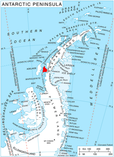
Ezcurra Inlet is an inlet forming the western arm of Admiralty Bay, King George Island, in the South Shetland Islands. It was charted by the French Antarctic Expedition, 1908–10, under Jean-Baptiste Charcot, and named "Fiord Ezcurra" after Pedro de Ezcurra, an Argentine politician and Minister of Agriculture in 1908, who assisted the French expedition.
Bergel Rock is a rock nearly 1 nautical mile (1.9 km) south of Quintana Island in the southwestern Wilhelm Archipelago. It was named by the UK Antarctic Place-Names Committee for Alexandra Bergel, a granddaughter of Sir Ernest Shackleton, and a sponsor for HMS Endurance which made surveys in this area in February 1969.

Bond Glacier is a steep, heavily crevassed glacier to the west of Ivanoff Head, flowing from the continental ice to Blunt Cove at the head of Vincennes Bay. It was mapped from air photos taken by U.S. Navy Operation Highjump (1946–47), and named by the Advisory Committee on Antarctic Names for Captain Charles A. Bond, U.S. Navy, commander of the expedition's Western Group.
Bothy Bay is a small bay on the northwest side of Fildes Peninsula, King George Island. The entrance is 0.7 nautical miles (1.3 km) southeast of Square End Island and the bay is backed by a wide beach, with low cliffs on the northeast and southwest sides. The name, applied by the UK Antarctic Place-Names Committee in 1977, is suggested by a crude stone hut ("bothy"), evidently built by nineteenth-century sealers, on the shore of the bay.
Brazitis Nunatak is a nunatak, 1,625 metres (5,330 ft) high, along the edge of an ice escarpment 5 nautical miles (9 km) south of DesRoches Nunataks in the southwestern Patuxent Range, Pensacola Mountains. It was mapped by the United States Geological Survey from surveys and from U.S. Navy air photos, 1956–66, and named by the Advisory Committee on Antarctic Names for Peter F. Brazitis, a cosmic ray scientist at South Pole Station, winter 1967.

Breitfuss Glacier is a glacier 10 nautical miles (19 km) long, which flows southeast from Avery Plateau into Mill Inlet to the west of Cape Chavanne, on the east coast of Graham Land. It was charted by the Falkland Islands Dependencies Survey (FIDS) and photographed from the air by the Ronne Antarctic Research Expedition in 1947. It was named by the FIDS for Leonid Breitfuss, a German polar explorer, historian, and author of many polar bibliographies.
Collins Peak is a small but noteworthy peak, 1,810 metres (5,940 ft) high, at the east side of Malta Plateau, on the end of the ridge overlooking the confluence of Hand Glacier and Line Glacier, in the Victory Mountains, Victoria Land. It was mapped by the United States Geological Survey from surveys and from U.S. Navy air photos, 1960–64, and named by the Advisory Committee on Antarctic Names for Eric J. Collins, biologist at Hallett Station, 1965–66.

Coulston Glacier is a small tributary glacier flowing south from the Cartographers Range into Trafalgar Glacier, 10 nautical miles (19 km) west of Bypass Hill, in the Victory Mountains of Victoria Land. It was mapped by the United States Geological Survey from surveys and from U.S. Navy air photos 1960–64, and named by the Advisory Committee on Antarctic Names for Peter W. Coulston, an aviation electronics technician with U.S. Navy Squadron VX-6 at McMurdo Station, 1967.
Mount Strange is a partly ice-free mountain 4 nautical miles (7 km) east-northeast of Mount Isherwood, standing at the east side of Simmons Glacier in the Kohler Range, Marie Byrd Land. Mapped by United States Geological Survey (USGS) from surveys and U.S. Navy air photos, 1959-66. Named by Advisory Committee on Antarctic Names (US-ACAN) for Joe F. Strange, USGS topographic engineer, member of the Marie Byrd Land Survey Party, 1966-67.
Mount Dewe is a mountain in the southeast part of the Hauberg Mountains in Palmer Land. It was mapped by the United States Geological Survey from ground surveys and U.S. Navy air photos, 1961–67, and was named by the Advisory Committee on Antarctic Names for Michael B. Dewe, a glaciologist at Byrd Station, summer 1965–66.

Plummer Glacier is a short glacier descending east through the Enterprise Hills to the north of Lippert Peak and the Douglas Peaks, in the Heritage Range in Antarctica. Mapped by United States Geological Survey (USGS) from surveys and U.S. Navy air photos, 1961-66. Named by Advisory Committee on Antarctic Names (US-ACAN) for Charles C. Plummer, United States Antarctic Research Program (USARP) glaciologist at Palmer Station in 1965.

Field Glacier is a glacier on Pernik Peninsula, Loubet Coast in Graham Land, situated south of Salmon Cove, and flowing west into Lallemand Fjord just south of Kanchov Peak. It was mapped from air photos taken by the Falkland Islands and Dependencies Aerial Survey Expedition, 1956–57. In association with the names of glaciologists grouped in this area, it was named by the UK Antarctic Place-Names Committee after William B.O. Field, an American glaciologist and surveyor, sometime Research Fellow of the American Geographical Society.

Foley Glacier is a glacier about 4 nautical miles (7 km) long flowing north from the western end of Thurston Island just east of Cape Petersen. It was named by the Advisory Committee on Antarctic Names after Kevin M. Foley, of the United States Geological Survey, Reston, Virginia, a computer specialist and team member of the Glaciological and Coastal-Change Maps of Antarctica Project.
Sölch Glacier is a glacier on the Pernik Peninsula of the Loubet Coast in Graham Land, flowing west to Salmon Cove just north of Kanchov Peak on the east side of Lallemand Fjord. It was mapped from air photos taken by the Falkland Islands and Dependencies Aerial Survey Expedition, 1956–57, and named by United Kingdom Antarctic Place-Names Committee for Johann Sölch (1883–1951), an Austrian glacial geologist and glaciologist.
Somigliana Glacier is a glacier flowing north to Langmuir Cove on the north part of Arrowsmith Peninsula in Graham Land. Mapped by Falkland Islands Dependencies Survey (FIDS) from surveys and air photos, 1956-59. Named by United Kingdom Antarctic Place-Names Committee (UK-APC) for Carlo Somigliana, Italian mathematician and physicist who originated a viscous theory of glacier flow, in 1921.
Squires Glacier is a tributary glacier between the Playfair and Hutton Mountains, flowing east-northeast to Swann Glacier, in Palmer Land. Mapped by United States Geological Survey (USGS) from surveys and U.S. Navy air photos, 1961-67. Named by Advisory Committee on Antarctic Names (US-ACAN) for Peter L. Squires, glaciologist at Byrd Station, summer 1965-66.
Thorne Point is a point at the west side of Langmuir Cove, marking the northwest extremity of Arrowsmith Peninsula, Graham Land. It was mapped in 1960 from surveys made by the Falkland Islands Dependencies Survey (FIDS), and was named for John Thorne, FIDS meteorologist at Detaille Island in 1956 and 1957.
Mount Kershaw is a mountain, 1,180 metres (3,870 ft) high, rising above Jones Ice Shelf and Kosiba Wall in the northeast end of Blaiklock Island, off the west coast of Graham Land, Antarctica. It was named by the UK Antarctic Place-Names Committee after John E.G. Kershaw (1948–1990), a British Antarctic Survey senior pilot, 1974–79, and pilot on the Transglobe Expedition, 1980–82, and other expeditions. He was killed in a flying accident on Jones Ice Shelf, March 5, 1990, and his remains now rest near the foot of this mountain.