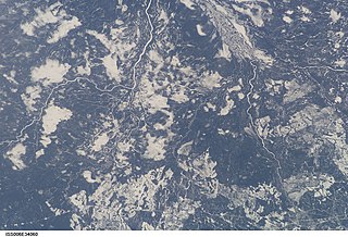
The Kenogami River is a river in the James Bay drainage basin in Thunder Bay and Cochrane districts in Northern Ontario, Canada, which flows north from Long Lake near Longlac to empty into the Albany River. The river is 320 kilometres (199 mi) in length and its name means "long water" in the Cree language. A portion of the river's headwaters have been diverted into the Lake Superior drainage basin.

Kaladar is a compact rural community and unincorporated area in the municipality of Addington Highlands, Lennox and Addington County in Eastern Ontario, Canada. It is located at the junction of Ontario Highway 7 and Ontario Highway 41.

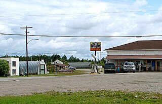
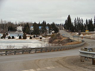
Foleyet is an unincorporated community in the Unorganized North Part of Sudbury District in Northeastern Ontario, Canada, midway between Chapleau and Timmins on Highway 101. The town was created during the construction of the Canadian Northern Railway (CNR) through the area in the early years of the 20th century.

South Algonquin is a township municipality in Nipissing District, Ontario, Canada. Located south of Algonquin Provincial Park, it is the sole populated portion of the district that lies south of the traditional dividing line between Northern Ontario and Southern Ontario and is closer connected to Renfrew County as opposed to the core portions of Nipissing District.

Raith is a dispersed rural community and unincorporated area in geographic Golding Township in the Unorganized Part of Thunder Bay District in Northwestern Ontario, Canada.

Rice Lake is an unincorporated place and railway point in geographic Rice Township in Unorganized Kenora District in northwestern Ontario, Canada, 2.5 kilometres (1.6 mi) east of the border with the province of Manitoba.

Departure Lake is a dispersed rural community and unincorporated place in geographic Haggart Township, Cochrane District in Northeastern Ontario, Canada. It is located on Ontario Highway 11 between the communities of Strickland to the west and Smooth Rock Falls to the east.

Blount is a railway point and unincorporated place in the eponymous geographic Blount Township, Cochrane District, Ontario, Canada. It is on the Ontario Northland Railway line from Cochrane to Moosonee, between the community of Gardiner to the north and Clute railway station to the south, but is not served by Polar Bear Express passenger trains.

Malachi is an unincorporated place and community in Unorganized Kenora District in northwestern Ontario, Canada. It is also the name of the surrounding geographic township. The community is almost exclusively situated on the shores of Malachi Lake.

The Blanche River is a river in the Saint Lawrence River drainage basin in Timiskaming District in northeastern Ontario, Canada. The river is a tributary of Lake Timiskaming and its name is from the French for the colour "white".

Ruel is an unincorporated community in geographic Blewett Township in the Unorganized North Part of Sudbury District in Northeastern Ontario, Canada. The community is on the Opikinimika River, part of the James Bay drainage basin, just over the height of land between the latter basin and the Great Lakes Basin.

Stupart is an unincorporated place and railway point in geographic Hennessy Township in the Unorganized North Part of Sudbury District in Northeastern Ontario, Canada. The community is just off Deschênes Lake in the Opikinimika River system, part of the James Bay drainage basin.

Felix is an unincorporated place and railway point in geographic Marshay Township in the Unorganized North Part of Sudbury District in Northeastern Ontario, Canada. The community is on Ningoowaswi Lake in the Wanapitei River system, part of the Great Lakes Basin.

The Black River is a river in Cochrane District and Timiskaming District in Northeastern Ontario, Canada. It is part of the James Bay drainage basin, and is a right tributary of the Abitibi River. The municipality of Black River-Matheson is named after the river.

The Onaping River is a river in Greater Sudbury and Sudbury District in Northeastern Ontario, Canada. It is in the Great Lakes Basin and is a right tributary of the Vermilion River.

The Matawin River is a river in Thunder Bay District in Northwestern Ontario, Canada. It is in the Great Lakes Basin and is a right tributary of the Kaministiquia River.

The Shebandowan River is a river in Thunder Bay District in Northwestern Ontario, Canada. It is in the Great Lakes Basin and is a left tributary of the Matawin River. Three-quarters of the length of the river valley is paralleled by Ontario Highway 11, at this point part of the Trans-Canada Highway; and the entire length of the river valley is paralleled by a Canadian National Railway main line, built originally as the Canadian Northern Railway transcontinental main line.

The Oskondaga River is a river in Thunder Bay District in Northwestern Ontario, Canada. It is in the Great Lakes Basin and is a left tributary of the Shebandowan River. The river valley is paralleled by Ontario Highway 17, at this point part of the Trans-Canada Highway; and by both the Canadian Pacific Railway transcontinental main line, still in operation, and the Canadian National Railway Graham Subdivision main line, originally built as part of the National Transcontinental Railway, now abandoned.

Salem Creek is a stream in the municipal township of Cramahe, Northhumberland County in Central Ontario, Canada. It is a tributary of Lake Ontario. The creek takes its name from the community of Salem which it flows past.

Minnipuka is an unincorporated place and Dispersed Rural Community in geographic Marjorie Township, in the Unorganized North part of Algoma District in northeastern Ontario, Canada. It is on the Canadian National Railway transcontinental railway main line between the railway points of Neswabin to the west and Dishnish to the east, has a passing track, and is passed but not served by Via Rail transcontinental Canadian passenger trains. The place is on the east side of Minnipuka Lake, part of the Goat River system.


