
The term "United States," when used in the geographic sense, refers to the contiguous United States, Alaska, Hawaii, the five insular territories of Puerto Rico, Northern Mariana Islands, U.S. Virgin Islands, Guam, American Samoa, and minor outlying possessions. The United States shares land borders with Canada and Mexico and maritime borders with Russia, Cuba, The Bahamas, and many other countries, mainly in the Caribbeanin addition to Canada and Mexico. The northern border of the United States with Canada is the world's longest bi-national land border.

California is a U.S. state on the western coast of North America. Covering an area of 163,696 sq mi (423,970 km2), California is among the most geographically diverse states. The Sierra Nevada, the fertile farmlands of the Central Valley, and the arid Mojave Desert of the south are some of the geographic features of this U.S. state. It is home to some of the world's most exceptional trees: the tallest, most massive, and oldest. It is also home to both the highest and lowest points in the 48 contiguous states.

The Humboldt–Toiyabe National Forest (HTNF) is the principal U.S. National Forest in the U.S. state of Nevada, and has a smaller portion further west in Eastern California in the state of California. With an area of 6,289,821 acres (25,454.00 km2), it is the largest U.S. National Forest reservation outside of Alaska, further northwest on the North American continent.
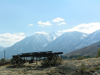
The Carson Range is a spur of the Sierra Nevada in eastern California and western Nevada that starts at Carson Pass and stretches north to the Truckee River near Verdi, Nevada.

The Feather River is the principal tributary of the Sacramento River, in the Sacramento Valley of Northern California. The river's main stem is about 73 miles (117 km) long. Its length to its most distant headwater tributary is just over 210 miles (340 km). The main stem Feather River begins in Lake Oroville, where its four long tributary forks join—the South Fork, Middle Fork, North Fork, and West Branch Feather Rivers. These and other tributaries drain part of the northern Sierra Nevada, and the extreme southern Cascades, as well as a small portion of the Sacramento Valley. The total drainage basin is about 6,200 square miles (16,000 km2), with approximately 3,604 square miles (9,330 km2) above Lake Oroville.
The Laguna Mountains are a mountain range of the Peninsular Ranges in eastern San Diego County, California. The mountains run in a northwest/southeast alignment for approximately 35 miles (56 km).

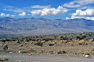
Eureka Valley is located in Inyo County, in eastern California in the southwestern United States. It is approximately 28 miles (45 km) long and up to 10 miles (16 km) wide, with elevations varying from 2,870 feet (870 m) up to 8,456 feet (2,577 m). The southern section of the valley is now part of the Death Valley National Park - Death Valley itself lies just to the southeast. To the north is Deep Springs Valley, Fish Lake Valley, and the White Mountain Range. To the east the Last Chance Range rises over 5,500 feet (1,700 m) above the valley floor. To the west are the Saline Mountains, and to the southwest lies Saline Valley.

The North American Cordillera, sometimes also called the Western Cordillera of North America, the Western Cordillera, or the Pacific Cordillera, is the North American portion of the American Cordillera, the mountain chain system along the Pacific coast of the Americas. The North American Cordillera covers an extensive area of mountain ranges, intermontane basins, and plateaus in Western and Northwestern Canada, Western United States, and Mexico, including much of the territory west of the Great Plains.
The Cottonwood Mountains range is found in Death Valley National Park in Inyo County, California, U.S.
The Big Maria Mountains are located in the southeastern part of the U.S. state of California, near the Colorado River and Arizona. The range lies between Blythe and Vidal, and west of U.S. Route 95 in California and east of Midland. The mountains are home to the Eagle Nest Mine and reach an elevation of 1,030 m (3,380 ft). A power line that runs from Parker Dam to Yuma, Arizona runs through the range. A smaller range, the Little Maria Mountains, lie to the west of the Big Marias.

The Whipple Mountains are located in eastern San Bernardino County, California. They are directly west of the Colorado River, Parker Dam, and Lake Havasu; south of Needles, California; north of Parker, Arizona and Vidal, California; and northeast of Vidal Junction, California.

The Nopah Range is a mountain range located in Inyo County, California, United States, near the eastern border with Nevada.
The In-Ko-Pah Mountains are one of the Peninsular Ranges in Southern California near the Mexico–United States border, west of the Jacumba Mountains. The range, which lies in a north-south direction, is located just north of Interstate 8, and east of the Manzanita Indian Reservation.

The Jacumba Mountains are a mountain range of the Peninsular Ranges in eastern San Diego County, California, near the Mexico–United States border. The range reaches an elevation of 4,512 feet (1,375 m) at Jacumba Peak, near the southern end of the chain.
The El Paso Mountains are located in the northern Mojave Desert, in central Southern California in the Western United States.
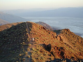
The Black Mountains are a mountain range located in the southern part of Inyo County and northern San Bernardino County, California, in the southeast part of Death Valley National Park.

The Mescal Range is a small mountain range in the eastern Mojave Desert in California about 12 miles from the Nevada state line.

The Piute Range is located in the Mojave Desert, primarily in northeast San Bernardino County, California, United States, with a north portion in Nevada. Most of the range is the eastern border of the Mojave National Preserve, a National Park Service natural area and park.

The Coast Ranges of California span 400 miles (644 km) from Del Norte or Humboldt County, California, south to Santa Barbara County. The other three coastal California mountain ranges are the Transverse Ranges, Peninsular Ranges and the Klamath Mountains.
The Perris Block is the central block of three major fault-bounded blocks of the northern part of the Peninsular Ranges. The Perris Block lies between the Santa Ana Block to the west and the San Jacinto Block to the east. The Perris Block, was named by Walter A. English in 1925 for the city of Perris, located near the center of the block.

