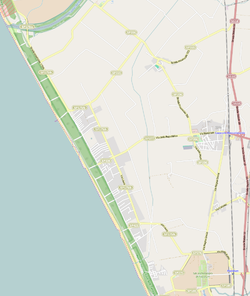
Paestum was a major ancient Greek city on the coast of the Tyrrhenian Sea in Magna Graecia. The ruins of Paestum are famous for their three ancient Greek temples in the Doric order, dating from about 550 to 450 BC, which are in a very good state of preservation. The city walls and amphitheatre are largely intact, and the bottom of the walls of many other structures remain, as well as paved roads. The site is open to the public, and there is a modern national museum within it, which also contains the finds from the associated Greek site of Foce del Sele.

The Sele is a river in southwestern Italy. Originating from the Monti Picentini in Caposele, it flows through the region of Campania, in the provinces of Salerno and Avellino. Its mouth is in the Gulf of Salerno, on the Tyrrhenian Sea, at the borders between the municipalities of Eboli and Capaccio, in the beginning point of Cilentan Coast.

Agropoli is a town and comune located in the Cilento area of the province of Salerno, Campania, Italy. It is situated at the start of the Cilentan Coast, on the Tyrrhenian Sea.
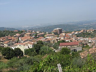
Albanella is a town and comune in the province of Salerno in the Campania region of south-western Italy. It is located 51 kilometers from the city of Salerno.

Capaccio Paestum is a town and comune in the province of Salerno in the Campania region of south-western Italy. The ruins of the ancient Greek city of Paestum lie within borders of the comune.

Cicerale is a town and comune in the province of Salerno in the Campania region of south-western Italy.

Giungano is a town and comune in the province of Salerno in the Campania region of south-western Italy.

Ogliastro Cilento is a town and comune in the province of Salerno in the Campania region of south-western Italy. As of 2011 its population was of 2,241.

Santa Barbara is an Italian village and hamlet (frazione) of the commune of Ceraso in the Province of Salerno, Campania. It has a population of roughly a thousand.
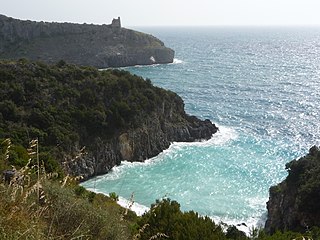
Cilento is an Italian geographical region of Campania in the central and southern part of the Province of Salerno and an important tourist area of southern Italy.
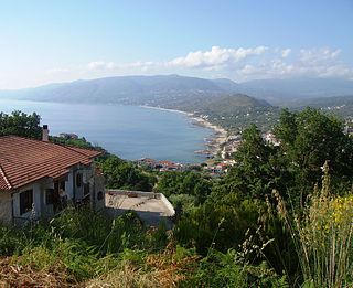
Palinuro is an Italian small town, the most populated civil parish (frazione) of Centola, Province of Salerno, in the Campania region. The name of the town is derived from Palinurus, the helmsman of Aeneas, as recorded in the fifth and sixth books of the Aeneid.

Cilento, Vallo di Diano and Alburni National Park is an Italian national park in the Province of Salerno, in Campania in southern Italy. It includes much of the Cilento, the Vallo di Diano and the Monti Alburni. It was founded in 1991, and was formerly known as the Parco Nazionale del Cilento e Vallo di Diano.

The Cilento Coast is an Italian stretch of coastline of Cilento, on the southern side of the Province of Salerno. It is situated in the gulfs of Salerno and Policastro, extending from the municipalities of Capaccio-Paestum in the north-west, to Sapri in the south-east.
The Cilentan dialect is a Neapolitan dialect spoken in the area of Cilento, located in the southern part of the Province of Salerno, Campania, Italy.

Case del Conte, sometimes also spelled Casa del Conte, is a southern Italian village and hamlet (frazione) of Montecorice, a municipality in the province of Salerno, Campania. As of 2009 its population was of 235.

San Severino is an Italian village and hamlet (frazione) of the municipality of Centola in the Province of Salerno, Campania. As of 2011 its population was of 435.

Massicelle is a southern Italian village and hamlet (frazione) of Montano Antilia, a municipality in the province of Salerno, Campania. in 2011 it had a population of 529.

Paestum is a frazione of the comune (municipality) of Capaccio in the Cilento area of southern Italy. It lies in the province of Salerno which is part of the region of Campania. It is situated on the Tyrrhenian coast and is notable for the famous ruins of the ancient city of the same name nearby.
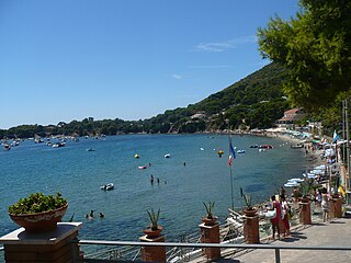
Ogliastro Marina, sometimes shortened as Ogliastro, is a southern Italian village and hamlet (frazione) of Castellabate, a municipality in the province of Salerno, Campania. As of 2009 its population was of 172.

Licosa is a southern Italian village and hamlet (frazione) of Castellabate, a municipality in the province of Salerno, Campania. As of 2009 its population was of 82.
