This article includes a list of general references, but it lacks sufficient corresponding inline citations .(August 2013) |
Leaf Cay Airport | |||||||||||
|---|---|---|---|---|---|---|---|---|---|---|---|
| Summary | |||||||||||
| Airport type | Private | ||||||||||
| Serves | Leaf Cay | ||||||||||
| Location | Bahamas | ||||||||||
| Elevation AMSL | 5 ft / 2 m | ||||||||||
| Coordinates | 24°8′57.9″N76°28′22.5″W / 24.149417°N 76.472917°W | ||||||||||
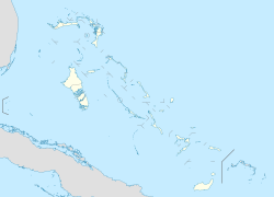
| Map | |||||||||||
| Runways | |||||||||||
| |||||||||||
| Source: Landings.com [1] [2] | |||||||||||
Leaf Cay Airport( ICAO : MYXD) is a private use airport located near Leaf Cay, the Bahamas.
Contents
The airstrip was still in use as of 2009, [3] but as of 2025 satellite photos and commercial listings show the airstrip to be heavily damaged and overgrown with trees and unusable for landing. [4]
