Related Research Articles

Schuylkill County is a county in the U.S. state of Pennsylvania. As of the 2020 census, the population was 143,049. The county seat is Pottsville. The county was created on March 1, 1811 from parts of Berks and Northampton counties and named for the Schuylkill River, which originates in the county. On March 3, 1818, additional territory in its northeast was added from Columbia and Luzerne counties.

Tower City is a borough in Schuylkill County, Pennsylvania, United States. The population was 1,346 at the 2010 census.

Swatara Creek is a 72-mile-long (116 km) tributary of the Susquehanna River in east-central Pennsylvania in the United States. It rises in the Appalachian Mountains in central Schuylkill County and passes through northwest Lebanon County before draining into the Susquehanna at Middletown in Dauphin County.

The Union Canal was a towpath canal that existed in southeastern Pennsylvania in the United States during the 19th century. First proposed in 1690 to connect Philadelphia with the Susquehanna River, it ran approximately 82 mi from Middletown on the Susquehanna below Harrisburg to Reading on the Schuylkill River.

The Reading Company was a railroad in eastern Pennsylvania and neighboring states that operated from 1924 until its 1976 acquisition by Conrail.
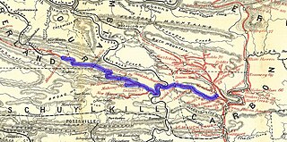
The Lehigh and Mahanoy Railroad, originally the Quakake Railroad, was a rail line connecting Black Creek Junction, in the Lehigh Valley, with Quakake, Delano, and Mount Carmel. Opened from Black Creek Junction to Quakake in 1858 and to Mount Carmel in 1860, it allowed anthracite coal mined along the line and bridge traffic to move east towards New York City. After 1866, it was merged into the Lehigh Valley Railroad to become its Mahanoy Branch.
Union Water Works, commonly known as Water Works, is an unincorporated community in North Annville Township, Lebanon County, Pennsylvania, United States.
The Allentown Railroad was a rail line proposed in the 1850s to connect the Central Railroad of New Jersey at Allentown with the Pennsylvania Railroad's main line across the Allegheny Mountains. Though grading was almost entirely finished, the project was halted by the Panic of 1857, and the completion of the East Pennsylvania Railroad in 1859 made the Allentown Railroad's proposed line largely redundant. As a result, track was never laid on most of the line. The small portion that did became a branchline of the Reading Company from Topton to Kutztown, and was nominally owned by the Allentown Railroad until the Reading dissolved it in 1945 to simplify corporate bookkeeping. Other Reading subsidiaries also laid track on parts of the right-of-way elsewhere along the route.
Rausch Gap is a ghost town in Cold Spring Township, Lebanon County, Pennsylvania in the United States.
Swatara State Park is a 3,515-acre (1,422 ha) Pennsylvania state park in Bethel, Swatara and Union Townships, Lebanon and Pine Grove Township, Schuylkill Counties in Pennsylvania in the United States. 8 miles (13 km) of Swatara Creek lie within the park's boundaries, which are roughly formed by Pennsylvania Route 443 to the north and Interstate 81 to the south. The park is in a valley in the ridge and valley region of Pennsylvania between Second Mountain (north) and Blue Mountain (south).
The Lorberry Creek Railroad was an early railroad in Schuylkill County, Pennsylvania, United States intended to feed coal shipments to the Union Canal (Pennsylvania).
Pennsylvania Route 443 is an 80-mile-long (130 km) east–west state highway in the US state of Pennsylvania. The western terminus is at an intersection with State Route 3009 at North Front Street on the east bank of the Susquehanna River in the community of Fort Hunter in Middle Paxton Township, just west of an interchange with the U.S. Route 22 /US 322 freeway. The eastern terminus is at US 209 in Lehighton. The route runs through rural areas in the Ridge-and-Valley Appalachians in Dauphin, Lebanon, Schuylkill, and Carbon counties, serving Fort Indiantown Gap, Pine Grove, Schuylkill Haven, Orwigsburg, New Ringgold, and South Tamaqua. PA 443 intersects several major roads, including US 22/US 322 near its western terminus, PA 72 in Union Township, Interstate 81 (I-81) near Pine Grove, PA 61 between Schuylkill Haven and Orwigsburg, and PA 309 in South Tamaqua.
Pennsylvania Route 125 is a 32.0-mile-long (51.5 km) state highway located in Schuylkill and Northumberland Counties in Pennsylvania. The southern terminus is at PA 443 in Pine Grove. The northern terminus is at PA 61 in Shamokin. The route follows a winding alignment through mountains and valleys in the western part of the Coal Region. PA 125 does not directly access Interstate 81 (I-81); however, north of Pine Grove, there is an interchange with SR 3013 just yards from the highway in Ravine. The route has a concurrency with U.S. Route 209 in Tremont and crosses PA 25 in Hegins. PA 125 was designated in 1928 between PA 25 in Hegins and US 209 in Newtown while the present alignment between Pine Grove and Hegins was a part of PA 25 and the section between Line Mountain and Shamokin was part of PA 225. PA 125 was realigned to its current alignment between PA 443 in Pine Grove and US 122 in Shamokin in the 1930s, with the former section between Hegins and Newtown becoming a realigned PA 25.
The Williams Valley Railroad was an anthracite-hauling railroad that operated in Schuylkill and Dauphin Counties, Pennsylvania from 1892 to 1971. For most of that time, it was a subsidiary of the Reading Railroad. It extended the Reading's Brookside Branch at Brookside 11 miles (18 km) down the Williams Valley to Lykens.

The Swatara Furnace is a historic iron furnace and 200-acre national historic district located along Mill Creek, a tributary of the Swatara Creek in Pine Grove Township, Schuylkill County, Pennsylvania.
The Schuylkill and Susquehanna Navigation Company was a limited liability corporation founded in Pennsylvania on September 29, 1791.
The Pennsylvania State Game Lands Number 80 are Pennsylvania State Game Lands in Berks, Lebanon and Schuylkill Counties in Pennsylvania in the United States providing hunting, bird watching, and other activities.
Suedberg is an unincorporated community in Schuylkill County, Pennsylvania, in the United States.
References
- 1 2 3 4 5 6 Taber, Thomas T. III (1987). Railroads of Pennsylvania Encyclopedia and Atlas. Thomas T. Taber III. ISBN 0-9603398-5-X.
- 1 2 "Proposed Library" . Retrieved 2006-10-25.
- 1 2 3 A.J. Burns, ed. (December 1957). The Official Guide of the Railways. National Railway Publication Company.
- ↑ Reading Company Reading Division Shamokin Division Timetable No. 18 (PDF). 1963-07-01. Archived from the original (PDF) on 2007-09-30. Retrieved 2007-08-01.
- ↑ "History of Pine Grove" (PDF). Retrieved 2006-10-25.[ permanent dead link ]
- ↑ Korson, George (1960). Black Rock: Mining Folklore of the Pennsylvania Dutch. Baltimore: The Johns Hopkins Press. pp. 221–222.
- ↑ "Railroad Financial News". Railroad Age Gazette. 45: 210.
- ↑ "History of Fort Indiantown Gap" . Retrieved 2006-10-25.
- ↑ "Map of Swatara State Park" (PDF). Retrieved 2006-10-25.
- ↑ "The Lincoln Colliery" . Retrieved 2006-10-25.