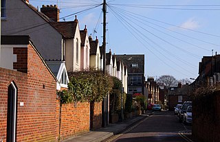
Leckford Road is a road in North Oxford, England. [1] It runs between Kingston Road to the west and Woodstock Road to the east.

Leckford Road is a road in North Oxford, England. [1] It runs between Kingston Road to the west and Woodstock Road to the east.
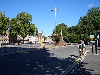
To the north halfway along is a junction with Warnborough Road. To the south, Leckford Place links with Plantation Road. Opposite the east end on the Woodstock Road is the Victorian St Philip and St James Church with its dominating spire, now used as the Oxford Centre for Mission Studies.
The houses in Leckford Road were leased between 1873 and 1885 as part of the St John's College North Oxford estate. [1]
The most famous resident of the road was Bill Clinton, the former US president between 1993 and 2001. He lived in 46 Leckford Road while studying as a Rhodes Scholar at University College, Oxford from 1968 to 1970. [2] [3] He shared the house with Frank Aller, David Satter, and Strobe Talbott (later an editor of Time magazine).
Wyndham House, a retirement home that backs onto Leckford Road on land originally owned by St John's College, Oxford, was officially opened by Queen Elizabeth the Queen Mother in 1973. [4]
Leckford Road is the former location of St Philip and St James Church of England Aided Primary School ("Phil and Jim" or "Pip and Jim"), now in Navigation Way. [5] The buildings have been converted for new use as Leckford Place School, part of d'Overbroeck's College, an independent day school for boys and girls between 11 and 16. [6]
Sara Maitland is a British writer of religious fantasy. A novelist, she is also known for her short stories. Her work has a magic realist tendency.

North Oxford is a suburban part of the city of Oxford in England. It was owned for many centuries largely by St John's College, Oxford and many of the area's Victorian houses were initially sold on leasehold by the college.

Banbury Road is a major arterial road in Oxford, England, running from St Giles' at the south end, north towards Banbury through the leafy suburb of North Oxford and Summertown, with its local shopping centre. Parallel and to the west is the Woodstock Road, which it meets at the junction with St Giles'. To the north, Banbury Road meets the Oxford Ring Road at a roundabout. The road is designated the A4165. Prior to the building of the M40 motorway extension in 1990, the road formed part of the A423 from Maidenhead to Coventry.

Summertown in North Oxford is a suburb of Oxford, England. Summertown is a one-mile square residential area, north of St Giles, the boulevard leading out of Oxford's city centre. Summertown is home to several independent schools and the city's most expensive houses. On both sides of Banbury Road are Summertown's popular shops. A smaller street of shops and restaurants, South Parade, links Banbury Road and Woodstock Road. Summertown is home to much of Oxford's broadcast media. BBC Radio Oxford and the BBC Television's Oxford studios are on Banbury Road. Start-ups also have an increasing presence on the parade, such as Brainomix and Passle. The studios for JACK FM, Glide FM, and Six TV Oxford are on Woodstock Road.

Woodstock Road is a major road in Oxford, England, running from St Giles' in the south, north towards Woodstock through the leafy suburb of North Oxford. To the east is Banbury Road, which it meets at the junction with St Giles'.

St Giles' is a wide boulevard leading north from the centre of Oxford, England. At its northern end, the road divides into Woodstock Road to the left and Banbury Road to the right, both major roads through North Oxford. At the southern end, the road continues as Magdalen Street at the junction with Beaumont Street to the west. Also to the west halfway along the street is Pusey Street. Like the rest of North Oxford, much of St Giles' is owned by St John's College.

The Oxford Centre for Mission Studies (OCMS) is in the former SS Philip and James Parish Church on Woodstock Road, Oxford, England, opposite Leckford Road. It was established in 1983 by Rev. Vinay Samuel.

Walton Street is on the eastern edge of the Jericho district of central Oxford, England.

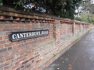
Canterbury Road is a road in North Oxford, England. It runs between Woodstock Road to the west and Banbury Road to the east. Winchester Road leads south from halfway along Canterbury Road, linking with Bevington Road that runs parallel to the south. Also to the south are North Parade and Church Walk.

Winchester Road is a road in North Oxford, England. It runs north–south between and roughly parallel with Woodstock Road to the west and Banbury Road to the east. It is in a desirable area with high house prices.

St Margaret's Road is a road in North Oxford, England.

St Giles' Church is a church in North Oxford, England. It is at the northern end of the wide thoroughfare of St Giles', at the point where it meets Woodstock Road and Banbury Road. It stands between where Little Clarendon Street joins Woodstock Road and Keble Road joins Banbury Road.

Christ Church Cathedral School is an independent preparatory school for boys in Oxford, England. It is one of three choral foundation schools in the city and educates choristers of Christ Church Cathedral, and the Chapels of Worcester College and Pembroke College. It is a member of the IAPS and the Choir Schools Association.

Rawlinson Road is a residential road in North Oxford, England.

Plantation Road is a residential road in North Oxford, England, connecting Kingston Road to the west with Woodstock Road to the east.
Harry George Walter Drinkwater (1844–1895) was an English architect who practised in and around Oxford. His work included several churches and public houses.

St Bernard's Road is a residential road in North Oxford, England, connecting the southern end of Kingston Road and the northern end of Walton Street, at the junction with Walton Well Road, to the west with Woodstock Road, opposite Bevington Road, to the east.

Warnborough Road is a residential road in North Oxford, England.

Wyndham House is a retirement home in North Oxford, England.