
Surbiton was a local government district in northeast Surrey, United Kingdom from 1855 to 1965.

Woodstock Road is a major road in Oxford, England, running from St Giles' in the south, north towards Woodstock through the leafy suburb of North Oxford. To the east is Banbury Road, which it meets at the junction with St Giles'.

Parks Road is a road in Oxford, England, with several Oxford University colleges along its route. It runs north–south from the Banbury Road and Norham Gardens at the northern end, where it continues into Bradmore Road, to the junction with Broad Street, Holywell Street and Catte Street to the south.

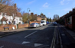
Walton Street is on the eastern edge of the Jericho district of central Oxford, England.

Linton Road is a road in North Oxford, England.
Leckford Road is a road in North Oxford, England. It runs between Kingston Road to the west and Woodstock Road to the east.

Clearwell is a village and former ancient manor in the Forest of Dean, West Gloucestershire, England. A recent survey indicated that the population of Clearwell is approximately 350.
Walton Manor is a residential suburb in Oxford, England. It is north of Jericho and the Radcliffe Observatory Quarter and forms part of North Oxford. The street layout and many of the area's buildings date from the mid-19th century. It was developed on land belonging to St John's College, Oxford.

The New QEII Hospital is located in Welwyn Garden City and managed by East and North Hertfordshire NHS Trust.
Chalfont Road is a road in Walton Manor, north Oxford, England.

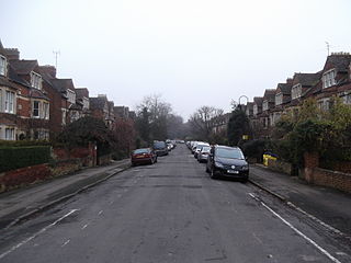
Farndon Road is a residential road in North Oxford, England.

The Radcliffe Observatory Quarter (ROQ) is a major University of Oxford development project in Oxford, England, in the estate of the old Radcliffe Infirmary hospital. The site, covering 10 acres is in central north Oxford. It is bounded by Observatory Street and Green Templeton College to the north, the Woodstock Road to the east, Somerville College to the south, and Walton Street to the west. The project and the new university area is named after the grade I listed Radcliffe Observatory to the north east of the site, now the centrepiece of Green Templeton College, which is intended to form the visual centrepiece of the project.

Walton Well Road is a road, about 400 metres long, near the centre of Oxford, England. It provides a link from central Oxford to Port Meadow.

St Bernard's Road is a residential road in North Oxford, England, connecting the southern end of Kingston Road and the northern end of Walton Street, at the junction with Walton Well Road, to the west with Woodstock Road, opposite Bevington Road, to the east.

Bradmore Road is a residential road in North Oxford, England.
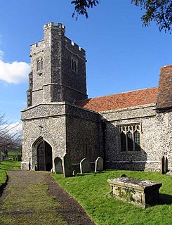
Rodmersham is a village and civil parish in the Borough of Swale in the north of the English county of Kent. It is just under 1 mile (1.6 km) south of Bapchild on the A2 road and 1.5 miles (2.4 km) south-east of the town of Sittingbourne. Rodmersham Green, which forms the bulk of the modern village, is 0.5 miles (0.80 km) to the south-west of the village church towards the Highsted Valley and Tunstall.

Warnborough Road is a residential road in North Oxford, England.

Longworth Road is a residential road in Walton Manor, north Oxford, England.

Wyndham House is a retirement home in North Oxford, England.
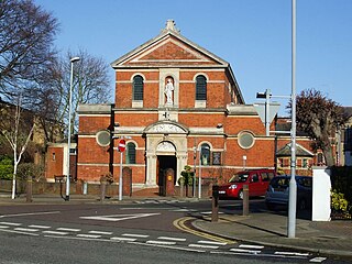
St Agatha's is a Roman Catholic church on Wyndham Road in Kingston upon Thames, London. It is dedicated to Saint Agatha of Sicily.


