
Melton Mowbray is a market town in the Melton district in Leicestershire, England, 19 miles (31 km) north-east of Leicester and 20 miles (32 km) south-east of Nottingham. It lies on the River Eye, known below Melton as the Wreake. The town had a population of 27,670 in 2019. The town is sometimes promoted as Britain's "Rural Capital of Food"; it is the home of the Melton Mowbray pork pie and is the location of one of six licensed makers of Stilton cheese.

Wycomb is a small hamlet in the district of Melton, which is approximately 4 miles (6.4 km) northeast of Melton Mowbray in Leicestershire, and is part of the civil parish of Scalford, which also includes the neighbouring village of Chadwell. Until 1 April 1936 it was in the parish of Wycomb and Chadwell.

Hose is a village and former civil parish, now in the parish of Clawson, Hose and Harby, in the Borough of Melton and the county of Leicestershire, England. The town of Melton Mowbray is six miles (10 km) to the south. In 1931 the civil parish had a population of 421, the 2011 population of the built-up area being 580.

Waltham on the Wolds is a village and former civil parish, now in the parish of Waltham on the Wolds and Thorpe Arnold, in the Melton borough of Leicestershire, England. It lies about 5 miles (8.0 km) north-east of Melton Mowbray and 11 miles (17.7 km) south-west of Grantham on the main A607 road. In 1931 the parish had a population of 510. The population of Waltham on the Wolds and Thorpe Arnold was 967 in 2011.

South Leicestershire is a constituency represented in the House of Commons of the UK Parliament since 2015 by Alberto Costa, a member of the Conservative Party.

Somerby is a village and civil parish in the Melton district, in the county of Leicestershire, England. It is 5+1⁄2 miles (8.9 km) south of Melton Mowbray. The population of the civil parish at the 2011 census was 812.

Pickwell is a small, hill-crest village 5 miles (8.0 km) south-east of Melton Mowbray in the Melton district, in Leicestershire which used to have an ecclesiastical parish of its own and is since the early 20th century has been in the civil parish and Church of England parish of Somerby which is 0.5 miles (0.80 km) to the SSW, connected by an almost straight lane.

The A606 is an A road in England that starts in West Bridgford, on the outskirts of Nottingham, and heads southeastwards through Leicestershire and the towns of Melton Mowbray and Oakham, terminating at Stamford, Lincolnshire on the former Great North Road.
North Leicestershire, formally the "Northern Division of Leicestershire", was a county constituency represented in the House of Commons of the Parliament of the United Kingdom. It elected two Members of Parliament (MPs) by the bloc vote system of election.

Ashby Folville is a village and former civil parish, now in the parish of Gaddesby, in the Melton district of Leicestershire, England, south west of Melton Mowbray. In 1931 the parish had a population of 123.

Barsby is a hamlet and former civil parish now in the parish of Gaddesby, in the Melton district, in the county of Leicestershire, England. In 1931 the parish had a population of 162. The surname derives from the village.
Stainby is a village and former civil parish, now in the parish of Gunby and Stainby, in the South Kesteven district of Lincolnshire, England. It is situated 2 miles (3.2 km) west from the A1 road, 1.5 miles (2.4 km) east from the Viking Way and the Leicestershire border, and 8 miles (13 km) south from Grantham. In 1921 the parish had a population of 117.

Thorpe Arnold is a farming village and former civil parish, now in the parish of Waltham on the Wolds and Thorpe Arnold in the district of Melton, which is approximately 1.2 miles (1.9 km) northeast of Melton Mowbray in Leicestershire, England. In 1931 the parish had a population of 128. On 1 April 1936 the parish was abolished and to form Waltham.
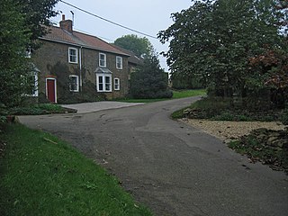
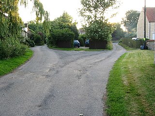
Chadwell is a small village in the district of Melton, which is approximately 4 miles (6.4 km) northeast of Melton Mowbray in Leicestershire, and is part of the civil parish of Scalford, which also includes the neighbouring hamlet of Wycomb. Until 1 April 1936 it was in the parish of Wycomb and Chadwell. The village name means 'spring/stream which is cold'. Chadwell is half a mile east of Wycomb, and they share the Church of St. Mary in the same ecclesiastical parish. The Church of St Mary is a Grade II* listed building.

Harston is a crossroads village and former civil parish, now in the parish of Belvoir, in the Melton district, in Leicestershire, England, near the border with Lincolnshire. The nearest town is Grantham, about 6 miles (10 km) to the north-east. It once contained several quarries for iron ore. Part of the village borders Lincolnshire. In 1931 the parish had a population of 182. On 1 April 1936 the parish was abolished and merged with Belvoir.

Knossington is a village and former civil parish, now in the parish of Knossington and Cold Overton, in the Melton borough of Leicestershire, England. It is located close to the border with Rutland, around 4 miles (6.4 km) west of Oakham. The population of the civil parish of "Knossington and Cold Overton" at the 2011 census was 316.

Branston is a village and former civil parish, now in the parish of Croxton Kerrial in the Melton district, in the county of Leicestershire, England. It lies 1 mile (1.6 km) north of the A607 road, 7 miles (11 km) south-west of Grantham and 7 miles north-east of Melton Mowbray, on the southern edge of the Vale of Belvoir, 3 miles (5 km) south-west of Belvoir Castle. Knipton Reservoir is 700 yards (640 m) to the north. In 1931 the parish had a population of 249.

Cold Overton is a village and former civil parish, now in the parish of Knossington and Cold Overton, in the Melton district of Leicestershire, England. It is close to the border with Rutland, and approximately 3 miles (5 km) west from the market and county town of Oakham, and 1.5 miles (2.4 km) south-west of the A606 road. In 1931 the parish had a population of 133.

Rotherby is a village and former civil parish, 9 miles (14 km) north east of Leicester, now in the parish of Hoby with Rotherby, in the Melton district, in the county of Leicestershire, England. In 1931 the parish had a population of 133.

Shoby is a hamlet and former civil parish 12 miles (19 km) north east of Leicester, now in the parish of Grimston, in the Melton district, in the county of Leicestershire, England. In 2000 it had an estimated population of 39. In 1931 the parish had a population of 49. Gregory Brokesby who was a resident of Shoby became the Sheriff of Leicestershire in 1632.

