
The MacArthur Highway, officially the Manila North Road (MNR), is a 500-kilometer (310 mi), two-to-six lane, national primary highway in Luzon, Philippines, it connects Caloocan in Metro Manila to the Laoag City in Ilocos Norte. It is the second longest road in the Philippines, after Maharlika Highway.
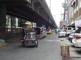
Taft Avenue is a major road in the south of Metro Manila. It passes through three cities in the metropolis: Manila, Pasay and Parañaque. The road was named after the former Governor-General of the Philippines and U.S. President, William Howard Taft; the Philippines was a former commonwealth territory of the United States in the first half of the 20th century. The avenue is a component of National Route 170 (N170), a secondary road in the Philippine highway network, and anchors R-2 of the Manila arterial road network. It was previously designated as N1 in the old route numbering system.

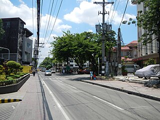
Padre Burgos Avenue is a 14-lane important thoroughfare in Manila, Philippines. It was named after one of the martyred priests, Jose Burgos. It is a road in the center of the city providing access to several important thoroughfares like Taft Avenue, Rizal Avenue, Roxas Boulevard, and Quezon Boulevard. The avenue is a component of Circumferential Road 1 (C-1) of Manila's highway sysyem. The Manila City Hall can be accessed using this road, and so is the Rizal Park and Intramuros.

Pablo Ocampo Street, also known simply as Ocampo Street and formerly and still referred to as Vito Cruz Street, is an inner city main road in Manila, Philippines. It runs west-east for about 3.448 kilometers (2.142 mi) connecting the southern districts of Malate and San Andres southeast to Makati.

Kalaw Avenue is a short stretch of road in the Ermita district of Manila, Philippines. It forms the southern boundary of Rizal Park running east–west from San Marcelino Street to Roxas Boulevard near the center of the city. It begins as a four-lane road at the intersection with San Marcelino widening to an eight-lane divided roadway along the stretch of Rizal Park from Taft Avenue west to Roxas Boulevard. It has a short extension into the reclaimed area of Luneta and Quirino Grandstand as South Drive. The avenue's segment from Taft Avenue to Roxas Boulevard is assigned as National Route 155 (N155) of the Philippine highway network.
President Elpidio Quirino Avenue, more commonly known as Quirino Avenue, is a 6-10 lane divided highway in Manila, Philippines. It runs for 3.6 kilometers in a northeast-southwest direction from Nagtahan Bridge across from Santa Mesa in the north to Roxas Boulevard in Malate in the south. It passes through Paco and Pandacan districts where it also serves as a truck route between Port Area and South Luzon Expressway. North of Nagtahan Bridge, the road continues as Nagtahan Street. It is designated as part of Circumferential Road 2.

Lacson Avenue is the principal northwest-southeast artery located in Sampaloc district in northern Manila, Philippines. It is a 6-8 lane median divided avenue that runs approximately 2.9 kilometers from Tayuman Street in Santa Cruz to Nagtahan Bridge in Santa Mesa. It is a component of Circumferential Road 2 of the Manila arterial road network and N140 of the Philippine highway network.

Francis Burton Harrison Avenue, more commonly known as F.B. Harrison Avenue or simply Harrison Avenue, is a major north-south collector road in Pasay, western Metro Manila, Philippines. It is a four-lane undivided arterial running parallel to Roxas Boulevard to the west and Taft Avenue to the east, from Pasay's border with Malate district in the north to Baclaran in Parañaque in the south. The avenue is named for U.S. Governor-General of the Philippines, Francis Burton Harrison.
Samson Road is a major east–west street in Caloocan, northern Metro Manila, Philippines. The road is a continuation of Epifanio de los Santos Avenue (EDSA), linked to it via the Monumento Roundabout to form a single through route. These roads form part of Circumferential Road 4 (C-4) of the Metro Manila Road Network.

Blumentritt Road is a major road in Manila, Philippines. It runs through the border of the City of Manila with Quezon City from Rizal Avenue in Santa Cruz district to Gregorio Tuazon Street in Sampaloc district. The road also forms the southern boundary of the Manila North Cemetery. It is named after Bohemian professor and filipinologist, Ferdinand Blumentritt.

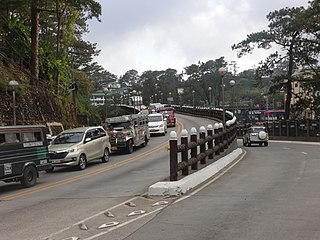
The Aspiras–Palispis Highway is a Philippine major highway in northern Luzon that runs from the city of Baguio to the municipality of Agoo in the province of La Union.

Marcelo H. del Pilar Street, also known as M.H. del Pilar Street or simply Del Pilar Street, is a north–south road running for 1.895 kilometers (1.177 mi) connecting Ermita and Malate districts in Manila, Philippines. It is a two-lane street which carries traffic one-way southbound from Kalaw Avenue in Rizal Park to Quirino Avenue just across from the Ospital ng Maynila. It was formerly called Calle Real.
Elpidio Quirino Avenue, also known simply as Quirino Avenue, is a major north-south collector road in Parañaque, southern Metro Manila, Philippines. It is a four-lane undivided arterial running parallel to Roxas Boulevard and its extension, the Manila–Cavite Expressway, to the west from Baclaran at Parañaque's border with Pasay in the north to San Dionisio right by the border with Las Piñas in the south. It is a continuation of Harrison Avenue from Pasay and was originally a segment of the coastal highway called Calle Real. The avenue is designated as a component of Manila's Radial Road 2 network. It was named after President Elpidio Quirino.

North Bay Boulevard is a 2.34-kilometer-long (1.45 mi) two- to four-lane access road in the Navotas Fish Port Complex of northern Metro Manila, Philippines. It is one of the main roads in Navotas which travels north-south through the southern parts of the city running parallel to Radial Road 10 (R-10) to the west. The road links the Balut area of Tondo in Manila and San Rafael Village in the south to the central Navotas barangay of Bagumbayan South in the north. It was named after its location in Manila Bay north of the Manila North Harbor complex.
Maysan Road is one of the main east–west thoroughfares of Valenzuela, Philippines. It is a narrow street with only one lane in each direction making it one of the most congested streets in northern Metro Manila. It runs for approximately 4.5 kilometers (2.8 mi) from MacArthur Highway in barangay Malinta, past the North Luzon Expressway intersection, into North Caloocan. The road connects the central Valenzuela barangays of Malinta, Maysan, Paso de Blas, and Bagbaguin. It was the main access road for vehicles going to Valenzuela and the Manila North Harbor from the North Luzon Expressway prior to the construction of NLEX Segment 9, which parallels it to the south.
Kisad Road is a major road in Baguio in the Philippines. It connects from Aspiras-Palispis Highway to Shuntug Road in the city's downtown core. Burnham Park, which is named after Daniel Burnham, is located along the road.
The Governor Pack Road is a major highway in Baguio, Philippines, named for the American William F. Pack, who was appointed Military Governor of Benguet on November 15, 1901 and served as the civilian Governor of Mountain Province from 1909 to 1915.
The Loakan Road is a 6.2-kilometer (3.9 mi), major road in Baguio, Philippines. It provides access to Loakan Airport located in the outskirts of the city. The entire road forms part of National Route 231 (N231) of the Philippine highway network.
Amparo Heights Road is a major road in Baguio in the Philippines that connects from Kennon Road to Bakakeng Sur Road.