Related Research Articles

Mississippi County is the easternmost county in the U.S. state of Arkansas. As of the 2020 census, the population was 40,685. There are two county seats, Blytheville and Osceola. The county was formed on November 1, 1833, and named for the Mississippi River which borders the county to the east. Mississippi County is part of the First Congressional District in Arkansas.

Jefferson County, Arkansas is a county located in the U.S. state of Arkansas in the area known as the Arkansas Delta that extends west of the Mississippi River. Jefferson County consists of five cities, two towns, and 20 townships. The county is bisected by the Arkansas River, which was critical to its development and long the chief transportation byway. In 2020, Jefferson County's population was estimated at 67,260. Its county seat and largest city is Pine Bluff. Jefferson County is included in the Pine Bluff metropolitan statistical area. The county seat and the most populous city is Pine Bluff.

Cross County is a rural Northeast Arkansas county in the Arkansas Delta. Created as Arkansas's 53rd county on November 15, 1862, Cross County contains four incorporated municipalities, including Wynne, the county seat and most populous city. It is named for Confederate Colonel David C. Cross, a political leader in the area.


Anthonyville is a town in Crittenden County, Arkansas, United States. The population was 161 at the 2010 census, down from 250 in 2000.

Edmondson is a town in Crittenden County, Arkansas, United States. The population was 427 at the 2010 census.

Horseshoe Lake is a town in Crittenden County, Arkansas, United States. The population was 264 at the 2020 census.

Jennette is a town in Crittenden and St. Francis counties, Arkansas, United States. The population was 118 at the 2020 census.
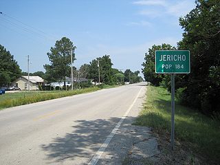
Jericho is a town in Crittenden County, Arkansas, United States. The population was 119 at the 2010 census, down from 184 in 2000.

Marion is a city in and the county seat of Crittenden County, Arkansas, United States. The population was 12,345 at the 2010 census, a 38.7% increase since 2000. The city is part of the Memphis metropolitan area. It is the second largest city in Crittenden County, behind West Memphis.

Highway 77 is a north–south state highway in Northeast Arkansas. The route of 66.70 miles (107.34 km) runs from US Highway 70 (US 70) in West Memphis north through small towns and agricultural areas of the Arkansas Delta to the Missouri state line. It is generally a low-traffic road except in West Memphis. Created during the 1926 Arkansas state highway numbering, the route was extended in the 1950s and 1960s, including along a former alignment of US 61. AR 77 does not have any spur or business routes.

Interstate 40 (I-40) is an east–west Interstate Highway that has a 284.69-mile (458.16 km) section in the U.S. state of Arkansas, connecting Oklahoma to Tennessee. The route enters Arkansas from the west just north of the Arkansas River near Dora. It travels eastward across the northern portion of the state, connecting the cities of Fort Smith, Clarksville, Russellville, Morrilton, Conway, North Little Rock, Forrest City, and West Memphis. I-40 continues into Tennessee, heading through Memphis. The highway has major junctions with I-540 at Van Buren, I-49 at Alma, I-30 in North Little Rock, and I-55 to Blytheville.
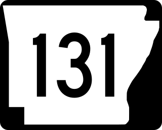
Highway 131 is a designation for five north–south state highways in northeast Arkansas. One route of 5.51 miles (8.87 km) runs from Highway 1 in Haynes east to Lee County Road 719. A second route of 9.57 miles (15.40 km) begins at US Route 79 (US 79) near Brickeys and runs south to the Mississippi River levee. A third route of 8.74 miles (14.07 km) forms a semicircle around Horseshoe Lake and Porter Lake, connecting to Highway 147 at both ends. A fourth route of 3.11 miles (5.01 km) begins at Highway 147 and runs through Edmondson. A fifth route begins at Interstate 55/US 61/US 64/US 79 in West Memphis and runs north to Martin Luther King Jr. Drive/Mound City Road in West Memphis. All routes are maintained by the Arkansas State Highway and Transportation Department (AHTD).

Highway 118 is a designation for two state highways in the Upper Arkansas Delta. One route of 41.43 miles (66.68 km) begins at US Highway 64 (US 64) and Highway 149 east to Mississippi County Road 495 near the Mississippi River levee. A second route of 4.29 miles (6.90 km) runs from US 70/US 79 in West Memphis to US 64 in Marion. Both routes are maintained by the Arkansas State Highway and Transportation Department (AHTD).
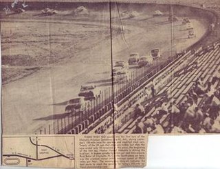
The Memphis-Arkansas Speedway was a dirt oval track located just west of West Memphis, Arkansas, United States, in the community of Lehi.
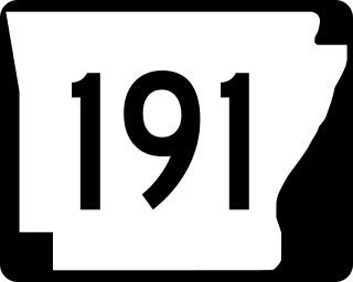
Arkansas Highway 191 is a 2.27-mile (3.65 km) state highway located entirely within West Memphis in the U.S. state of Arkansas. The highway runs from U.S. Highway 70 (US 70) north to AR 77. The highway is maintained by the Arkansas Department of Transportation (ArDOT).
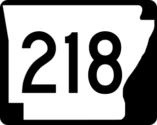
Arkansas Highway 218 is an east–west state highway in Crittenden County, Arkansas. The route of 7.35 miles (11.83 km) runs from US Route 70 (US 70) and US 79 at Shearerville north across Interstate 40 (I-40) through rural Crittenden County to Highway 147 at Cunningham Corner.
Midway Corner is an unincorporated community in Crittenden County, Arkansas, United States. Midway Corner is located on Arkansas Highway 147, 8.2 miles (13.2 km) southwest of West Memphis.

Highway 147 is a 25.83-mile-long (41.57 km) north–south state highway in Crittenden County, Arkansas, United States. The route runs from Highway 131 at Bruins north across Interstate 40/US Route 79 (I-40/US 70/US 79) to US 64 near West Memphis. A portion of the route make up the western routing of the Great River Road.

Jackson Township is a township in Crittenden County, Arkansas, United States. Its total population was 1,352 as of the 2010 United States Census, a decrease of 1.24 percent from 1,369 at the 2000 census.
References
- ↑ U.S. Geological Survey Geographic Names Information System: Lehi, Arkansas
- ↑ Arkansas Department of Transportation (2016) [originally issued 2007]. General Highway Map: Crittenden County (PDF) (Map). 1:62500. Arkansas State Highway and Transportation Department, Transportation Planning and Policy Division. Retrieved August 1, 2020.
- ↑ "Memphis-Arkansas Speedway". CALS Encyclopedia of Arkansas. Central Arkansas Library System. February 19, 2020. Retrieved August 10, 2020.
35°08′49″N90°17′35″W / 35.147°N 90.293°W
Municipalities and communities of Crittenden County, Arkansas, United States | ||
|---|---|---|
| Cities | 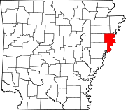 | |
| Towns | ||
| Unincorporated communities | ||