Clarkedale, Arkansas | |
|---|---|
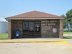
Post office Clarkedale sign on highway | |
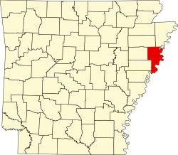
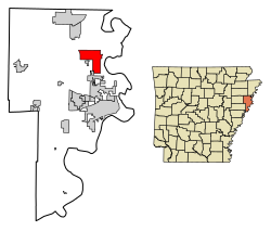 Location of Clarkedale in Crittenden County, Arkansas. | |
 Clarkedale, Arkansas | |
| Coordinates: 35°18′23″N90°14′10″W / 35.30639°N 90.23611°W | |
| Country | United States |
| State | Arkansas |
| County | Crittenden |
| Area | |
• Total | 11.44 sq mi (29.62 km2) |
| • Land | 11.44 sq mi (29.62 km2) |
| • Water | 0 sq mi (0.00 km2) |
| Elevation | 223 ft (68 m) |
| Population (2020) | |
• Total | 336 |
• Estimate (2024) | 332 |
| • Density | 29.4/sq mi (11.34/km2) |
| Time zone | UTC-6 (Central (CST)) |
| • Summer (DST) | UTC-5 (CDT) |
| ZIP code | 72325 |
| Area code | 870 |
| FIPS code | 05-14050 |
| GNIS feature ID | 2404055 [2] |

Clarkedale is a town [3] in Crittenden County, Arkansas, United States. Per the 2020 census, the population was 336. [4] Clarkedale was incorporated on November 15, 2000. [5]