
Prince Rupert is a port city in the province of British Columbia, Canada. Its location is on Kaien Island near the Alaskan panhandle. It is the land, air, and water transportation hub of British Columbia's North Coast, and has a population of 12,220 people as of 2016.
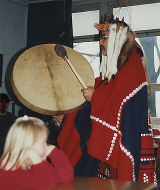
The Tsimshian are an Indigenous people of the Pacific Northwest Coast. Their communities are mostly in coastal British Columbia in Terrace and Prince Rupert, and Metlakatla, Alaska on Annette Island, the only reservation in Alaska.
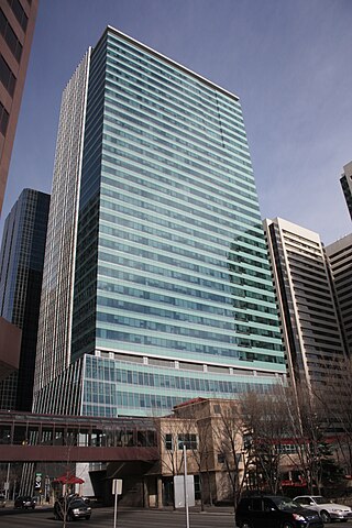
TC Energy Corporation is a major North American energy company, based in the TC Energy Tower building in Calgary, Alberta, Canada, that develops and operates energy infrastructure in Canada, the United States, and Mexico. The company operates three core businesses: Natural Gas Pipelines, Liquids Pipelines and Energy.
Khutzeeymateen Provincial Park, also known as Khutzeymateen/K'tzim-A-Deen Grizzly Sanctuary, is a Class A provincial park located in the North Coast region of British Columbia, Canada. The park, within the purview of BC Parks, was established on August 15, 1994, to protect critical habitat for the region's grizzly bear population and the largest contiguous stand of old-growth Sitka spruce in the world. It was officially opened by Prince Philip, Duke of Edinburgh, on August 17, 1994.
The North Coast Regional District is a quasi-municipal administrative area in British Columbia. It is located on British Columbia's west coast and includes Haida Gwaii, the largest of which are Graham Island and Moresby Island. Its administrative offices are in the City of Prince Rupert.

Lax-Kwʼalaams, previously called Port Simpson until 1986, is an Indigenous village community in British Columbia, Canada, not far from the city of Prince Rupert. It is located on Port Simpson Indian Reserve No. 1, which is shared with other residential communities of the Tsimshian Nation. The Nine Allied Tribes are: Gilutsʼaaw, Ginadoiks, Ginaxangiik, Gispaxloʼots, Gitando, Gitlaan, Gitsʼiis, Gitwilgyoots, and Gitzaxłaał.
The Gitando are the youngest of the 14 tribes of the Tsimshian people in British Columbia, Canada. It is one of the nine of those tribes making up the "Nine Tribes" First Nation of the lower Skeena River resident at Lax Kw'alaams, British Columbia. The name Gitando means the people of weirs. Their traditional territory includes the watershed of the Exstew River, a tributary of the Skeena River. Since 1834, the Gitando have been based at Lax Kw'alaams, following establishment of a Hudson's Bay Company trading fort there. They are closely related to the Gispaxlo'ots, another of the Nine Tribes, who have an adjacent territory.

Port Essington was a cannery town on the south bank of the Skeena River estuary in northwestern British Columbia, Canada, between Prince Rupert and Terrace, and at the confluence of the Skeena and Ecstall Rivers. It was founded in 1871 by Robert Cunningham and Thomas Hankin and was for a time the largest settlement in the region. During its heyday it was home to an ethnic mix of European-Canadians, Japanese-Canadians, and members of First Nations from throughout the region, especially Tsimshians from the Kitselas and Kitsumkalum tribes. In the Tsimshian language, the site of Port Essington is called Spaksuut or, in English spelling, "Spokeshute", which means "autumn camping place". This also became the Tsimshian name for the town of Port Essington, and was conferred on Spokeshute Mountain, which stands above and behind the community. It sits on the traditional territory of the Gitzaxłaał tribe, one of the nine Tsimshian tribes based at Lax Kw'alaams. In 1888, the anthropologist Franz Boas visited Port Essington, interviewing Haida and Tsimshian individuals and establishing a working relationship with Odille Morison, the Tsimshian linguist, who lived in Port Essington.
Metlakatla, British Columbia is a small community that is one of the seven Tsimshian village communities in British Columbia, Canada. It is situated at Metlakatla Pass near Prince Rupert, British Columbia. It is the one Tsimshian village in Canada that is not associated with one particular tribe or set of tribes out of the Tsimshian nation's 14 constituent tribes.
Frederick Alexcee was a Canadian carver and painter from the community of Lax Kw'alaams with Tsimshian ethnicity.
Thomas Crosby was an English Methodist missionary known for his work among the First Nations people of coastal British Columbia, Canada.
The District of Port Edward is a district municipality of approximately 577, located in the Range 5 Coast Land District of British Columbia, Canada. It is situated on the Tsimpsean Peninsula, at Porpoise Harbour, near the southern end of Chatham Sound, close to the mouth of the Skeena River, 15 km (9 mi) southeast of Prince Rupert.

Porcher Island is an island in Hecate Strait, British Columbia, Canada, near the mouth of the Skeena River and southwest of the port city of Prince Rupert. The locality of Porcher Island is located near the island's northern tip at Humpback Bay, 54°05′11″N130°23′23″W. Stephens and Prescott Islands are located off its northwestern tip.
The Lax-kw'alaams Band is a First Nations government at Lax Kw'alaams, formerly Port Simpson, close to Prince Rupert in British Columbia, Canada.

MV Nicola is an N-class ferry, owned, but not operated by BC Ferries. It is also known as Spirit of Lax Kw' Alaams, a British Columbia First Nations name. Spirit of Lax Kw' Alaams currently runs between Prince Rupert and Port Simpson, a British Columbia First Nations community on British Columbia's North Coast. Overnight the vessel is kept at the Smit tugboat dock in Prince Rupert Harbour.
Zayas Island is an island on the North Coast of British Columbia, Canada, located in the east side of Dixon Entrance to the west of Dundas Island. Three parcels of land on the north, east and south shores of the island are reserves of the Lax Kw'alaams First Nation.
Jennifer Rice is a Canadian politician, who was elected to the Legislative Assembly of British Columbia to represent the electoral district of North Coast. She is a member of the BC New Democratic Party. Rice was first elected as a member of legislative assembly (MLA) in the 2013 provincial election and was re-elected in the 2017 election. In the 40th Parliament of British Columbia she acted as the official opposition's critic for northern and rural economic development and deputy critic for children and family development and introduced one private member bill, the Drinking Water Protection Amendment Act regarding regularizing testing of drinking water in schools.
The Ecstall River is a tributary of the Skeena River in the province of British Columbia, Canada. It originates in the Kitimat Ranges, and flows about 110 km (68 mi) to the lower tidal reach of the Skeena River at Port Essington, about 30 km (19 mi) southeast of Prince Rupert, 95 km (59 mi) southwest of Terrace, and 85 km (53 mi) northwest of Kitimat. Its drainage basin covers about 1,485 km2 (573 sq mi) and contains the largest blocks of unlogged land on the north coast of British Columbia, although large-scale industrial logging operations, both active and proposed, have been occurring in the watershed since the 1980s.
The Gitnadoix River is a tributary of the Skeena River in the province of British Columbia, Canada. It originates in the Kitimat Ranges, and flows about 38 km (24 mi) north to the Skeena River, about 45 km (28 mi) west of Terrace.
The Khtada River is a tributary of the Skeena River in the North Coast Regional District of the province of British Columbia, Canada. It originates in the Kitimat Ranges of the Coast Mountains, and flows south about 26 km (16 mi) to the lower tidal reach of the Skeena River, about 24 km (15 mi) upriver from Port Essington, 48 km (30 mi) southeast of Prince Rupert, and about 74 km (46 mi) southwest of Terrace.

