Lem Peak

Last updated
Lem Peak
Highest point
Elevation 3,349.8 m (10,990 ft)
Prominence 751 m (2,464 ft)
Parent peak Big Creek Peak
Isolation 42.65 km (26.50 mi)
Coordinates 44°46′49″N113°51′59″W / 44.7804°N 113.8664°W / 44.7804; -113.8664
Geography
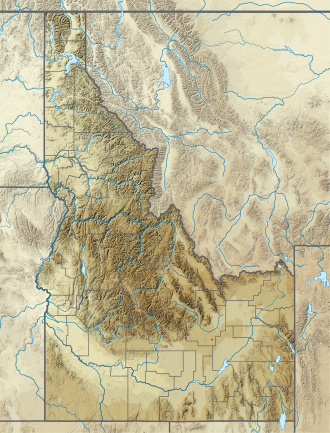
Location Lemhi County, Idaho
Parent range Lemhi Range

Lem Peak is a mountain in Lemhi County, Idaho. At 3349m, it is the 16th highest summit in Idaho that has at least 500m of topographic prominence. [1] [2] [3]
Climate

Climate data for Lem Peak 44.7667 N, 113.8610 W, Elevation: 10,220 ft (3,120 m) (1991–2020 normals)
MonthJanFebMarAprMayJunJulAugSepOctNovDecYear
Mean daily maximum °F (°C)22.4
(−5.3)
22.1
(−5.5)
27.4
(−2.6)
33.3
(0.7)
42.4
(5.8)
51.8
(11.0)
64.1
(17.8)
63.5
(17.5)
53.7
(12.1)
39.9
(4.4)
27.2
(−2.7)
21.3
(−5.9)
39.1
(3.9)
Daily mean °F (°C)15.3
(−9.3)
13.9
(−10.1)
17.9
(−7.8)
22.6
(−5.2)
31.0
(−0.6)
39.8
(4.3)
50.7
(10.4)
50.1
(10.1)
41.2
(5.1)
29.5
(−1.4)
19.9
(−6.7)
14.3
(−9.8)
28.9
(−1.7)
Mean daily minimum °F (°C)8.2
(−13.2)
5.8
(−14.6)
8.5
(−13.1)
11.9
(−11.2)
19.6
(−6.9)
27.9
(−2.3)
37.2
(2.9)
36.7
(2.6)
28.7
(−1.8)
19.1
(−7.2)
12.5
(−10.8)
7.4
(−13.7)
18.6
(−7.4)
Average precipitation inches (mm)3.07
(78)
2.66
(68)
3.63
(92)
4.52
(115)
4.60
(117)
4.13
(105)
1.34
(34)
1.41
(36)
3.06
(78)
3.30
(84)
3.22
(82)
3.32
(84)
38.26
(973)
Source: PRISM Climate Group [4]

Related Research Articles

<span class="mw-page-title-main">Borah Peak</span> Highest mountain in Idaho, United States

Borah Peak, also known as Mount Borah or Beauty Peak, is the highest mountain in the U.S. state of Idaho and one of the most prominent peaks in the contiguous United States. It is located in the central section of the Lost River Range, within the Challis National Forest in eastern Custer County. On February 11, 2021, the USGS officially recognized Mt. Borah as Idaho's only active glacier.

<span class="mw-page-title-main">Truchas Peak</span>

Truchas Peak is the second highest peak in the U.S. State of New Mexico behind Wheeler Peak. It is in the Sangre de Cristo Mountains 26 miles (42 km) northeast of Santa Fe. It lies within the Pecos Wilderness, part of the Santa Fe National Forest. The name of the peak is Spanish for "trout" (plural). It is the highest point in both Rio Arriba and Mora counties. It is also the most southerly peak and land area in the continental United States to rise above 13,000 feet (3,962 m).

<span class="mw-page-title-main">Lolo Peak</span> Mountain in Montana, United States

Lolo Peak is a 9,143 feet (2,787 m) mountain in the Bitterroot Range of western Montana, United States. It is in Missoula County, southwest of Missoula.

<span class="mw-page-title-main">Wyoming Peak</span> Mountain in Wyoming, United States

Wyoming Peak is the tallest mountain in the Wyoming Range in the U.S. state of Wyoming. Situated in Bridger-Teton National Forest, a now collapsed fire lookout is located on the summit. Wyoming Peak is .75 miles (1.21 km) south-southeast of Coffin Peak, the second highest peak in the Wyoming Range.

<span class="mw-page-title-main">Naomi Peak</span> Mountain in northern Utah, United States

Naomi Peak, or Mount Naomi, is the highest peak in the Bear River Range in northern Utah and southern Idaho, United States.

<span class="mw-page-title-main">Snowshoe Peak</span> Mountain in Montana, United States

Snowshoe Peak is a mountain in the U.S. state of Montana. At 8,738 ft (2,663 m), it is the highest peak in the Cabinet Mountains of Northwestern Montana and Idaho.

<span class="mw-page-title-main">Sacajawea Peak</span>

Sacajawea Peak is a peak in the Wallowa Mountains, in the U.S. state of Oregon. It is in the Eagle Cap Wilderness and the Wallowa–Whitman National Forest.

<span class="mw-page-title-main">Hyndman Peak</span>

Hyndman Peak, at an elevation of 12,012 feet (3,661 m) above sea level, is the ninth highest peak in Idaho and the highest point in the Pioneer Mountains, Sawtooth National Forest, and Blaine County. Hyndman Peak is located on the border of Custer and Blaine counties. The towns of Hailey, Ketchum, and Sun Valley are west of the peak.

<span class="mw-page-title-main">Ryan Peak (Idaho)</span> Mountain in the state of Idaho

Ryan Peak, at 11,714 feet (3,570 m) above sea level is the highest peak in the Boulder Mountains of Idaho. Located in Custer County, Ryan Peak is about 0.5 miles (800 m) north of the Blaine County border. The peak is also on the border of Sawtooth National Recreation Area and Salmon-Challis National Forest and partially within the Hemingway–Boulders Wilderness.

<span class="mw-page-title-main">Cache Peak</span> Mountain in the state of Idaho

Cache Peak, at 10,339 feet (3,151 m) above sea level, is the highest peak in the Albion Mountains of Cassia County in Southern Idaho. Cache Peak is located in the central part of the range southeast of Oakley and north of Almo in the Albion Division of the Minidoka Ranger District of Sawtooth National Forest.

<span class="mw-page-title-main">Diamond Peak (Idaho)</span>

Diamond Peak is the highest point in the Lemhi Range in the Rocky Mountains in Idaho. At 12,202 feet (3,719 m) above sea level, it is the third highest peak in Idaho. It is situated 34.5 miles (55.5 km) east of Borah Peak in the Lost River Range, opposite the Little Lost River valley. It is the highest point in the Caribou–Targhee National Forest. The closest higher peak is Mount Church, which is 31.8 mi (51.2 km) to the west.

<span class="mw-page-title-main">Altair Peak</span>

Altair Peak, at 11,825 feet (3,604 m) above sea level is the seventh highest peak in the Pioneer Mountains of Idaho, United States. The peak is located in Salmon-Challis National Forest and Custer County. It is the 25th highest peak in Idaho and about 1 mi (1.6 km) northeast of Standhope Peak and 0.85 mi (1.37 km) southwest of Pyramid Peak.

Big Creek Peak, at 11,350 feet (3,460 m) above sea level is a peak in the Lemhi Range of Idaho. The peak is located in Lemhi County on the border of Caribou-Targhee National Forest and Salmon-Challis National Forest. It is about 1.1 mi (1.8 km) northwest of Flatiron Mountain and 23.7 mi (38.1 km) northwest of Bell Mountain, its line parent. It is the 55th highest peak in Idaho.

Mount Breitenbach, at 12,140 feet (3,700 m) above sea level, is the fifth-highest peak in the U.S. state of Idaho and the fourth-highest in the Lost River Range. The peak is located in Salmon-Challis National Forest in Custer County. It is 2.0 miles (3.2 km) east of Mount Church, its line parent, 1.4 miles (2.3 km) east of Donaldson Peak, 0.85 miles (1.37 km) southeast of No Regret Peak, and 1.8 miles (2.9 km) north of Lost River Peak.

USGS Peak, at 11,982 feet (3,652 m) above sea level, is the tenth-highest peak in the U.S. state of Idaho and the eighth-highest in the Lost River Range. The peak is located in Salmon-Challis National Forest in Custer County. It is 1.6 miles (2.6 km) northeast of Mount McCaleb and 4.15 miles (6.68 km) southeast of Lost River Peak, its line parent.

<span class="mw-page-title-main">Bighorn Peak</span> Mountain in the American state of Wyoming

Bighorn Peak is located in the Bighorn Mountains in the U.S. state of Wyoming. The peak is the seventh highest in the range and it is in the Cloud Peak Wilderness of Bighorn National Forest. Bighorn Peak is 1.5 miles (2.4 km) south of Darton Peak.

<span class="mw-page-title-main">Calkins Peak</span> Mountain in the state of Idaho

Calkins Peak, is a peak also known as Calkens, O'Calkens Peak, Caulkens Peak, and O'Caulkens Peak. At an elevation of 11,487 feet (3,501 m) above sea level it is the second highest peak in the White Cloud Mountains of Idaho. The peak is located in Sawtooth National Recreation Area in Custer County about 5.75 mi (9.25 km) north-northwest of Castle Peak, its line parent. It is the 46th highest peak in Idaho, and it is located about 0.5 mi (0.80 km) north-northeast of White Cloud Peak 9 and 1 mi (1.6 km) north-northwest of D. O. Lee Peak. Calkins Peak is directly north of Slide Lake, northwest of Sheep Lake, and southwest of Tin Cup Lake. Calkins Peak is named for Stephen Calkins (1842–1922), a prospector who established lode claims in the area.

Smiley Mountain is a 11,427-foot (3,483 m) peak in Custer County, Idaho, USA, and one of the higher points in the Pioneer Mountains. It is located in the Salmon-Challis National Forest about 15 miles (24 km) west of Lost River.

Scott Peak is an 11,378-foot (3,468 m) summit in the Caribou-Targhee National Forest, in Lemhi County, Idaho in the United States. It is the highest point of the Beaverhead Mountains, and is located in the "Italian Peaks" section of the range. Scott peak is located about 20 miles (32 km) west-northwest of Dubois, Idaho.

White Mountain, or White Mountain West, is the highest peak in the Salmon River Mountains in Idaho, USA, with an elevation of 10,442 feet (3,183 m).

References

  1. "Lem Peak". NGS Data Sheets. Retrieved 2018-06-11.
  2. "GNIS Detail - Lem Peak". geonames.usgs.gov. Retrieved 2018-06-11.
  3. "Lem Peak - Peakbagger.com". www.peakbagger.com. Retrieved 2018-06-11.
  4. "PRISM Climate Group, Oregon State University". PRISM Climate Group, Oregon State University. Retrieved October 2, 2023. To find the table data on the PRISM website, start by clicking Coordinates (under Location); copy Latitude and Longitude figures from top of table; click Zoom to location; click Precipitation, Minimum temp, Mean temp, Maximum temp; click 30-year normals, 1991-2020; click 800m; click Retrieve Time Series button.