Related Research Articles

Zigzag is an unincorporated community in Clackamas County, Oregon, United States. It is located within the Mount Hood Corridor, between Rhododendron and Welches on U.S. Route 26. The community is part of a local type of government called a village as one of the communities making up the Villages at Mount Hood, which stretches from the border of Sandy to Government Camp.

The Dog River is a small river in Oregon's Cascade Range and drains a few eastern foothills of Mount Hood. It is a tributary of East Fork Hood River and also contributes water for The Dalles and Hood River water systems. It is approximately 8 miles (14 km) long and drains the most southeastern portion of the Hood River watershed.

Ortley is a former town in Wasco County, Oregon, in the United States. It was about 1 mile (2 km) south of Rowena and about 7 miles (11 km) southeast of Mosier; the site is now on private land and no evidence of the townsite exists today. It is still classed as a populated place by the USGS.

Bull Run is an unincorporated community in Clackamas County, Oregon, United States. It is located about 5 miles northeast of Sandy, near the Bull Run River and the powerhouse of the defunct Mount Hood Railway and Power Company.

Odell Lake is located near Willamette Pass in the northwest corner of Klamath County, Oregon, United States. It is one of several lakes in the Cascade Range in Central Oregon, and lies within the Deschutes National Forest. It was named for Oregon Surveyor General William Holman Odell by Byron J. Pengra, in July 1865, while they were making a preliminary survey for the Oregon Central Military Road, which would later become Oregon Route 58. The lake fills a basin carved by a glacier, and the resulting terminal moraine confines the water along the lake's southeast shore.
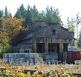
Dee is an unincorporated community and former company town in Hood River County, Oregon, United States, on Oregon Route 281, about 11 miles south of Hood River.
Pine Grove is an unincorporated community in Hood River County, Oregon, United States on Oregon Route 35 in the middle Hood River Valley near Neal Creek. It is about five miles south of the city of Hood River and has a Hood River ZIP code.
Clem is an unincorporated community in Gilliam County, Oregon, United States, at an elevation of 1,903 feet (580 m). It was named for Clemens Augustus Danneman, who was born in Germany, came to Oregon in 1879, and owned a ranch in Gilliam County. The Clem post office was open between November 1884 and April 1937. Clem "also was a station on the Condon branch of the Union Pacific Railroad." Now, Clem is on Oregon Route 19 about 4 miles (6.4 km) southeast of Mikkalo. As of November 2021, the population is seven people and one cow.
Lenz is an unincorporated community in Klamath County, Oregon, United States on U.S. Route 97, directly east of Crater Lake and 20 miles (32 km) south of Chemult. This station on the Cascade Line of the Southern Pacific Railroad was named after Charles A. Lenz, who settled in the area before the turn of the 20th century. The elevation is 4554 feet.
Modoc Point is an unincorporated community in Klamath County, Oregon, United States on U.S. Route 97 on the shore of Upper Klamath Lake.
Wyeth is an unincorporated locale in Hood River County, Oregon, United States. It is the site of a campground area in the Columbia River Gorge National Scenic Area off Interstate 84 (I-84).
Tonquin is an unincorporated locale in Washington County, Oregon, United States.
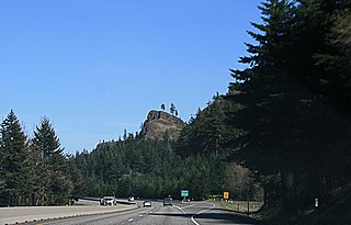
Mitchell Point is a cape in the Columbia River Gorge in Hood River County, Oregon, United States.

Fairbanks is an unincorporated community in Wasco County, Oregon, United States. It is about 12 miles (19 km) east of The Dalles, just south of U.S. Route 30/Interstate 84, near Fifteenmile Creek.
Bloucher is an unincorporated historic community west of Odell in Hood River County, Oregon, United States.
Dodson is an unincorporated community in Multnomah County, Oregon, United States. It is located about 4½ miles (7.2 km) east of Multnomah Falls and one mile west of Warrendale, in the Columbia River Gorge on Interstate 84/U.S. Route 30. It is across the Columbia River from Skamania, Washington. Dodson is within the Cascade Locks ZIP code.
Jonesboro is an unincorporated historic community in Malheur County, Oregon, United States. It is located on U.S Route 20, between Juntura and Harper, near the Malheur River.
Kamela is an unincorporated community in Union County, Oregon, United States. It is located west of Interstate 84 about 20 miles northwest of La Grande.
Clifton is an unincorporated locale in Hood River County, Oregon, United States. It is located about 3 miles west of the city of Hood River. The name originates from the drop in elevation Interstate 84 takes from the cliffs there, which are 250 feet above the Columbia River.
Faubion is an unincorporated community in Clackamas County, Oregon, United States. It is located about 2 miles northwest of Rhododendron, in the Mount Hood Corridor on a loop road off U.S. Route 26 near the Zigzag River.
References
- 1 2 McArthur, Lewis A.; Lewis L. McArthur (2003) [1928]. Oregon Geographic Names (7th ed.). Portland, Oregon: Oregon Historical Society Press. ISBN 0-87595-277-1.
- ↑ Miscellaneous Railroad Timetables. On File at Oregon Historical Society. One of four segments also included in The Railroad Stations of Oregon by Lewis L. McArthur and Cynthia B. Gardiner, 1996.
- ↑ "Lenz". Geographic Names Information System . United States Geological Survey. November 28, 1980. Retrieved 2009-12-24.
Municipalities and communities of Hood River County, Oregon, United States | ||
|---|---|---|
| Cities |  | |
| CDPs | ||
| Other communities | ||
| Indian reservation | ||
| Footnotes | ‡This populated place also has portions in an adjacent county or counties | |
Coordinates: 45°37′46″N121°31′27″W / 45.629562°N 121.524241°W
| | This Hood River County, Oregon state location article is a stub. You can help Wikipedia by expanding it. |