Collect Pond, or Fresh Water Pond, was a body of fresh water in what is now Chinatown in Lower Manhattan, New York City. For the first two centuries of European settlement in Manhattan, it was the main New York City water supply system for the growing city. The former pond became the site of a jail and is now a city park, Collect Pond Park, which includes a pond evocative of its former status.

Green Pond is a private lakeside residential unincorporated community within Rockaway Township in Morris County, New Jersey, United States. The lakeside community is managed by two corporations, Green Pond Corporation and Lake End Corporation.

Grafton Lakes State Park is a 2,545-acre (10.30 km2) state park located in Rensselaer County, New York, United States. The park is in the central part of the Town of Grafton and north of the hamlet of Grafton on NY Route 2, northeast of Albany. The park contains the Shaver Pond Nature Center.

Saranac River is an 81-mile-long (130 km) river in the U.S. state of New York. In its upper reaches is a region of mostly flat water and lakes. The river has more than three dozen source lakes and ponds north of Upper Saranac Lake; the highest is Mountain Pond on Long Pond Mountain. In the last third of its length it drops two-thirds of its total drop, and is known for having navigable rapids, which make it a popular site for whitewater kayaking and canoeing.

The Johns River, in northern New Hampshire, arises at Cherry Pond in Jefferson and runs approximately 14 miles (23 km), generally northwest, to the Connecticut River. It passes through Hazens Pond, near the Mount Washington Regional Airport, traverses the town of Whitefield, where it is crossed by U.S. Route 3, and then crosses the town of Dalton before joining the Connecticut. It is named for an early hunter and trapper of the area, John Glines, who established a fishing and hunting camp in the area in the 18th century. Another nearby river, the Israel River, is named for John's brother Israel.
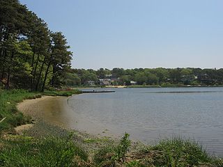
Follins Pond is a brackish lake located on Cape Cod, separating the towns of Dennis, Massachusetts, and Yarmouth, Massachusetts. The lake is connected to Nantucket Sound via the Bass River.

Ashuelot Pond is a 368-acre (149 ha) water body located in Sullivan County in western New Hampshire, United States, in the town of Washington. It is situated along the upper reaches of the Ashuelot River, a tributary of the Connecticut River.

Country Pond is a 306-acre (124 ha) water body located in Rockingham County in southern New Hampshire, United States, in the towns of Kingston and Newton. Water from Country Pond flows via the Powwow River to the Merrimack River in Amesbury, Massachusetts.

Goose Pond is a 625-acre (2.5 km2) water body located in Grafton County in western New Hampshire, United States, in the towns of Canaan and Hanover. It is considered a great pond by the state of New Hampshire. The lake has 6.3 miles (10.1 km) of shoreline, and is approximately 3 miles (5 km) long by 0.5 miles (0.8 km) wide. All but the northernmost end of the pond is in the town of Canaan. The average depth of the pond is approximately 10 feet (3.0 m), with the deepest part approximately 35 feet (11 m). The lake is part of the Mascoma River watershed, flowing to the Connecticut River.

Grafton Pond is a 319-acre (1.3 km2) water body located in Grafton County in western New Hampshire, United States, in the town of Grafton. The pond is part of the Mascoma River watershed, flowing to the Connecticut River. Outflow from the pond travels through Bicknell Brook to Crystal Lake in Enfield, then north to the Mascoma River in West Canaan.

Success Pond is a 282-acre (1.14 km2) water body located in Coos County in northern New Hampshire, United States, in the township of Success. Water from the pond flows west via Chickwolnepy Stream to the Androscoggin River.

Dublin Pond or Dublin Lake is a 236-acre (0.96 km2) water body located in Cheshire County in southwestern New Hampshire, United States, in the town of Dublin. The pond lies at an elevation of 1,480 feet (451 m) above sea level, near the height of land between the Connecticut River/Long Island Sound watershed to the west and the Merrimack River/Gulf of Maine watershed to the east.
Great Pond is a 268-acre (1.08 km2) water body located in Rockingham County in southeastern New Hampshire in the United States. The lake lies near the center of the town of Kingston. Kingston State Park, a small preserve with a swimming beach, occupies the northeastern end of the lake, near the town center. The lake is located along the Powwow River, a tributary of the Merrimack River.

Powwow Pond is a 348-acre (1.41 km2) water body in Rockingham County in southeastern New Hampshire, United States. The outlet of the pond is located in the town of East Kingston, but most of the lake lies in the town of Kingston. The Powwow River, the outlet of the pond, flows to the Merrimack River in Amesbury, Massachusetts.

Island Pond is a 179-acre (0.72 km2) water body located in Cheshire County in southwestern New Hampshire, United States, in the town of Stoddard. It is fed primarily by the outflow from Highland Lake, and its outlet is a tributary of the North Branch Contoocook River, part of the Merrimack River watershed.
Cedar Pond is an 80-acre (32 ha) lake in Coos County, northern New Hampshire, United States, in the town of Milan. The lake is located just south of Route 110A and west of Route 110B.

Willowbrook Park is a recreational park in Willowbrook, Staten Island, New York City, within the Staten Island Greenbelt. The 164-acre (0.66 km2) public park provides baseball fields, a playground, and a pond. A carousel was opened in 1999. The former Staten Island Hotel can be seen from the park.

The Kisco River is a creek that runs through the Mount Kisco, New York area. It is formed by the forks of Chappaqua Brook and an unnamed stream. It follows a 3.3-mile (5.3 km) winding course before emptying into the New Croton Reservoir at Lake Road Bridge in the town of New Castle near the hamlet of Stanwood and eventually into the Atlantic Ocean via the Croton River, the Hudson River, and New York Harbor.

