Letart, West Virginia | |
---|---|
Coordinates: 38°53′41″N81°56′00″W / 38.89472°N 81.93333°W Coordinates: 38°53′41″N81°56′00″W / 38.89472°N 81.93333°W | |
Country | United States |
State | West Virginia |
County | Mason |
Elevation | 581 ft (177.1 m) |
Time zone | EST (UTC-5) |
• Summer (DST) | EDT (UTC-4) |
ZIP code | 25253 |
Area code(s) | 304 |
GNIS | 1541798 |
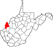
Letart is an unincorporated community in Mason County, West Virginia, USA. It is located on the Ohio River. [1] [2]
In law, an unincorporated area is a region of land that is not governed by a local municipal corporation; similarly an unincorporated community is a settlement that is not governed by its own local municipal corporation, but rather is administered as part of larger administrative divisions, such as a township, parish, borough, county, city, canton, state, province or country. Occasionally, municipalities dissolve or disincorporate, which may happen if they become fiscally insolvent, and services become the responsibility of a higher administration. Widespread unincorporated communities and areas are a distinguishing feature of the United States and Canada. In most other countries of the world, there are either no unincorporated areas at all, or these are very rare; typically remote, outlying, sparsely populated or uninhabited areas.
Mason County is a county in the U.S. state of West Virginia. As of the 2010 census, the population was 27,324. Its county seat is Point Pleasant. The county was founded in 1804 and named for George Mason, delegate to the U.S. Constitutional Convention. Before the Civil War, the county was in the State of Virginia.
West Virginia is a state located in the Appalachian region in the Southern United States that is also considered to be a part of the Middle Atlantic States. It is bordered by Pennsylvania to the north, Maryland to the east and northeast, Virginia to the southeast, Kentucky to the southwest, and Ohio to the northwest. West Virginia is the 41st largest state by area, and is ranked 38th in population. The capital and largest city is Charleston.
Letart is part of the Point Pleasant, WV– OH Micropolitan Statistical Area.
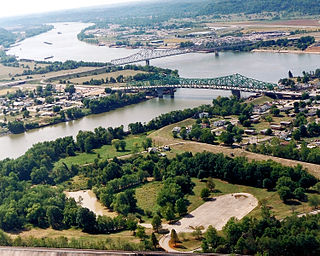
Point Pleasant is a city in and the county seat of Mason County, West Virginia, USA, at the confluence of the Ohio and Kanawha Rivers. The population was 4,350 at the 2010 census. It is the principal city of the Point Pleasant, WV-OH Micropolitan Statistical Area.
Ohio is a Midwestern state in the Great Lakes region of the United States. Of the fifty states, it is the 34th largest by area, the seventh most populous, and the tenth most densely populated. The state's capital and largest city is Columbus.
The Point Pleasant Micropolitan Statistical Area, as defined by the United States Census Bureau, is an area consisting of two counties – one in West Virginia and one in Ohio – anchored by the city of Point Pleasant, West Virginia.
The community was named after one Mr. LeTart, a local pioneer settler. [3]
Lehew is an unincorporated community in Hampshire County, West Virginia on the Virginia line. Lehew is located on Timber Ridge along West Virginia Route 259 at its crossroads with H.G. Brill Road and White Pine Ridge Road.
Claysville is an unincorporated community in Mineral County, West Virginia located at the intersection of West Virginia Route 93 and U.S. Route 50. It is part of the Cumberland, MD-WV Metropolitan Statistical Area.
Big Four is an unincorporated community located in McDowell County, West Virginia, United States. Their post office has been closed. Originally known as Cirrus, Big Four is reported to have been renamed for the four men who operated the coal mines in the area.
Baker is an unincorporated community on the Lost River in Hardy County, West Virginia, United States. Baker is located at the intersection of West Virginia Route 259 and West Virginia Route 55. The ZCTA population for Baker's ZIP Code was 1,262 at the 2000 census.
Letart Township is one of the twelve townships of Meigs County, Ohio, USA. The 2000 census found 641 people in the township.
Yawkey is an unincorporated community in eastern Lincoln County, West Virginia, United States. It lies at the intersection of West Virginia Routes 3 and 214, east of the town of Hamlin, the county seat of Lincoln County. Its elevation is 738 feet (225 m). Although it is unincorporated, it had a post office, with the ZIP code of 25573.
Looneyville is an unincorporated community on Flat Creek of the Pocatalico River in Roane County, West Virginia, United States. It is on West Virginia Route 36. The community is named for Robert Looney, a pioneer settler. The post office was established in 1870.
Robson is an unincorporated community in Fayette County, West Virginia, United States, situated primarily on the banks of Loup Creek. Robson is served by State Highway 61, and is located 8 miles (13 km) from Montgomery and 15 miles (24 km) from Oak Hill. Robson's Post Office serves the smaller communities of Beards Fork and Mulberry.
Prince is a census-designated place (CDP) in Fayette County, West Virginia, United States. As of the 2010 census, its population was 116. Located at an altitude of 1,263 feet (385 m), it is served by an Amtrak station.
Falling Rock is an unincorporated community in Kanawha County, West Virginia, United States. Falling Rock is located at the confluence of Falling Rock Creek with the Elk River 3 miles (4.8 km) southwest of Clendenin along US Route 19. Falling Rock has a post office with ZIP code 25079.
Thursday is an unincorporated community located in Ritchie County, West Virginia, United States. It is near the community of Burnt House.
Blue Pennant is an unincorporated community in Boone County, West Virginia. At one time, it was known as Red Dragon which has closed its post office. Red Dragon as a community was also called Kam and then Mordue.
Sodom is an unincorporated community in Logan County, West Virginia.
Mud is an unincorporated community in Lincoln County, West Virginia, United States. Its post office is closed.
Wickham is an unincorporated community in Raleigh County, West Virginia, United States. Its post office is closed.
Legg is an unincorporated community in Kanawha County, West Virginia, United States. Its post office is closed.
Copenhaver was an unincorporated community in Kanawha County, West Virginia, United States. Its post office is closed.
Maynor is an unincorporated community in Raleigh County, West Virginia, United States. Its post office is closed.
Wevaco is an unincorporated community and former coal town in Kanawha County, West Virginia, United States. Its post office is closed.
Woodyard was an unincorporated community in Roane County, West Virginia. Its post office is closed.
This article about a location in Mason County, West Virginia is a stub. You can help Wikipedia by expanding it. |