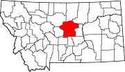
Lewistown Heights, Montana | |
---|---|
![]() Location of Lewistown Heights, Montana | |
Coordinates: 47°4′32″N109°27′21″W / 47.07556°N 109.45583°W | |
Country | United States |
State | Montana |
County | Fergus |
Area | |
• Total | 2.36 sq mi (6.10 km2) |
• Land | 2.36 sq mi (6.10 km2) |
• Water | 0.00 sq mi (0.00 km2) |
Elevation | 4,009 ft (1,222 m) |
Population (2020) | |
• Total | 364 |
• Density | 154.43/sq mi (59.62/km2) |
Time zone | UTC-7 (Mountain (MST)) |
• Summer (DST) | UTC-6 (MDT) |
Area code | 406 |
FIPS code | 30-43400 |
GNIS feature ID | 2408604 [2] |
Lewistown Heights is an unincorporated area and census-designated place (CDP) in Fergus County, Montana, United States. The population was 407 at the 2010 census, [3] up from 365 in 2000.
Lewistown Heights is located northwest of Lewistown, the county seat. It is bordered to the south by Valach Road, to the east by Joyland Road, to the north by Wolverine Creek Road, and to the west by Wolverine Creek. Downtown Lewistown is 1.5 miles (2.4 km) to the southeast.
According to the United States Census Bureau, the CDP has a total area of 2.4 square miles (6.1 km2), all land. [3]
Census | Pop. | Note | %± |
---|---|---|---|
2020 | 364 | — | |
U.S. Decennial Census [4] |
As of the census [5] of 2000, there were 365 people, 138 households, and 93 families residing in the CDP. The population density was 155.6 inhabitants per square mile (60.1/km2). There were 149 housing units at an average density of 63.5 per square mile (24.5/km2). The racial makeup of the CDP was 94.52% White, 1.64% African American, 1.37% Native American, 1.64% from other races, and 0.82% from two or more races. Hispanic or Latino of any race were 1.64% of the population.
There were 138 households, out of which 32.6% had children under the age of 18 living with them, 57.2% were married couples living together, 5.8% had a female householder with no husband present, and 31.9% were non-families. 18.8% of all households were made up of individuals, and 8.7% had someone living alone who was 65 years of age or older. The average household size was 2.64 and the average family size was 3.13.
In the CDP, the population was spread out, with 29.0% under the age of 18, 6.0% from 18 to 24, 28.8% from 25 to 44, 24.7% from 45 to 64, and 11.5% who were 65 years of age or older. The median age was 37 years. For every 100 females, there were 92.1 males. For every 100 females age 18 and over, there were 107.2 males.
The median income for a household in the CDP was $31,154, and the median income for a family was $34,063. Males had a median income of $28,382 versus $13,036 for females. The per capita income for the CDP was $11,274. About 9.3% of families and 15.6% of the population were below the poverty line, including 12.7% of those under age 18 and none of those age 65 or over.
Summit is a census-designated place (CDP) in Pima County, Arizona, United States. The population was 3,702 at the 2000 census.
Sun Prairie is a census-designated place (CDP) in Cascade County, Montana, United States. The population was 1,630 at the 2010 census. It is part of the Great Falls Metropolitan Statistical Area and may have evolved as a remote suburb of Great Falls.
Moore is a town in Fergus County, Montana, United States. The population was 194 at the 2020 census.
Inverness is a census-designated place (CDP) in Hill County, Montana, United States. The population was 55 at the 2010 census. It was named after a city in Scotland.
Fortine is a census-designated place (CDP) in Lincoln County, Montana, United States. The population was 206 at the 2021 census.
Orchard Homes is a census-designated place (CDP) in Missoula County, Montana, United States. It is part of the Missoula metropolitan area. The population was 5,377 at the 2020 census.
Wye is an unincorporated community and census-designated place in Missoula County, Montana, United States. It is part of the Missoula metropolitan area. The population was 714 at the 2020 census, up from 511 in 2010. The community is named for the "y"-shaped DeSmet Junction where US 93 and MT 200 met former US 10.
Reserve is a census-designated place (CDP) in Sheridan County, Montana, United States. The population was 23 at the 2010 census.
Day Heights is a census-designated place (CDP) in Miami Township, Clermont County, Ohio, United States. The population was 2,625 at the 2020 census.
Mount Healthy Heights is a census-designated place (CDP) in Colerain Township, Hamilton County, Ohio, United States. The population was 2,918 at the 2020 census.
Perry Heights is a census-designated place in Stark County, Ohio, United States. The population was 8,391 at the 2020 census. It is part of the Canton–Massillon metropolitan area.
Lenape Heights is a census-designated place (CDP) in Armstrong County, Pennsylvania, United States. The population was 1,144 at the 2020 census.
Wayne Heights is a census-designated place (CDP) in Franklin County, Pennsylvania, United States. The population was 2,606 at the 2020 census.
Arlington Heights is a census-designated place (CDP) in Monroe County, Pennsylvania, United States. The population was 6,331 at the 2020 census. One notable location in Arlington Heights is the Stroud Mall.
Palmer Heights is a census-designated place (CDP) in the Town of Palmer, Pennsylvania. The population of Palmer Heights was 3,762 at the 2010 census. Palmer Heights is part of the Lehigh Valley, which had a population of 861,899 and was the 68th-most populous metropolitan area in the U.S. as of the 2020 census.
Shenandoah Heights is a census-designated place (CDP) in Schuylkill County, Pennsylvania. The population was 1,298 at the 2000 census.
Woodland Heights is a census-designated place (CDP) in Venango County, Pennsylvania, United States. The population was 1,402 at the 2000 census.
Ashland Heights is a census-designated place (CDP) and unincorporated community in Pennington County, South Dakota, United States. The population was 678 at the 2020 census.
Longview Heights is a census-designated place (CDP) in Cowlitz County, Washington, United States. The population was 4,033 at the 2020 Census. The CDP is known locally as Columbia Heights.
Arlington Heights is a census-designated place (CDP) in Snohomish County, Washington, United States. As of the 2020 census, the population was 2,477, up from 2,284 at the 2010 census.