Ley-Miro

Last updated
Ley-Miro
Sub-prefecture and town
Guinea adm location map.svg
Red pog.svg
Ley-Miro
Location in Guinea
Coordinates: 10°56′N12°53′W / 10.933°N 12.883°W / 10.933; -12.883
CountryFlag of Guinea.svg  Guinea
Region Mamou Region
Prefecture Pita Prefecture
Time zone GMT (UTC+0)

Ley-Miro is a town and sub-prefecture in the Pita Prefecture in the Mamou Region of northern-central Guinea. [1]

Town settlement that is bigger than a village but smaller than a city


A town is a human settlement. Towns are generally larger than villages but smaller than cities, though the criteria to distinguish them vary considerably between different parts of the world.

Sub-prefectures of Guinea

The sub-prefectures are the third-level administrative divisions in Guinea. As of 2009 there were 303 rural sub-prefectures of Guinea and 38 urban sub-prefectures, 5 of which compose the Conakry greater urban area; Kaloum, Dixinn, Matam, Ratoma and Matoto.

Pita Prefecture Prefecture in Mamou Region, Guinea

Pita is a prefecture located in the Mamou Region of Guinea. The capital is Pita. The prefecture covers an area of 4,320 km.² and has an estimated population of 266,000.

Related Research Articles

Boké Urban Sub-prefecture and city in Boké Region, Guinea

Boké is the capital city of Boké Prefecture within the Boké Region of Lower Guinea near the border with Guinea-Bissau. It is also a sub-prefecture of Guinea. Located along the Rio Nuñez which flows to its not-too-distant mouth on the Atlantic Ocean, Boké is a port. It is known for the Fortin de Boké museum, formerly a slave fort. The town is served by Boké Baralande Airport. As of 2014 the city and surrounding sub-prefecture had a population of 61,449 people.

Lélouma Sub-prefecture and town in Labe Region, Guinea


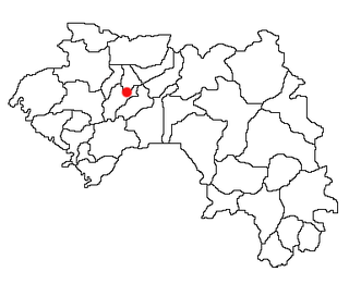
Lélouma is a town located in west central Guinea. It is the capital of Lélouma Prefecture.

Moussadou Sub-prefecture and town in Nzérékoré Region, Guinea

Moussadou is a town and sub-prefecture in the Beyla Prefecture in the Nzérékoré Region of south-eastern Guinea.

Kolaboui Sub-prefecture and town in Boké Region, Guinea

Kolaboui is a town and sub-prefecture in the Boké Prefecture in the Boké Region of western Guinea. As of 2014 it had a population of 57,251 people.

Kobéla Sub-prefecture and town in Nzérékoré Region, Guinea

Kobéla is a town and sub-prefecture in the Nzérékoré Prefecture in the Nzérékoré Region of Guinea.

Songoyah Sub-prefecture and town in Faranah Region, Guinea

Songoyah is a town and sub-prefecture in the Faranah Prefecture in the Faranah Region of Guinea. As of 2014 it had a population of 13,422 people.

Kounsitel Sub-prefecture and town in Boké Region, Guinea

Kounsitel is a town and sub-prefecture in the Gaoual Prefecture in the Boké Region of north-western Guinea. As of 2014 it had a population of 18,572 people.

Moribayah Sub-prefecture and town in Kankan Region, Guinea

Moribayah is a town and sub-prefecture in the Kankan Prefecture in the Kankan Region of eastern Guinea. As of 2014 it had a population of 14,141 people.

Friguiagbé Sub-prefecture and town in Kindia Region, Guinea

Friguiagbé is a town and sub-prefecture in the Kindia Prefecture in the Kindia Region of western Guinea.

Madina-Oula Sub-prefecture and town in Kindia Region, Guinea

Madina-Oula is a town and sub-prefecture in the Kindia Prefecture in the Kindia Region of western Guinea.

Molota Sub-prefecture and town in Kindia Region, Guinea

Molota is a town and sub-prefecture in the Kindia Prefecture in the Kindia Region of western Guinea.

Samayah Sub-prefecture and town in Kindia Region, Guinea

Samayah is a town and sub-prefecture in the Kindia Prefecture in the Kindia Region of western Guinea.

Yendé-Millimou Sub-prefecture and town in Faranah Region, Guinea

Yendé-Millimou is a sub-prefecture in the Kissidougou Prefecture in the Faranah Region of Guinea. It includes the settlements of Yendé and Millimou. As of 2014 it had a population of 20,372 people.

Guingan Sub-prefecture and town in Boké Region, Guinea

Guingan is a town and sub-prefecture in the Koundara Prefecture in the Boké Region of northern Guinea. As of 2014 it had a population of 14,347 people.

Salambandé Sub-prefecture and town in Labé Region, Guinea

Salambandé is a town and sub-prefecture in the Mali Prefecture in the Labé Region of northern Guinea.

Téliré Sub-prefecture and town in Labé Region, Guinea

Téliré is a town and sub-prefecture in the Mali Prefecture in the Labé Region of northern Guinea.

Kiniéran Sub-prefecture and town in Kankan Region, Guinea

Kiniéran is a town and sub-prefecture in the Mandiana Prefecture in the Kankan Region of eastern Guinea. As of 2014 it had a population of 37,944 people.

Fatako Sub-prefecture and town in Labé Region, Guinea

Fatako is a town and sub-prefecture in the Tougué Prefecture in the Fouta Region of northern-central Guinea.

Tangali Sub-prefecture and town in Labé Region, Guinea

Tangali is a town and sub-prefecture in the Tougué Prefecture in the Labé Region of northern-central Guinea.

Konsotamy Sub-prefecture and town in Kindia Region, Guinea

Konsotamy is a town and sub-prefecture in the Télimélé Prefecture in the Kindia Region of western-central Guinea.

References

  1. "Subprefectures of Guinea". Statoids. Retrieved April 20, 2009.

Coordinates: 10°56′N12°53′W / 10.933°N 12.883°W / 10.933; -12.883

Geographic coordinate system Coordinate system

A geographic coordinate system is a coordinate system that enables every location on Earth to be specified by a set of numbers, letters or symbols. The coordinates are often chosen such that one of the numbers represents a vertical position and two or three of the numbers represent a horizontal position; alternatively, a geographic position may be expressed in a combined three-dimensional Cartesian vector. A common choice of coordinates is latitude, longitude and elevation. To specify a location on a plane requires a map projection.