NGC 188 is an open cluster in the constellation Cepheus. It was discovered by John Herschel in 1825. Unlike most open clusters that drift apart after a few million years because of the gravitational interaction of our Milky Way galaxy, NGC 188 lies far above the plane of the galaxy and is one of the most ancient of open clusters known, at approximately 6.8 billion years old. NGC 188 is very close to the North Celestial Pole, under five degrees away, and in the constellation of Cepheus at an estimated 5,000 light-years' distance, this puts it slightly above the Milky Way's disc and further from the center of the galaxy than the Sun.

Halmahera Sea is a regional sea located in the central eastern part of the Australasian Mediterranean Sea. It is centered at about 1°S and 129°E and is bordered by the Pacific Ocean to the north, Halmahera to the west, Waigeo and Irian Jaya to the east, and the Seram Sea to the south. It covers about 95,000 km and its topography comprises a number of separate basins and ridges, the chief of which is the Halmahera Basin reaching a depth of 2039 m.

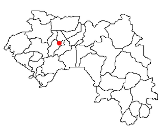
Koundara is a prefecture located in the Boké Region of Guinea. The capital is Koundara. The prefecture covers an area of 5,238 km.² and has a population of 130,205.

The Mamou Region is located in central Guinea. It is bordered by the country of Sierra Leone and the Guinean regions of Faranah, Labé, and Kindia.

Koundara is a town in northwestern Guinea. It is the capital of Koundara Prefecture. The town is served by Sambailo Airport. As of 2014 it had a population of 27,433 people.

The Ceram Sea or Seram Sea is one of several small seas between the scattered islands of Indonesia. It is a section of the Pacific Ocean with an area of approximately 12,000 square kilometers located between Buru and Seram, which are two of the islands once called the South Moluccas. These islands are the native habitat of plants long coveted for their use as spices, such as nutmeg, cloves, and black peppercorns, and the seas surrounding them were busy shipping routes. The Ceram Sea is also the habitat of several species of tropical goby and many other fish. Like many other small Indonesian seas, the Ceram Sea is rocky and very tectonically active.
Hontoria de Cerrato is a municipality located in the province of Palencia, Castile and León, Spain. According to the 2004 census (INE), the municipality has a population of 111 inhabitants.
Algimia de Almonacid is a municipality in the comarca of Alto Palancia, Castellón, Valencia, Spain.
Kassadou is a town and sub-prefecture in the Guéckédou Prefecture in the Nzérékoré Region of south-western Guinea.
Kondiadou or Koundiatou is a town and sub-prefecture in the Kissidougou Prefecture in the Faranah Region of Guinea. As of 2014 it had a population of 14,897 people.
Daralabe is a town and sub-prefecture in the Labé Prefecture in the Labé Region of northern-central Guinea.

Kokota is a town and sub-prefecture in the Lola Prefecture in the Nzérékoré Region of south-eastern Guinea.
Balaya is a town and sub-prefecture in the Lélouma Prefecture in the Labé Region of northern-central Guinea.
Ourémai is a town and sub-prefecture in the Macenta Prefecture in the Nzérékoré Region of south-eastern Guinea.
Gayah is a town and sub-prefecture in the Mali Prefecture in the Labé Region of northern Guinea.
Dialakoro is a town and sub-prefecture in the Mandiana Prefecture in the Kankan Region of eastern Guinea. As of 2014 it had a population of 63,159 people.
Koundian is a town and sub-prefecture in the Mandiana Prefecture in the Kankan Region of eastern Guinea. As of 2014 it had a population of 32,298 people.
Dongol-Maci is a town and sub-prefecture in the Pita Prefecture in the Mamou Region of northern-central Guinea.
Sintali is a town and sub-prefecture in the Pita Prefecture in the Mamou Region of northern-central Guinea.
Sannou is a town and sub-prefecture in the Labé Prefecture, located in the Labé Region of northern-central Guinea.