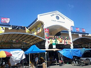
Sinait, officially the Municipality of Sinait, is a 3rd class municipality in the province of Ilocos Sur, Philippines. According to the 2015 census, it has a population of 25,640 people.

The Central Cebu Protected Landscape (CCPL) is a protected area located in the mountains and drainage basins of central Cebu in the Philippines.

Bataan National Park is a protected area of the Philippines located in the mountainous interior of Bataan province in the Central Luzon Region. The park straddles the northern half of Bataan Peninsula near its border with Subic Bay Freeport Zone, Zambales. The park was first established in 1945 under Proclamation No. 24 with an initial area of 31,000 hectares and included portions in Subic, Zambales. The park was reduced in 1987 to its present size of 23,688 hectares and is now wholly located in Bataan province. The park encompasses the Bataan towns and cities of Hermosa, Orani, Samal, Abucay, Balanga, Bagac and Morong.

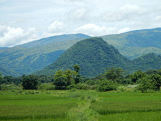
Balbalasang–Balbalan National Park is a protected area of the Philippines located in the municipality of Balbalan, Kalinga in the Cordillera Administrative Region. The park covers an area of 1,338 hectares and is centered on Mount Balbalasang in the barangay of the same name near the provincial border with Abra. Dubbed the "green heart of the Cordillera", the park is representative of the rich biodiversity and landscape of this mountain region with some of the most intact pine forests and richly endemic flora and fauna. It was declared a national park in 1972 by virtue of Republic Act No. 6463.
The Manleluag Spring Protected Landscape is a protected area containing natural hot springs in the Ilocos Region of the Philippines. It is one of 34 protected landscapes in the Philippines located in the municipality of Mangatarem, Pangasinan in the west-central area of the island of Luzon.

The Roosevelt Protected Landscape, also known as Roosevelt Park, is a protected area in the Central Luzon region in the Philippines. It occupies an area of 786.04 hectares of grasslands and old-growth forest in northern Bataan province near Olongapo and the Subic Bay Freeport Zone. The park was established as Roosevelt National Park covering an area of 1,485 hectares on 30 March 1933 through Proclamation No. 567 signed by Governor-General Theodore Roosevelt, Jr. In 1965, the national park was reduced to 1,334 hectares. On 23 April 2000, the park was reclassified as a protected landscape area and was further reduced to its present area of 786.04 hectares.

The Magapit Protected Landscape is a protected area of forested limestone hills and grasslands in the Cagayan Valley of northern Luzon island in the Philippines. It covers an area of 3,403.62 hectares in northeastern Cagayan province straddling the municipalities of Lal-lo and Gattaran. The park was established as a game refuge and bird sanctuary on 15 August 1947 covering an initial area of 4,554 hectares declared through Administrative Order No. 10 by President Manuel Roxas. On 23 April 2000, the park was redesignated as a protected landscape area under the National Integrated Protected Areas System Act through Proclamation No. 285 signed by President Joseph Estrada. The park is a component of the Northeastern Cagayan Key Biodiversity Area and also contains the Lal-lo and Gattaran Shell Middens, a proposed World Heritage Site.

The Salinas Natural Monument is a natural monument comprising saline springs and forested mountains in southern Cagayan Valley in the Philippines. It is one of four protected areas in the landlocked province of Nueva Vizcaya spanning an area of 6,675.56 hectares in the municipalities of Bambang, Kayapa and Aritao. The park was established on 18 May 1914 as the Salinas Forest Reserve covering the Salinas Salt Springs and surrounding forest through Executive Order No. 44 signed by Governor-General Francis Burton Harrison. In 1926, through amendments made in Proclamation No. 53 by Governor-General Leonard Wood, the forest reserve was re-established as the Salinas Deer Refuge. Salinas was finally declared a natural monument in 2000 under the National Integrated Protected Areas System through Proclamation No. 275 by President Joseph Estrada.
The Casecnan Protected Landscape is a protected area in the Casecnan River watershed of eastern Luzon in the Philippines. It has a total area of 88,846.80 hectares straddling the provinces of Nueva Vizcaya, Quirino and Aurora. The 57,930-hectare (143,100-acre) Casecnan River Watershed Forest Reserve was established in August 1987 by virtue of Executive Order No. 136 issued by President Corazon Aquino. In April 2000, the forest reserve was enlarged to 88,846.80 hectares and was reclassified as a protected landscape area through Proclamation No. 289. It is considered as one of the last remaining substantial water source for the region of Central Luzon.

The Mount Timolan Protected Landscape is a protected area covering Mount Timolan and its surrounding forested landscape in the region of Zamboanga Peninsula on Mindanao in the Philippines. The park encompasses an area of 1,994.79 hectares and a buffer zone of 695.39 hectares in the municipalities of San Miguel, Guipos and Tigbao in the province of Zamboanga del Sur. It was established on 14 August 2000 through Proclamation Order No. 354 issued by President Joseph Estrada. The park was also earlier established by the provincial government of Zamboanga del Sur as a provincial park and wildlife sanctuary known as the Zamboanga del Sur Provincial Park through Provincial Ordinance No. 3 in 1992.
The Bessang Pass Natural Monument is a protected area and memorial that commemorates the victory on 14 June 1945 by Filipino soldiers serving the U.S. Army Forces in the Philippines Northern Luzon (USAFIP-NL) over the Imperial Japanese Army in the Battle of Bessang Pass which led to Japan's eventual surrender and end to World War II in the Philippines. It covers an area of 693.32 hectares and a buffer zone of 427.79 hectares in the municipality of Cervantes in Ilocos Sur. The mountain pass was initially a component of the Tirad Pass National Park, declared in 1938 through Proclamation No. 294 by then President Manuel Luis Quezon. On 10 August 1954, it was established as the Bessang Pass National Shrine with an area of 304 hectares by virtue of Proclamation No. 55 signed by President Ramon Magsaysay. The national shrine was finally declared and reclassified as a natural monument under the National Integrated Protected Areas System in April 2000 through Proclamation No. 284 by President Joseph Estrada.

The Lidlidda Protected Landscape, also known as the Lidlidda–Banayoyo Protected Landscape, is a protected area of natural springs and surrounding mountain forests in Ilocos Sur on the island of Luzon in the Philippines. It is an important watershed providing the agricultural and household water requirements of the communities in the municipalities of Lidlidda and Banayoyo. It was established in 1936 as the Lidlidda Watershed Forest Reserve through Proclamation No. 79 signed by President Manuel Luis Quezon with an initial area of 1,228 hectares. In 2000, under the National Integrated Protected Areas System, it was redesignated as a protected landscape area covering its present size of 1,157.44 hectares.
The Santa Lucia Protected Landscape, also known as the Salcedo Protected Landscape, is a protected area located in the foothills of the Cordillera Central mountain range in the Ilocos Sur province of the Philippines. It protects an important watershed that serves as the water source for the surrounding communities in the municipality of Salcedo. It had an initial area of 174 hectares proclaimed as the Santa Lucia Watershed Forest Reserve in 1938 through Proclamation No. 333 issued by President Manuel Luis Quezon. In 2000, the forest reserve was reestablished as a protected landscape area under the National Integrated Protected Areas System with the signing of Proclamation No. 296 by President Joseph Estrada.
The Bigbiga Protected Landscape is a protected landscape of forested hills, open grasslands and natural springs in Ilocos Sur in the northwestern part of the island of Luzon, Philippines. It is one of five protected landscape areas in the Ilocos Region under the Philippines' National Integrated Protected Areas System. The park has a total area of 135.71 hectares located entirely within the municipality of Narvacan. It was created in 1939 as the Bigbiga Spring Watershed Forest Reserve by virtue of Proclamation No. 431 signed by President Manuel Luis Quezon. In 2000, it was reclassified as a protected landscape by Proclamation No. 290.
The Mati Protected Landscape is a protected area located in Davao Oriental on the southern Philippine island of Mindanao. It protects the watershed in Mati which is the source of water supply for the city's Mati Waterworks System. The protected area was established in 1967 when 890 hectares of forest in Central Mati was proclaimed as the Mati Watershed Forest Reserve through Proclamation No. 222 issued by President Ferdinand Marcos. Under the National Integrated Protected Areas System, the area was reclassified as a protected landscape with the signing of Proclamation No. 912 in 2005 by President Gloria Arroyo.

The Pasonanca Natural Park is a protected area that preserves a major watershed in the southern Philippine island of Mindanao in the Zamboanga Peninsula. It contains the headwaters of the Tumaga River in the southern Zamboanga Cordillera mountain range that serves the water requirements of some 800,000 residents in Zamboanga City. It was named after the village of Pasonanca located in the city's northern fringes where the Pasonanca Park, a public eco-park, and the Abong-Abong Park, a pilgrimage site, can also be found.

The La Mesa Watershed Reservation is a protected area that preserves the only major watershed in Metro Manila, Philippines. Also known as the Novaliches Watershed, it contains the last remaining rainforest of its size in Metro Manila surrounding the La Mesa Dam and Reservoir, the primary source of potable drinking water for 12 million residents in the Manila metropolitan area. The area is under the joint administration, supervision and control of the Department of Environment and Natural Resources and the Metropolitan Waterworks and Sewerage System. It was established in 2007 through Proclamation No. 1336 issued by President Gloria Arroyo.

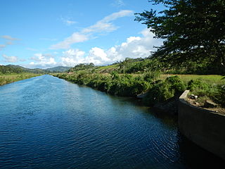
The Angat Watershed Forest Reserve is a conservation area that protects the drainage basin in the southern Sierra Madre range north of Metro Manila in the Philippines where surface water empties into the Angat River and its tributaries. It is spread over an area of 62,309 hectares in the eastern portion of Bulacan and northern Rizal province at an altitude of between 490 and 1,206 metres. The conservation area also extends to the provinces of Nueva Ecija and Quezon and is centered on an artificial lake created by the Angat Dam which, together with the Ipo Dam located 7.5 kilometres (4.7 mi) downstream, supply 97% of the water requirement of Metro Manila via an aqueduct system to the La Mesa Dam and Reservoir and the Balara Filtration Plant in Quezon City. The Angat Dam and Reservoir is also a major source of hydroelectricity for Metro Manila and surrounding provinces, contributing some 200 megawatts to the Luzon grid. The watershed is a popular birdwatching site and is a biodiversity hotspot containing most of the remaining closed-canopy forests in Central Luzon.

The Pantabangan–Carranglan Watershed Forest Reserve is a conservation area located in the upper reaches of the Pampanga River in Nueva Ecija, Philippines, and borders the Sierra Madre and Caraballo Mountains in Aurora and Nueva Vizcaya. It encompasses 84,500 hectares of the drainage basin surrounding the Pantabangan Lake, an impoundment of the Pampanga River by the Pantabangan Dam. The multi-purpose dam is situated at the confluence of Pampanga River's two headwaters, namely the Pantabangan and Carranglan Rivers in the municipality of Pantabangan. It stretches above the dam site for 21 kilometres (13 mi) to where Carranglan River originates in the Caraballo on the north, and for 18 kilometres (11 mi) to where Pantabangan River originates in the Sierra Madre on the east. It is considered a critical watershed for the agricultural economy and hydroelectric power generation in the region of Central Luzon.

The Samar Island Natural Park, in Samar, is the largest contiguous tract of old-growth forest in the Philippines. It is the country's largest terrestrial protected area, with an area of 333,300 hectares. The buffer is spread north to south over the island's three provinces and totals 458,700 hectares, about a third of the entire island of Samar.

