
The Philippines is an archipelago that comprises 7,641 islands, and with a total land area of 300,000 square kilometers (115,831 sq mi), it is the world's fifth largest island country. The eleven largest islands contain 95% of the total land area. The largest of these islands is Luzon at about 105,000 square kilometers (40,541 sq mi). The next largest island is Mindanao at about 95,000 square kilometers (36,680 sq mi). The archipelago is around 800 kilometers (500 mi) from the Asian mainland and is located between Taiwan and Borneo.

Calabarzon, sometimes referred to as Southern Tagalog and designated as Region IV‑A, is an administrative region in the Philippines. The region comprises five provinces: Batangas, Cavite, Laguna, Quezon, and Rizal; and one highly urbanized city, Lucena. It is the most populous region in the Philippines, according to the Philippine Statistics Authority (PSA), having over 16.1 million inhabitants in 2020, and is also the country's second most densely populated after the National Capital Region. It is situated southeast of Metro Manila, and is bordered by Manila Bay and South China Sea to the west, Lamon Bay and the Bicol Region to the east, Tayabas Bay and the Sibuyan Sea to the south, and Central Luzon to the north. It is home to places like Mount Makiling near Los Baños, Laguna, and Taal Volcano in Batangas. Calamba City is the regional center while Antipolo is the most populous city in the region.

Aurora, officially the Province of Aurora, is a province in the Philippines located in the eastern part of Central Luzon region, facing the Philippine Sea. Its capital is Baler and borders, clockwise from the south, the provinces of Quezon, Bulacan, Nueva Ecija, Nueva Vizcaya, Quirino, and Isabela. Maria Aurora is the only landlocked town in the province and yet, the most populous.

Batanes, officially the Province of Batanes, is an archipelagic province in the Philippines, administratively part of the Cagayan Valley region. It is the northernmost province in the Philippines, and the smallest, both in population and land area. The capital is Basco, located on the island of Batan and also the most populous in the province.

The Cordillera Central or Cordillera Range is a massive mountain range 320 kilometres (200 mi) long north–south and 118 kilometres (73 mi) east-west situated in the north-central part of the island of Luzon, in the Philippines. The mountain range encompasses all provinces of the Cordillera Administrative Region, as well as portions of eastern Ilocos Norte, eastern Ilocos Sur, eastern La Union, northeastern Pangasinan, western Nueva Vizcaya, and western Cagayan.

Santa, officially the Municipality of Santa, is a 4th class municipality in the province of Ilocos Sur, Philippines. According to the 2020 census, it has a population of 14,992 people.

The Kalbario–Patapat Natural Park is a protected area in the Philippines, located on the Patapat Mountains in the municipalities of Pagudpud and Adams in northern Ilocos Norte province.

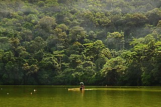
Mount Isarog is an active stratovolcano located in the province of Camarines Sur, Philippines, on the island of Luzon. The mountain has active fumaroles and hot springs. It has an elevation of 2,011.6 m (6,600 ft) above mean sea level.
The Bulusan Volcano Natural Park is a 3,673-hectare (9,080-acre) protected area of rainforest surrounding Mount Bulusan in the Philippines. It was first designated as a National Park by Proclamation no. 811 on June 7, 1935. Under the National Integrated Protected Areas System (NIPAS) of 1992 managed by the Department of the Environment and Natural Resources, the park was reclassified as a Natural Park by Proc. 421 on November 27, 2000. The area features the volcano itself, Bulusan Lake, the two other mountains known as the 'Sharp Peak' and 'Hormahan' and Lake Aguingay. The park is in the south central part of Sorsogon Province, southern Luzon, Bicol Region, Philippines, bounded by five municipalities: Bulusan, Barcelona, Irosin, Juban and Casiguran.
Aurora Memorial National Park is a protected area of the Philippines located within the Sierra Madre mountain range between the provinces of Nueva Ecija and Aurora in Central Luzon. The Aurora Memorial National Park covers an area of 5,676 hectares stretching over 50 kilometers along the scenic Bongabon-Baler road. Established in 1937 by virtue of Proclamation No. 220, the park initially had an area of 2,356 hectares. By 1941, its size was more than doubled to its current area. The park was subsequently dedicated to former First Lady Aurora Aragon Quezon in May 1949. The maximum altitude of the park is reported to be 1,000 m, so the main forest type inside the park must be lowland dipterocarp, with only limited areas of montane forest. Land uses inside the park include both permanent and shifting agriculture (kaingin) and forestry.

Bataan National Park is a protected area of the Philippines located in the mountainous interior of Bataan province in the Central Luzon Region. The park straddles the northern half of Bataan Peninsula near its border with Subic Bay Freeport Zone. The park was first established in 1945 under Proclamation No. 24 with an initial area of 31,000 hectares and included portions of the fenced area of Subic Bay Freeport Zone. The park was reduced in 1987 to its present size of 23,688 hectares and is now wholly located in Bataan province. The park encompasses the Bataan towns and cities of Hermosa, Orani, Samal, Abucay, Balanga, Bagac and Morong.

Balbalasang–Balbalan National Park is a protected area of the Philippines located in the municipality of Balbalan, Kalinga in the Cordillera Administrative Region. The park covers an area of 1,338 hectares and is centered on Mount Balbalasang in the barangay of the same name near the provincial border with Abra. Dubbed the "green heart of the Cordillera", the park is representative of the rich biodiversity and landscape of this mountain region with some of the most intact pine forests and richly endemic flora and fauna. It was declared a national park in 1972 by virtue of Republic Act No. 6463.

The Mayon Volcano Natural Park is a protected area of the Philippines located in the Bicol Region on southeast Luzon Island, the largest island of the country. The Natural park covers an area of 5,775.7 hectares, which includes its centerpiece Mayon Volcano, the most active volcano in the Philippines, and its adjacent surroundings. The volcano is also renowned for having an almost perfect cone. First protected as a National Park in 1938, it was reclassified as a Natural Park in the year 2000.

The Northern Sierra Madre Natural Park is the largest protected area of the Philippines covering the northern range of the Sierra Madre mountains of eastern Luzon. The park is located in the eastern part of the province of Isabela in Cagayan Valley containing a total of 359,486 hectares. It was first declared a wilderness reserve encompassing an area within a 45 kilometres (28 mi) radius of Palanan Point known as the Palanan Wilderness Area through Letter of Instructions No. 917-A signed by President Ferdinand Marcos on September 7, 1979. On March 10, 1997, the area was converted into a natural park with the signing of Proclamation No. 978 by President Fidel Ramos.
The Mounts Palay-Palay–Mataas-na-Gulod Protected Landscape is a 3,973.13-hectare (9,817.8-acre) protected area encompassing the Palay-Palay Mountain Range in southwestern Luzon island near Manila in the Philippines. It was established on October 26, 1976 as a national park and game refuge and bird sanctuary covering an initial area of 4,000 hectares. In 2007, the national park was designated as a protected landscape area under the National Integrated Protected Areas System through Proclamation No. 1315 signed by President Gloria Arroyo. The park is the last remaining lowland rainforest in the province of Cavite and is well known for Mount Pico de Loro, a popular destination for mountaineers and hikers from Metro Manila.
The Libunao Protected Landscape, also known as the Libunao Spring Protected Landscape, is a protected area in the Ilocos Region of the island of Luzon in the Philippines located on the western foothills of the Ilocos Mountain Range. It protects the Libunao Spring and surrounding forests, as well as the Nagcullooban River watershed. First proclaimed as the Libunao Spring Watershed Forest Reserve in 1931 through Proclamation No. 410 issued by Governor-General Dwight F. Davis, the park was reestablished as a protected landscape area under the National Integrated Protected Areas System in 2000 through Proclamation No. 280 signed by President Joseph Estrada. The Libunao watershed is the source of water supply for domestic use and irrigation of the surrounding farms and communities of northern Ilocos Sur province.
The Bessang Pass Natural Monument is a protected area and memorial that commemorates the victory on June 14, 1945, by Filipino soldiers serving the U.S. Army Forces in the Philippines Northern Luzon (USAFIP-NL) over the Imperial Japanese Army in the Battle of Bessang Pass which led to Japan's eventual surrender and end to World War II in the Philippines. It covers an area of 693.32 hectares and a buffer zone of 427.79 hectares in the municipality of Cervantes in Ilocos Sur. The mountain pass was initially a component of the Tirad Pass National Park, declared in 1938 through Proclamation No. 294 by then President Manuel Luis Quezon. On August 10, 1954, it was established as the Bessang Pass National Shrine with an area of 304 hectares by virtue of Proclamation No. 55 signed by President Ramon Magsaysay. The national shrine was finally declared and reclassified as a natural monument under the National Integrated Protected Areas System in April 2000 through Proclamation No. 284 by President Joseph Estrada.
The Bigbiga Protected Landscape is a protected landscape of forested hills, open grasslands and natural springs in Ilocos Sur in the northwestern part of the island of Luzon, Philippines. It is one of five protected landscape areas in the Ilocos Region under the Philippines' National Integrated Protected Areas System. The park has a total area of 135.71 hectares located entirely within the municipality of Narvacan. It was created in 1939 as the Bigbiga Spring Watershed Forest Reserve by virtue of Proclamation No. 431 signed by President Manuel Luis Quezon. In 2000, it was reclassified as a protected landscape by Proclamation No. 290.

The Quezon Protected Landscape is a protected area in the Republic of the Philippines, spanning the municipalities of Pagbilao, Padre Burgos and Atimonan in Quezon province. The park is situated north of the narrowest section of Luzon in Quezon province, located about 164 km (102 mi) southeast of Metro Manila.

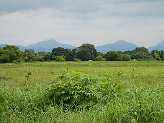
The Sierra Madre is the longest mountain range in the Philippines. Spanning over 540 kilometers (340 mi), it runs from the province of Cagayan down to the province of Quezon, forming a north–south direction on the eastern portion of Luzon, the largest island of the archipelago. It is bordered by the Pacific Ocean to the east, Cagayan Valley to the northwest, Central Luzon to the midwest, and Calabarzon to the southwest. Some communities east of the mountain range, along the coast, are less developed and so remote that they could only be accessed by taking a plane or a boat.

