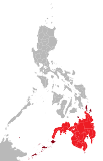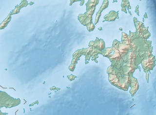
Mindanao, also commonly known as the Southern Philippines, is the second-largest island in the Philippines, after Luzon. Mindanao and the smaller islands surrounding it make up the island group of the same name. Located in the southern region of the archipelago, as of the 2010 census, the main island was inhabited by 20,281,545 people, while the entire Mindanao island group had an estimated population of 25,537,691 (2018).

Lanao del Norte officially the Province of Lanao del Norte, is a province in the Philippines located in the Northern Mindanao region. Its capital is Tubod.

Lanao del Sur, officially the Province of Lanao del Sur, is a province in the Philippines located in the Bangsamoro Autonomous Region in Muslim Mindanao (BARMM). The capital is the city of Marawi, and it borders Lanao del Norte to the north, Bukidnon to the east, and Maguindanao and Cotabato to the south. To the southwest lies Illana Bay, an arm of the Moro Gulf.

Soccsksargen, formerly known as Central Mindanao, is an administrative region of the Philippines, located in south-central Mindanao. It is numerically designated as Region XII. The name is an acronym that stands for the region's four provinces and one highly urbanized city. The regional center is in Koronadal located in the province of South Cotabato, and the center of commerce and industry is General Santos, which is the most populous city in the region.

Marawi, officially the Islamic City of Marawi, is a 4th class component city and capital of the province of Lanao del Sur, Philippines. According to the 2015 census, it has a population of 201,785 people.

The Maranao people, also spelled Meranao, Maranaw, and Mëranaw, is the term used by the Philippine government to refer to the southern indigenous people who are the "people of the lake", a predominantly-Muslim Lanao province region of the Philippine island of Mindanao. They are known for their artwork, weaving, wood, plastic and metal crafts and epic literature, the Darangen. They are ethnically and culturally closely related to the Iranun, and Maguindanao, all three groups being denoted as speaking Danao languages and giving name to the island of Mindanao.

Amai Manabilang, officially the Municipality of Amai Manabilang, is a 3rd class municipality in the province of Lanao del Sur, Philippines. According to the 2015 census, it has a population of 10,401 people.

Butig, officially the Municipality of Butig, is a 6th class municipality in the province of Lanao del Sur, Philippines. According to the 2015 census, it has a population of 19,302 people.

Saguiaran, officially the Municipality of Saguiaran, is a 4th class municipality in the province of Lanao del Sur, Philippines. According to the 2015 census, it has a population of 24,619 people.

Agus River is a river that flows for 36.5 kilometres (22.7 mi) from Lanao Lake to Iligan Bay, Philippines. It cuts through the provinces of Lanao del Sur and Lanao del Norte. Settlements along the banks of the river include the City of Marawi, the Municipality of Linamon and the City of Iligan. It separates into two channels as it drains to Iligan Bay; one going over the Maria Cristina Falls while the other supplies the Tinago Falls. The river descends for about 2,200 feet (670 m) from its source as it flows for 21 miles (34 km) before draining to the sea. The river is relatively shallow as it is only 4 feet (1.2 m) deep in some areas. The Agus River's watershed spans about 11,320.00 hectares. In 1992, the National Power Corporation financed the reforestation of the Lake Lanao-Agus River watershed, planting over 1500 hectares of Acacia mangium, Durio zibethinus and other indigenous trees. It has a discharge of about 10 cubic metres per second (350 cu ft/s) and flows from a narrow depression off the northwestern rim of the lake and flows over a basalt rock formation. The canyon carved by the river suggests a short erosional period.
The legislative districts of Lanao del Norte are the representations of the province of Lanao del Norte in the various national legislatures of the Philippines. The province is currently represented in the lower house of the Congress of the Philippines through its first and second congressional districts.
The legislative district of Lanao was the representation of the historical province of Lanao in the various national legislatures of the Philippines until 1969. Marawi and Iligan also remained part of the province's representation even after becoming chartered cities in 1940 and 1950, respectively.
The legislative districts of Lanao del Sur are the representations of the province of Lanao del Sur in the various national legislatures of the Philippines. The province is currently represented in the lower house of the Congress of the Philippines through its first and second congressional districts.

Lake Dapao is a deep water lake located in the province of Lanao del Sur, southwest of Lake Lanao, in the island of Mindanao in the Philippines. It is one of the deepest lakes in the country, reaching a maximum depth of 120 metres (390 ft). It has an estimated surface area of 1,011 hectares (10.11 km2). The lake receives water from local run-off and several small rivers.
Lanao Province was one of the former provinces of the Philippines from 1914 to 1959. Today, the province comprises Lanao del Norte and Lanao del Sur.

Lake Butig National Park is a protected area of the Philippines located in the municipality of Butig, Lanao del Sur in Mindanao Island. The park spans an area of 68 hectares comprising Lake Butig and its surrounding forest. It was declared a national park in 1965 by virtue of Republic Act No. 4190.

Pantuwaraya Lake National Park is a protected area of the Philippines located in barangay Pantao Raya in the municipality of Saguiaran, Lanao del Sur. The park covers an area of 20 hectares comprising Lake Pantao Raya and surrounding area. It was declared a national park in 1965 by virtue of Republic Act No. 4190.

Rungkunan National Park is a protected area of the Philippines located in the municipalities of Ditsaan-Ramain and Tagoloan II in Lanao del Sur, some 10 kilometers east-south-east of the provincial capital Marawi. The park covers the mountainous eastern section of Lanao del Sur near the Lake Lanao-Agus River Watershed Area known for its beautiful sparkling stream, virgin forest and invigorating climate. It was declared a national park in 1965 by virtue of Republic Act No. 4190.

The Iranun language also Iranon, Illanun is an Austronesian language belonging to the Danao languages spoken in the provinces of Maguindanao and other part of Lanao del Sur and Lanao del Norte, coastal municipalities of Zamboanga del Sur from Tukuran to Dumalinao and Cotabato in southern Philippines and the Malaysian state of Sabah. It is the second most spoken language in Maguindanao after the Maguindanao language.

The Mount Inayawan Range Natural Park is a protected area of forested mountains in the Northern Mindanao region of the Philippines. The park encompasses the mountain range also known as Mount Iniaoan located in the landlocked municipality of Nunungan in Lanao del Norte and covers a total area of 3,632.74 hectares with a buffer zone of 889.04 hectares. The area was officially designated as a natural park on 30 July 2007 through Proclamation No. 1344 signed by President Gloria Arroyo. It is a critical watershed area and the largest remaining rainforest in Lanao del Norte.


