Turtle Islands تاڬانق Taganak | |
|---|---|
| Municipality of Turtle Islands | |
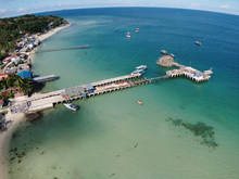
 Port of Taganak | |
 Flag  Seal | |
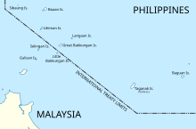
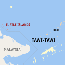 Map of Tawi-Tawi with Turtle Islands highlighted | |
OpenStreetMap  | |
 Turtle Islands Location within the Philippines | |
| Coordinates: 6°05′00″N118°19′00″E / 6.0833333°N 118.3166667°E | |
| Country | Philippines |
| Region | Bangsamoro Autonomous Region in Muslim Mindanao |
| Province | Tawi-Tawi |
| District | Lone district |
| Barangays | 2 (see Barangays) |
| Government | |
| • Type | Sangguniang Bayan |
| • Mayor | Mohammad Faizal H. Jamalul |
| • Vice Mayor | Suraida B. Ibnusali |
| • Representative | Dimszar M. Sali |
| • Municipal Council | Members |
| • Electorate | 8,331 voters (2022) |
| Area | |
• Total | 62.50 km2 (24.13 sq mi) |
| Elevation | 1.0 m (3.3 ft) |
| Highest elevation | 226 m (741 ft) |
| Lowest elevation | 0 m (0 ft) |
| Population (2020 census) [3] | |
• Total | 5,683 |
| • Density | 91/km2 (240/sq mi) |
| • Households | 893 |
| Economy | |
| • Income class | 5th municipal income class |
| • Poverty incidence | 35.11 |
| • Revenue | ₱ 62.27 million (2020), 25.8 million (2012), 26.81 million (2013), 30.08 million (2014), 33.71 million (2015), 37.25 million (2016), 43.26 million (2017), 46.29 million (2018), 51.3 million (2019), 61.69 million (2021), 86.57 million (2022) |
| • Assets | ₱ 39.83 million (2020), 13.21 million (2012), 13.85 million (2013), 12.33 million (2014), 3.094 million (2015), 7.822 million (2016), 5.971 million (2017), 31.31 million (2018), 65.66 million (2019), 31.97 million (2021), 32.33 million (2022) |
| • Expenditure | ₱ 62.15 million (2020), 26.28 million (2012), 25.49 million (2013), 29.38 million (2014), 33.46 million (2015), 37.1 million (2016), 40.12 million (2017), 46.69 million (2018), 51.34 million (2019), 61.57 million (2021), 86.22 million (2022) |
| Service provider | |
| • Electricity | Cagayan de Sulu Electric Cooperative |
| Time zone | UTC+8 (PST) |
| ZIP code | 7507 |
| PSGC | |
| IDD : area code | +63 (0)68 |
| Native languages | Sama Tagalog Sabah Malay |
Turtle Islands, officially the Municipality of Turtle Islands (Tagalog : Bayan ng Turtle Islands), is a municipality in the province of Tawi-Tawi, Philippines. According to the 2020 census, it has a population of 5,683 people, making it the least populated town in the province. [3]
Contents
- History
- Taganak Lighthouse Dispute
- Municipality status
- Malaysian annexation allegation controversy
- Geography
- Barangays
- Climate
- Mud volcanoes
- Demographics
- Economy
- Agriculture and aquaculture
- References
- External links
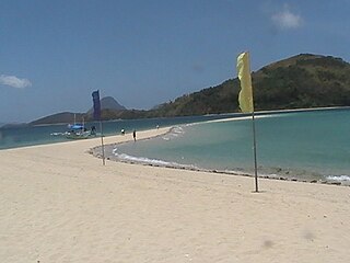
It is also known as Philippine Turtle Islands [5] [6] to distinguish it from its nearby Malaysian counterpart. Seven of the islands are part of the Philippines, of which Taganak is the largest.
Access to the Turtle Islands is difficult, as there are no regular means of transportation to the area. This has kept the islands protected from turtle egg poachers. A station for park rangers is also present on the islands.[ citation needed ] The island municipality and its surrounding waters form part of the Turtle Islands Wildlife Sanctuary.