Sapa-Sapa

Last updated
Sapa-Sapa
ساڤ-ساڤ
Municipality of Sapa-Sapa
Ph locator tawi-tawi sapa-sapa.png
Map of Tawi-Tawi with Sapa-Sapa highlighted
OpenStreetMap
Sapa-Sapa
Philippines location map (square).svg
Red pog.svg
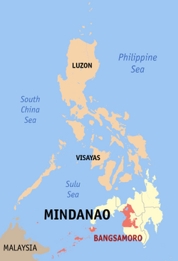
Sapa-Sapa
Location within the Philippines
Coordinates: 5°05′24″N120°16′22″E / 5.089897°N 120.272875°E / 5.089897; 120.272875
Country Philippines
Region Bangsamoro Autonomous Region in Muslim Mindanao
Province Tawi-Tawi
District Lone district
Barangays 23 (see Barangays)
Government
[1]
  Type Sangguniang Bayan
   Mayor Rhodesia M. Sali
   Vice Mayor Karim Darwis J. Masdal
   Representative Dimszar M. Sali
   Municipal Council
Members
   Electorate 18,419 voters (2022)
Area
[2]
  Total235.61 km2 (90.97 sq mi)
Elevation
5.0 m (16.4 ft)
Highest elevation
529 m (1,736 ft)
Lowest elevation
0 m (0 ft)
Population
 (2020 census) [3]
  Total33,580
  Density140/km2 (370/sq mi)
   Households
5,548
Economy
   Income class 3rd municipal income class
   Poverty incidence
24.76
% (2018) [4]
   Revenue 149.1 million (2020)
   Assets 125 million (2020)
   Expenditure 139.1 million (2020)
   Liabilities 4.929 million (2020)
Service provider
  ElectricityTawi Tawi Electric Cooperative (TAWELCO)
Time zone UTC+8 (PST)
ZIP code
7503
PSGC
IDD : area code +63(0)68
Native languages Sama
Tagalog
Website www.sapasapa.gov.ph

Sapa-Sapa, officially the Municipality of Sapa-Sapa (Tagalog : Bayan ng Sapa-Sapa), is a 3rd class municipality in the province of Tawi-Tawi, Philippines. According to the 2020 census, it has a population of 33,580. [3]

Contents

Geography

Barangays

Sapa-sapa is politically subdivided into 23 barangays. Each barangay consists of puroks while some have sitios.

  • Baldatal
  • Butun
  • Dalo-Dalo
  • Kohek
  • Lakit-Lakit
  • Latuan (Sunsang)
  • Banaran Lookan
  • Look Natoh
  • Lookan Latuan
  • Malanta
  • Tambunan
  • Sikubong
  • Palatih Gadjaminah
  • Pamasan
  • Sapaat
  • Sapa-Sapa (Poblacion)
  • Sokah-sokah
  • Bukut Sikubong
  • Tangngah Deom Sikubong
  • Tapian Bohe North
  • Tapian Bohe South
  • Banaran Tunggusong
  • Mantabuan Sannang Hati
  • Lookan Tup-Tup

Panampangan Island

Panampangan Island is located in the municipality of Sapa-sapa. The island itself is famous for its sandbar which is considered[ by whom? ] the longest in the Philippines.[ citation needed ]

At low tide, the sandbar connects to the nearby islet of Panampangan island.

Climate

Climate data for Sapa-Sapa, Tawi-Tawi
MonthJanFebMarAprMayJunJulAugSepOctNovDecYear
Average high °C (°F)29
(84)
29
(84)
29
(84)
30
(86)
30
(86)
30
(86)
29
(84)
30
(86)
30
(86)
30
(86)
29
(84)
29
(84)
30
(85)
Average low °C (°F)25
(77)
24
(75)
24
(75)
25
(77)
25
(77)
25
(77)
25
(77)
25
(77)
25
(77)
25
(77)
25
(77)
25
(77)
25
(77)
Average precipitation mm (inches)157
(6.2)
115
(4.5)
123
(4.8)
96
(3.8)
136
(5.4)
120
(4.7)
104
(4.1)
89
(3.5)
86
(3.4)
131
(5.2)
151
(5.9)
159
(6.3)
1,467
(57.8)
Average rainy days20.417.520.421.126.725.726.024.524.027.726.324.7285
Source: Meteoblue [5]

Demographics

Population census of Sapa-Sapa
YearPop.±% p.a.
1980 14,946    
1990 16,173+0.79%
1995 17,728+1.73%
2000 26,242+8.77%
2007 37,135+4.91%
2010 28,781−8.86%
2015 30,917+1.37%
2020 33,580+1.64%
Source: Philippine Statistics Authority [6] [7] [8] [9]

Economy

Related Research Articles

<span class="mw-page-title-main">Pangutaran</span> Municipality in Sulu, Philippines

Pangutaran, officially the Municipality of Pangutaran, is a 4th class municipality in the province of Sulu, Philippines. According to the 2020 census, it has a population of 36,374 people.

<span class="mw-page-title-main">Parang, Sulu</span> Municipality in Sulu, Philippines

Parang, officially the Municipality of Parang, is a 2nd class municipality in the province of Sulu, Philippines. According to the 2020 census, it has a population of 71,495 people.

<span class="mw-page-title-main">Bongao</span> Capital of Tawi-Tawi, Philippines

Bongao, officially the Municipality of Bongao, is a 2nd class municipality and capital of the province of Tawi-Tawi, Philippines. According to the 2020 census, it has a population of 116,118 people.

<span class="mw-page-title-main">Languyan</span> Municipality in Tawi-Tawi, Philippines

Languyan, officially the Municipality of Languyan, is a 1st class municipality in the province of Tawi-Tawi, Philippines. According to the 2020 census, it has a population of 37,096 people.

<span class="mw-page-title-main">Mapun</span> Municipality in Tawi-Tawi, Philippines

Mapun, officially the Municipality of Mapun, is a 4th class municipality in the province of Tawi-Tawi, Philippines. According to the 2020 census, it has a population of 30,038 people.

<span class="mw-page-title-main">Panglima Sugala</span> Municipality in Tawi-Tawi, Philippines

Panglima Sugala, officially the Municipality of Panglima Sugala, is a 3rd class municipality in the province of Tawi-Tawi, Philippines. According to the 2020 census, it has a population of 48,055 people. It was formerly known as Balimbing.

<span class="mw-page-title-main">Simunul</span> Municipality in Tawi-Tawi, Philippines

Simunul, officially the Municipality of Simunul, is a 4th class municipality in the province of Tawi-Tawi, Philippines. According to the 2020 census, it has a population of 34,245 people. The majority of the people living here are Muslims.

<span class="mw-page-title-main">Sitangkai</span> Municipality in Tawi-Tawi, Philippines

Sitangkai, officially the Municipality of Sitangkai, is a 1st class municipality in the province of Tawi-Tawi, Philippines. According to the 2020 census, it has a population of 37,319 people.

<span class="mw-page-title-main">South Ubian</span> Municipality in Tawi-Tawi, Philippines

South Ubian, officially the Municipality of South Ubian, is a 3rd class municipality in the province of Tawi-Tawi, Philippines. According to the 2020 census, it has a population of 29,583 people.

<span class="mw-page-title-main">Tandubas</span> Municipality in Tawi-Tawi, Philippines

Tandubas, officially the Municipality of Tandubas, is a 2nd class municipality in the province of Tawi-Tawi, Philippines. According to the 2020 census, it has a population of 34,316 people.

<span class="mw-page-title-main">Pagayawan</span> Municipality in Lanao del Sur, Philippines

Pagayawan, officially the Municipality of Pagayawan, is a 5th class municipality in the province of Lanao del Sur, Philippines. According to the 2020 census, it has a population of 15,057 people.

<span class="mw-page-title-main">Pualas</span> Municipality in Lanao del Sur, Philippines

Pualas, officially the Municipality of Pualas, is a 5th class municipality in the province of Lanao del Sur, Philippines. According to the 2020 census, it has a population of 14,526 people.

<span class="mw-page-title-main">Poona Bayabao</span> Municipality in Lanao del Sur, Philippines

Poona Bayabao, officially the Municipality of Poona Bayabao, is a 4th class municipality in the province of Lanao del Sur, Philippines. According to the 2020 census, it has a population of 31,141 people.

<span class="mw-page-title-main">Sultan Dumalondong</span> Municipality in Lanao del Sur, Philippines

Sultan Dumalondong, officially the Municipality of Sultan Dumalondong, is a 6th class municipality in the province of Lanao del Sur, Philippines. According to the 2020 census, it has a population of 12,500 people.

<span class="mw-page-title-main">Datu Odin Sinsuat</span> Capital of Maguindanao del Norte, Philippines

Datu Odin Sinsuat, officially the Municipality of Datu Odin Sinsuat, is a 2nd class municipality and capital of the province of Maguindanao del Norte, Philippines. According to the 2020 census, it has a population of 116,768 people.

<span class="mw-page-title-main">Guindulungan</span> Municipality in Maguindanao del Sur, Philippines

Guindulungan, officially the Municipality of Guindulungan, is a municipality in the province of Maguindanao del Sur, Philippines. According to the 2020 census, it has a population of 24,933 people.

<span class="mw-page-title-main">Sultan Mastura</span> Municipality in Maguindanao del Norte, Philippines

Sultan Mastura, officially the Municipality of Sultan Mastura, is a 5th class municipality in the province of Maguindanao del Norte, Philippines. According to the 2020 census, it has a population of 25,331 people.

<span class="mw-page-title-main">Al-Barka</span> Municipality in Basilan, Philippines

Al-Barka, officially the Municipality of Al-Barka, is a municipality in the province of Basilan, Philippines. According to the 2020 census, it has a population of 23,736 people.

<span class="mw-page-title-main">Sibutu</span> Municipality in Tawi-Tawi, Philippines

Sibutu, officially the Municipality of Sibutu, is a municipality in the province of Tawi-Tawi, Philippines. According to the 2020 census, it has a population of 34,243 people.

<span class="mw-page-title-main">Shariff Saydona Mustapha</span> Municipality in Maguindanao del Sur, Philippines

Shariff Saydona Mustapha, officially the Municipality of Shariff Saydona Mustapha, is a municipality in the province of Maguindanao del Sur, Philippines. According to the 2020 census, it has a population of 25,080 people.

References

  1. Municipality of Sapa-Sapa | (DILG)
  2. "2015 Census of Population, Report No. 3 – Population, Land Area, and Population Density" (PDF). Philippine Statistics Authority. Quezon City, Philippines. August 2016. ISSN   0117-1453. Archived (PDF) from the original on May 25, 2021. Retrieved July 16, 2021.
  3. 1 2 Census of Population (2020). "BARMM". Total Population by Province, City, Municipality and Barangay. Philippine Statistics Authority . Retrieved 8 July 2021.
  4. "PSA Releases the 2018 Municipal and City Level Poverty Estimates". Philippine Statistics Authority. 15 December 2021. Retrieved 22 January 2022.
  5. "Sapa-Sapa, Tawi-Tawi : Average Temperatures and Rainfall". Meteoblue. Retrieved 30 January 2019.
  6. Census of Population (2015). "ARMM – Autonomous Region in Muslim Mindanao". Total Population by Province, City, Municipality and Barangay. Philippine Statistics Authority . Retrieved 20 June 2016.
  7. Census of Population and Housing (2010). "ARMM – Autonomous Region in Muslim Mindanao". Total Population by Province, City, Municipality and Barangay. National Statistics Office . Retrieved 29 June 2016.
  8. Censuses of Population (1903–2007). "ARMM – Autonomous Region in Muslim Mindanao". Table 1. Population Enumerated in Various Censuses by Province/Highly Urbanized City: 1903 to 2007. National Statistics Office.
  9. "Province of Tawitawi". Municipality Population Data. Local Water Utilities Administration Research Division. Retrieved 17 December 2016.
  10. "Poverty incidence (PI):". Philippine Statistics Authority. Retrieved December 28, 2020.
  11. "Estimation of Local Poverty in the Philippines" (PDF). Philippine Statistics Authority. 29 November 2005.
  12. "2003 City and Municipal Level Poverty Estimates" (PDF). Philippine Statistics Authority. 23 March 2009.
  13. "City and Municipal Level Poverty Estimates; 2006 and 2009" (PDF). Philippine Statistics Authority. 3 August 2012.
  14. "2012 Municipal and City Level Poverty Estimates" (PDF). Philippine Statistics Authority. 31 May 2016.
  15. "Municipal and City Level Small Area Poverty Estimates; 2009, 2012 and 2015". Philippine Statistics Authority. 10 July 2019.
  16. "PSA Releases the 2018 Municipal and City Level Poverty Estimates". Philippine Statistics Authority. 15 December 2021. Retrieved 22 January 2022.