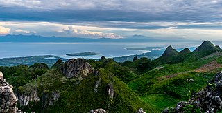
Cebu, officially the Province of Cebu, is a province of the Philippines located in the Central Visayas (Region VII) region, and consists of a main island and 167 surrounding islands and islets. Its capital and largest city is Cebu City, nicknamed "the Queen (Catholic) City of the South" having the Second Cardinal, the oldest city and first capital of the Philippines, which is politically independent from the provincial government.

Camiguin, officially the Province of Camiguin, is an island province in the Philippines located in the Bohol Sea, about 10 kilometres (6.2 mi) off the northern coast of mainland Mindanao. It is geographically part of Region X, the Northern Mindanao Region of the country and formerly a part of Misamis Oriental province.

Cebu City, officially the City of Cebu, is a 1st class highly urbanized city in the Central Visayas region of the Philippines. It is the capital of the province of Cebu, where it is geographically located but is one of three cities that are administratively independent of the provincial government. According to the 2020 census, it has a population of 964,169 people, making it the sixth-most populated city in the nation and the most populous in the Visayas.

The Chocolate Hills are a geological formation in the Bohol province of the Philippines. There are at least 1,260 hills, but there may be as many as 1,776 hills spread over an area of more than 50 square kilometers (20 sq mi). They are covered in green grass that turns into a chocolate-like brown during the dry season, hence the name.

Barili, officially the Municipality of Barili, is a 2nd class municipality in the province of Cebu, Philippines. According to the 2020 census, it has a population of 80,715 people.

Guadalupe Mountains National Park is an American national park in the Guadalupe Mountains, east of El Paso, Texas. The mountain range includes Guadalupe Peak, the highest point in Texas at 8,751 feet (2,667 m), and El Capitan used as a landmark by travelers on the route later followed by the Butterfield Overland Mail stagecoach line. The ruins of a stagecoach station stand near the Pine Springs visitor center. The restored Frijole Ranch contains a small museum of local history and is the trailhead for Smith Spring. The park covers 86,367 acres in the same mountain range as Carlsbad Caverns National Park, about 25 miles (40 km) to the north in New Mexico. The Guadalupe Peak Trail winds through pinyon pine and Douglas-fir forests as it ascends over 3,000 feet (910 m) to the summit of Guadalupe Peak, with views of El Capitan and the Chihuahuan Desert.
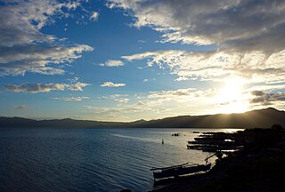
Mainit, officially the Municipality of Mainit, is a 4th class municipality in the province of Surigao del Norte, Philippines. According to the 2020 census, it has a population of 28,019 people.

Mount Banahaw is an active complex volcano on Luzon in the Philippines. The three-peaked volcano is located at the boundary of Laguna and Quezon provinces. It is the highest mountain in both provinces and Calabarzon region, dominating the landscape for miles around.

The Philippine naked-backed fruit bat or Philippine bare-backed fruit bat is a megabat that mostly lives on Negros Island. Two small populations were also found on Cebu Island in the Philippines. Like other bare-backed fruit bats, its wings meet along the midline of their bodies, making it a very agile flier. It roosted in caves, in areas where little light penetrated the gloom. It was so abundant once that it left piles of guano, which were used by miners as fertilizer.

Cordova, officially the Municipality of Cordova, is a 3rd class municipality in the province of Cebu, Philippines. According to the 2020 census, it has a population of 70,595 people.
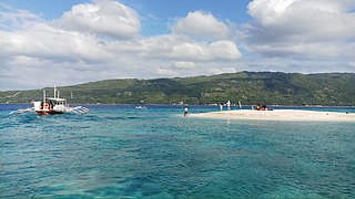
Oslob, officially the Municipality of Oslob, is a 4th class municipality in the province of Cebu, Philippines. According to the 2020 census, it has a population of 29,264 people.
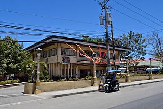
San Fernando, officially the Municipality of San Fernando, is a second-class municipality in the province of Cebu, Philippines. According to the 2020 census, it has a population of 72,224 people.

Sibonga, officially the Municipality of Sibonga, is a 3rd class municipality in the province of Cebu, Philippines. According to the 2020 census, it has a population of 53,424 people.
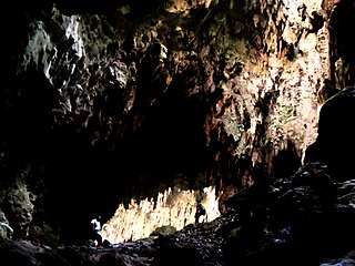
Callao Cave is one of 300 limestone caves located in the Barangays of Magdalo and Quibal in the municipality of Peñablanca, about 24 km (15 mi) northeast of Tuguegarao City, the capital of Cagayan province within the Peñablanca Protected Landscape and Seascape in the western foothills of the Northern Sierra Madre Mountains on Luzon island in the Philippines. The town Peñablanca's name refers to the predominance of white limestone rock formations in the area. First excavated in 1980 by Maharlika Cuevas, the seven-chamber show cave is the best known natural tourist attraction of the Cagayan province and in February 2020 has officially been recognized as an important cultural property of the Philippines.
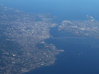
Metropolitan Cebu, or simply Metro Cebu,, is the main urban center of the province of Cebu in the Philippines. Metro Cebu is located along the central eastern portion of the island including the nearby island of Mactan. It accounts for 19.9 percent of the land area and 61.5 percent of the population of the entire province of Cebu.

Carcar, officially the City of Carcar, is a 5th class component city in the province of Cebu, Philippines. According to the 2020 census, it has a population of 136,453 people.

Bogo, officially the City of Bogo, is a 6th class component city in the province of Cebu, Philippines. According to the 2020 census, it has a population of 88,867 people.
The Mainit Hot Springs Protected Landscape is a protected landscape area located in the province of Davao de Oro on the island of Mindanao in the Philippines. It preserves the sulfuric hot springs and surrounding forest in Nabunturan municipality which also contains the headwaters of the Manat River, a source of water supply for surrounding villages. First declared a national park in 1957 by virtue of Proclamation No. 466 by President Carlos P. Garcia, it had an initial area of 1,381 hectares. Under the National Integrated Protected Areas System, it was reclassified as a protected landscape through Proclamation No. 320 issued in 2000 by President Joseph Estrada. The hot springs are a popular ecotourist attraction in Davao de Oro. Its name "Mainit" is a Filipino word which means hot.
Maximino Jaen Noel was a Filipino politician and the longest-serving congressman from Cebu, Philippines. Representing Cebu's 3rd district, he was a member of the House of Representatives from 1928 to 1934, 1945 to 1949 and 1953 to 1965. He was a member of the National Assembly from 1938 to 1941.


