| Lilloise Range | |
|---|---|
| Lilloise Bjerge | |
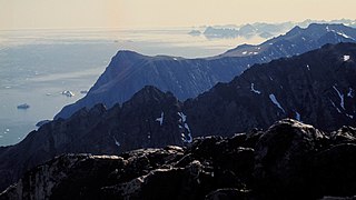
 Wreckage of a US Navy P-2V Neptune that crashed in the Kronborg Glacier with one of the peaks of the Lilloise Range rising in the distance. | |
| Highest point | |
| Peak | Lilloise Range High Point |
| Elevation | 2,429 m (7,969 ft) |
| Dimensions | |
| Length | 25 km (16 mi)N/S |
| Width | 10 km (6.2 mi)E/W |
| Geography | |
 Location | |
| Country | Greenland |
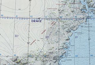
| Range coordinates | 68°32′N28°45′W / 68.533°N 28.750°W Coordinates: 68°32′N28°45′W / 68.533°N 28.750°W |
The Lilloise Range or Lilloise Mountains (Danish : Lilloise Bjerge) [1] is a mountain range in King Christian IX Land, eastern Greenland. Administratively this range is part of the Sermersooq Municipality.

Danish is a North Germanic language spoken by around six million people, principally in Denmark and in the region of Southern Schleswig in northern Germany, where it has minority language status. Also, minor Danish-speaking communities are found in Norway, Sweden, Spain, the United States, Canada, Brazil, and Argentina. Due to immigration and language shift in urban areas, around 15–20% of the population of Greenland speak Danish as their first language.

A mountain range or hill range is a series of mountains or hills ranged in a line and connected by high ground. A mountain system or mountain belt is a group of mountain ranges with similarity in form, structure, and alignment that have arisen from the same cause, usually an orogeny. Mountain ranges are formed by a variety of geological processes, but most of the significant ones on Earth are the result of plate tectonics. Mountain ranges are also found on many planetary mass objects in the Solar System and are likely a feature of most terrestrial planets.

King Christian IX Land is a coastal area of Southeastern Greenland in Sermersooq Municipality fronting the Denmark Strait and extending through the Arctic Circle from 65°N to 70°N.
Contents
In petrology the Lilloise Intrusion is named after this range. [2]

Petrology is the branch of geology that studies rocks and the conditions under which they form. Petrology has three subdivisions: igneous, metamorphic, and sedimentary petrology. Igneous and metamorphic petrology are commonly taught together because they both contain heavy use of chemistry, chemical methods, and phase diagrams. Sedimentary petrology is, on the other hand, commonly taught together with stratigraphy because it deals with the processes that form sedimentary rock.

Intrusive rock is formed when magma penetrates existing rock, crystallizes and solidifies underground to form intrusions, for example plutons, batholiths, dikes, sills, laccoliths, and volcanic necks. Some geologists use the term plutonic rock synomymously with intrusive rock but other geologists subdivide intrusive rock, by crystal size, into coarse-grained plutonic rock and medium-grained subvolcanic or hypabyssal rock.