Cheapside is a street in the City of London, the historic and modern financial centre of London, England, which forms part of the A40 London to Fishguard road. It links St Martin's Le Grand with Poultry. Near its eastern end at Bank junction, where it becomes Poultry, is Mansion House, the Bank of England, and Bank station. To the west is St Paul's Cathedral, St Paul's tube station and square.

Cannon Street is a road in the City of London, the historic nucleus of London and its modern financial centre. It runs roughly parallel with the River Thames, about 250 metres (820 ft) north of it, in the north of the City.

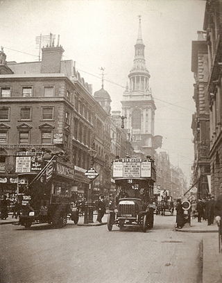
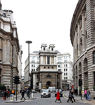
Gracechurch Street is a main road in the City of London, the historic and financial centre of London, England, which is designated the A1213.

The Lloyd's building is the home of the insurance institution Lloyd's of London. It is located on the former site of East India House in Lime Street, in London's main financial district, the City of London. The building is a leading example of radical Bowellism architecture in which the services for the building, such as ducts and lifts, are located on the exterior to maximise space in the interior.

Leadenhall Market is a covered market in London, England, located on Gracechurch Street but with vehicular access also available via Whittington Avenue to the north and Lime Street to the south and east, and additional pedestrian access via a number of narrow passageways.

Fenchurch Street is a street in London, England, linking Aldgate at its eastern end with Lombard Street and Gracechurch Street in the west. It is a well-known thoroughfare in the City of London financial district and is the site of many corporate offices and headquarters. The name "Fenchurch" means "church in the fenny or marshy ground" and presumably refers to St Gabriel Fenchurch, which stood at the junction of Fenchurch Street and Cullum Street until it was destroyed by the Great Fire.

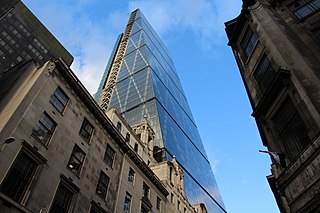
122 Leadenhall Street, which is also known as the Leadenhall Building, is a 225-metre-tall (738 ft) skyscraper in central London. It opened in July 2014 and was designed by the Rogers Stirk Harbour + Partners; it is known informally as The Cheesegrater because of its distinctive wedge shape, similar to that of the kitchen utensil of the same name. It is one of numerous tall buildings recently completed or under construction in the City of London financial district, including 20 Fenchurch Street, 22 Bishopsgate and The Scalpel.
Leadenhall Street is a street in the City of London. It is about 1⁄3-mile-long (0.54 km) and links Cornhill in the west to Aldgate in the east. It was formerly the start of the A11 road from London to Norwich, but that route now starts further east at Aldgate.

The Willis Building is a commercial skyscraper in London named after the primary tenant, Willis Group. It is located on Lime Street in the City of London financial district.

East India House was the London headquarters of the East India Company, from which much of British India was governed until the British government took control of the company's possessions in India in 1858. It was located in Leadenhall Street in the City of London. The first East India House on the site was an Elizabethan mansion, previously known as Craven House, which the Company first occupied in 1648. This was completely rebuilt in 1726–29; and further remodelled and extended in 1796–1800. It was demolished in 1861. The Lloyd's building, headquarters for Lloyd's of London, was built on the site of the former East India House.
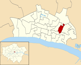
Lime Street is one of the 25 ancient wards of the City of London.
It is divided into four precincts; and it is worthy a remark that, though the ward includes parts of several parishes, there is not even a whole street in it.
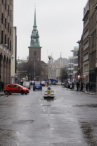
Great Tower Street, originally known just as Tower Street, is a street in the City of London, the historic nucleus and modern financial centre of London, England. It forms an eastern continuation of Eastcheap starting at Idol Lane, and leads towards Byward Street and Tower Hill. On Byward Street, opposite Great Tower Street, is the historic church All Hallows-by-the-Tower.

Queen Victoria Street, named after the British monarch who reigned from 1837 to 1901, is a street in London which runs east by north from its junction with New Bridge Street and Victoria Embankment in the Castle Baynard ward of the City of London, along a section that divides the wards of Queenhithe and Bread Street, then lastly through the middle of Cordwainer ward, until it reaches Mansion House Street at Bank junction. Beyond Bank junction, the street continues north-east as Threadneedle Street which joins Bishopsgate. Other streets linked to Queen Victoria Street include Puddle Dock, Cannon Street, Walbrook and Poultry.
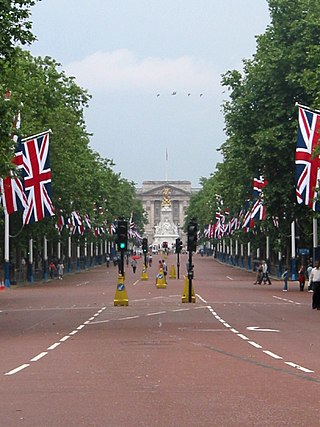
The 2012 Olympic Marathon Course is that of both the men's and women's marathon races at the 2012 Olympic and Paralympic Games in London.

Aldgate Pump is an historic former water pump located at the junction where Aldgate High Street meets Fenchurch Street and Leadenhall Street in the City of London. The pump is considered to be the symbolic start point of the East End of London.

Thames Street, divided into Lower and Upper Thames Street, is a road in the City of London, the historic and financial centre of London. It forms part of the busy A3211 route from Tower Hill to Westminster. The London Bridge underpass marks the divide between Upper and Lower Thames Street, with Lower to the east and Upper to the west.
Lombard Street is a street notable for its connections with the City of London's merchant, banking and insurance industries, stretching back to medieval times.
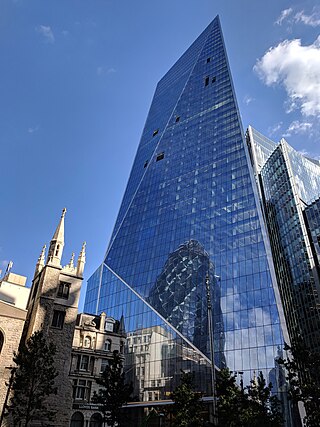
The Scalpel is a commercial skyscraper in London, United Kingdom. It is located at 52 Lime Street, on its corner with Leadenhall Street, in the City of London financial area. It is opposite the Lloyd's building and adjacent to the Willis Building. Completed in 2018, it is 190 m (620 ft) tall, with 38 storeys, and was designed by Kohn Pedersen Fox.

40 Leadenhall Street, also known as Stanza London is an office-led development in London that is currently under construction. It is located within the City of London financial district and is one of a number of new building developments for the area.

The St Botolph Building is a commercial office in Houndsditch, central London, opened in 2011 and designed by Grimshaw Architects.

