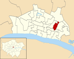
The City of London, also known as the City, is a city, ceremonial county and local government district that contains the ancient centre, and constitutes, along with Canary Wharf, the primary central business district (CBD) of London and one of the leading financial centres of the world. It constituted most of London from its settlement by the Romans in the 1st century AD to the Middle Ages, but the modern area referred to as London has since grown far beyond the City of London boundary. The City is now only a small part of the metropolis of Greater London, though it remains a notable part of central London. The City of London is not one of the London boroughs, a status reserved for the other 32 districts. It is also a separate ceremonial county, being an enclave surrounded by the ceremonial county of Greater London, and is the smallest ceremonial county in England.

Bishopsgate was one of the eastern gates in London's former defensive wall. The gate's name is traditionally attributed to Earconwald, who was Bishop of London in the 7th century. It was first built in Roman times and marked the beginning of Ermine Street, the ancient road running from London to York (Eboracum). The gate was rebuilt twice in the 15th and 18th centuries, but was permanently demolished in 1760.
Farringdon is an area in the London Borough of Islington, situated immediately north of its border with the City of London. The term is used to describe the area around Farringdon station.

The Lloyd's building is the home of the insurance institution Lloyd's of London. It is located on the former site of East India House in Lime Street, in London's main financial district, the City of London. The building is a leading example of radical Bowellism architecture in which the services for the building, such as ducts and lifts, are located on the exterior to maximise space in the interior.

Leadenhall Market is a covered market in London, England, located on Gracechurch Street but with vehicular access also available via Whittington Avenue to the north and Lime Street to the south and east, and additional pedestrian access via a number of narrow passageways.

122 Leadenhall Street, which is also known as the Leadenhall Building, is a 225-metre-tall (738 ft) skyscraper in central London. It opened in July 2014 and was designed by the Rogers Stirk Harbour + Partners; it is known informally as The Cheesegrater because of its distinctive wedge shape, similar to that of the kitchen utensil of the same name. It is one of numerous tall buildings recently completed or under construction in the City of London financial district, including 20 Fenchurch Street, 22 Bishopsgate and The Scalpel.
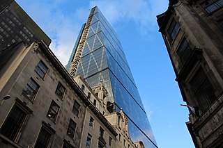
Leadenhall Street is a street in the City of London. It is about 1⁄3-mile-long (0.54 km) and links Cornhill in the west to Aldgate in the east. It was formerly the start of the A11 road from London to Norwich, but that route now starts further east at Aldgate.

Bassishaw is a ward in the City of London. Small, it is bounded by wards: Coleman Street, east; Cheap, south; Cripplegate, north; Aldersgate, west.

Farringdon Without is the most westerly ward of the City of London, England. Its suffix Without reflects its origin as lying beyond the City's former defensive walls. It was first established in 1394 to administer the suburbs west of Ludgate and Newgate, including West Smithfield and Temple. This was achieved by splitting the very large, pre-existing Farringdon Ward into two parts, Farringdon Within and Farringdon Without. The large and prosperous extramural suburb of Farringdon Without has been described as having been London's first West End.
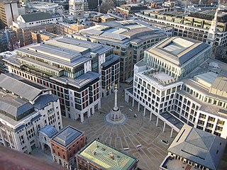
Bread Street is one of the 26 wards of the City of London, the name deriving from its principal street, which was anciently the city's bread market; already named Bredstrate for by the records it appears as that in 1302, Edward I announced that "the bakers of Bromley and Stratford-le-Bow [London], and ones already living on the street, were forbidden from selling bread from their own homes or bakeries, and could only do so from Bread Street." The street itself is just under 500 ft in length and now forms the eastern boundary of the ward after the 2003 boundary changes.
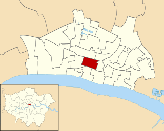
Cordwainer is a small, almost rectangular-shaped ward in the City of London, England. It is named after the cordwainers, the professional shoemakers who historically lived and worked in this particular area of London; there is a Livery Company for the trade — the Worshipful Company of Cordwainers. The ward is sometimes referred to as the "Cordwainers' ward".
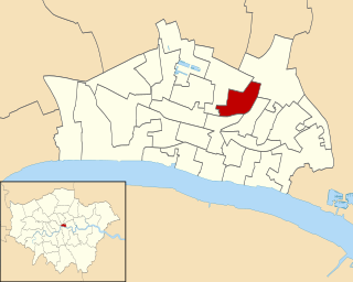
Broad Street is one of the 25 ancient wards of the City of London.

Cheap is a small ward in the City of London, England. It stretches west to east from King Edward Street, the border with Farringdon Within ward, to Old Jewry, which adjoins Walbrook; and north to south from Gresham Street, the border with Aldersgate and Bassishaw wards, to Cheapside, the boundary with Cordwainer and Bread Street wards. The name Cheap derives from the Old English word "chep" for "market".

Langbourn is one of the 25 ancient wards of the City of London. It reputedly is named after a buried stream in the vicinity.

Candlewick is a small ward, one of the 25 ancient wards in the City of London, England.

Coleman Street is one of the 25 ancient wards of the City of London, England, and lies on the City's northern boundary with the London Borough of Islington.
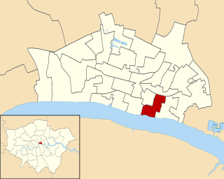
Bridge and Bridge Without is a small ward in the City of London and is named from its closeness to London Bridge. Since boundary changes in 2003, Bridge is bounded by the River Thames to the south, Swan Lane and Gracechurch Street to the west, Fenchurch Street to the north, and Rood Lane and Lovat Lane to the east.

Queenhithe is a small and ancient ward of the City of London, situated by the River Thames and to the south of St. Paul's Cathedral. The Millennium Bridge crosses into the City at Queenhithe.

Tower is one of the 25 wards of the City of London and takes its name from its proximity to the Tower of London. The ward covers the area of the City that is closest to the Tower.

The City of London is divided into 25 wards. The city is the historic core of the much wider metropolis of Greater London, with an ancient and sui generis form of local government, which avoided the many local government reforms elsewhere in the country in the 19th and 20th centuries. Unlike other modern English local authorities, the City of London Corporation has two council bodies: the now largely ceremonial Court of Aldermen, and the Court of Common Council.
