Farringdon, London

Last updated

Farringdon
Greater London UK location map 2.svg
Red pog.svg
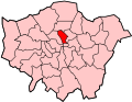
Farringdon
Location within Greater London
OS grid reference TQ315818
London borough
Ceremonial county Greater London
Region
Country England
Sovereign state United Kingdom
Post town LONDON
Postcode district EC1
Dialling code 020
Police Metropolitan
Fire London
Ambulance London
UK Parliament
London Assembly
List of places
UK
England
London
51°31′15″N0°06′13″W / 51.520905°N 0.103675°W / 51.520905; -0.103675

Farringdon is an area in London and is located in the London Borough of Islington. It lies just north of the border with the City of London in Central London and close to Holborn. The term is used to describe the area around Farringdon station.

Contents

Historically the district corresponded to southern Clerkenwell and the small parish of St Sepulchre Middlesex. The area's name is a back-formation: It takes its name from the station, which was in turn named after Farringdon Street. To the south lie the City of London wards of Farringdon Within and Farringdon Without. The City Wards, which were once a single unit, are unconnected to the distinct area of Farringdon to their north, though there is an etymological connection.

History

Toponymy

The Metropolitan Railway and the Fleet Ditch: February 1862 Building the underground.png
The Metropolitan Railway and the Fleet Ditch: February 1862

There are numerous places in England called Farringdon; all meaning fern covered hill. William and Nicholas de Faringdon, whose name is likely to have originated from one of these places, were two related prominent citizens and Aldermen in the early 13th century. [1] Nicholas purchased the area of the Farringdon ward of the City of London in 1279 and became its Alderman in 1281. [2] In 1394 the ward was split into the still extant Farringdon Within [3] and Farringdon Without. [4]

Farringdon Street was built by covering part of the River Fleet in the Farringdon Without Ward of the City. The street was named after either the Ward [2] or after the Nicholas de Faringdon. [1] Farringdon Road was an extension of Farringdon Street, also built over the River Fleet, but lying northward, beyond the City.

Farringdon Station was built close to Farringdon Road, and originally named Farringdon Street Station. [5] The presence of the railway station has led to the surrounding areas of southern Clerkenwell being referred to as Farringdon.

Farringdon station under British Rail with a Network SouthEast livery British Rail Class 319 on a Thameslink service Farringdon station - geograph.org.uk - 733756.jpg
Farringdon station under British Rail with a Network SouthEast livery British Rail Class 319 on a Thameslink service

Administration

Farringdon station and its environs historically corresponded to southern Clerkenwell and three much smaller areas; the parish of St Sepulchre Middlesex, Charterhouse and Glasshouse Yard.

When the Metropolitan Borough of Finsbury was formed in 1900, Clerkenwell and the other areas were absorbed into the new borough. [6] [7] In 1965 the Metropolitan Borough of Finsbury became part of the new London Borough of Islington. [8] [9]

Street name etymologies

Geography

The station and its immediate environs are located in the southern extremity of the London Borough of Islington, adjacent to the northern boundary of the City of London and the eastern boundary of the London Borough of Camden. [48]

Boundaries

Farringdon has no formally defined boundaries, but can be approximated as extending to Clerkenwell Road to the north, Goswell Road and Aldersgate Street to the east, Charterhouse Street, Charterhouse Square and Carthusian Street to the south and Farringdon Road to the west.

Boundary with the City

A map based on Stow c 1600 [49] shows the Fagswell Brook south of Cowcross Street as the northern boundary of the City. At Long Lane, by the brook, were the now lost ornamental boundary markers known as West Smithfield Bars, first documented in 1170 [50] and 1197. [51]

Until 1993, a small triangle of land south of Cowcross Street was within the City of London and formed part of the Farringdon Without ward. [52] [53] The boundary between the City of London and the London Borough of Islington was locally realigned in 1993 with small exchanges of land between each; in this area the boundary was moved slightly south to align with Charterhouse Street. [54] [55]

Transport

The redevelopment and expansion of Farringdon station has had a significant effect on the local area. The station is served by the Thameslink north-south rail route and since May 2022 the east-west Elizabeth line service which required the construction of additional station entrances. [56] [57] The Crossrail project to construct the Elizabeth line was delayed by a number of years, having been due to open in December 2018. [58] A proposed upgrade of the Thameslink route would also affect the local area, including the construction of further station entrances, the pedestrianisation of Cowcross Street and the demolition of several buildings. [59]

Related Research Articles

<span class="mw-page-title-main">London Borough of Islington</span> London borough in United Kingdom

The London Borough of Islington is a London borough which forms part of Inner London, England. Islington has an estimated population of 215,667. It was formed in 1965, under the London Government Act 1963, by the amalgamation of the metropolitan boroughs of Islington and Finsbury.

<span class="mw-page-title-main">Clerkenwell</span> Area of central London

Clerkenwell is an area of central London, England.

<span class="mw-page-title-main">River Fleet</span> Subterranean river in London, England

The River Fleet is the largest of London's subterranean rivers, all of which today contain foul water for treatment. It has been used as a sewer since the development of Joseph Bazalgette's London sewer system in the mid-19th century with the water being treated at Beckton Sewage Treatment Works. Its headwaters are two streams on Hampstead Heath, each of which was dammed into a series of ponds—the Hampstead Ponds and the Highgate Ponds—in the 18th century. At the southern edge of Hampstead Heath these descend underground as sewers and join in Camden Town. The waters flow 4 miles (6 km) from the ponds.

<span class="mw-page-title-main">Farringdon station</span> National rail and London Underground station

Farringdon is an interchange station located in Clerkenwell, London, England, in the London Borough of Islington, just outside the boundary of the City of London for London Underground, Elizabeth line and National Rail services.

<span class="mw-page-title-main">Metropolitan Borough of Finsbury</span>

The Metropolitan Borough of Finsbury was a metropolitan borough within the County of London from 1900 to 1965, when it was amalgamated with the Metropolitan Borough of Islington to form the London Borough of Islington.

<span class="mw-page-title-main">Hatton Garden</span> Street and area in Holborn, London

Hatton Garden is a street and commercial zone in the Holborn district of the London Borough of Camden, abutting the narrow precinct of Saffron Hill which then abuts the City of London. It takes its name from Sir Christopher Hatton, a favourite of Queen Elizabeth I, who established a mansion here and gained possession of the garden and orchard of Ely Place, the London seat of the Bishops of Ely. It remained in the Hatton family and was built up as a stylish residential development in the reign of King Charles II. For some decades it often went, outside of the main street, by an alternative name St Alban's Holborn, after the local church built in 1861.

<span class="mw-page-title-main">St Luke's, London</span> Human settlement in England

St Luke's is an area in London, England and is located in the London Borough of Islington. It lies just north of the border with the City of London near the Barbican Estate, and the Clerkenwell and Shoreditch areas.

<span class="mw-page-title-main">St Sepulchre (parish)</span> Ancient parish in England

St Sepulchre was an ancient parish which had its southern part within the boundaries of the City of London and its northern part outside. Its former area is now within the contemporary neighbourhoods of Smithfield, Farringdon and Clerkenwell.

<span class="mw-page-title-main">Farringdon Without</span> Ward of the City of London

Farringdon Without is the most westerly ward of the City of London, England. Its suffix Without reflects its origin as lying beyond the City's former defensive walls. It was first established in 1394 to administer the suburbs west of Ludgate and Newgate, including West Smithfield and Temple. This was achieved by splitting the very large, pre-existing Farringdon Ward into two parts, Farringdon Within and Farringdon Without. The large and prosperous extramural suburb of Farringdon Without has been described as having been London's first West End.

<span class="mw-page-title-main">Adelphi, London</span> District of London in the City of Westminster

Adelphi is a district of the City of Westminster in London. The small district includes the streets of Adelphi Terrace, Robert Street and John Adam Street. Of rare use colloquially, Adelphi is grouped with Aldwych as the greater Strand district which for many decades formed a parliamentary constituency and civil registration district.

<span class="mw-page-title-main">Charterhouse Square</span> Garden square in Farringdon in the London Borough of Islington

Charterhouse Square is a garden square, a pentagonal space, in Farringdon, in the London Borough of Islington, and close to the former Smithfield Meat Market. The square is the largest courtyard or yard associated with the London Charterhouse, mostly formed of Tudor and Stuart architecture restored after the London Blitz. The square adjoins other buildings including a small school. It lies between Charterhouse Street, Carthusian Street and the main Charterhouse complex of buildings south of Clerkenwell Road. The complex includes a Chapel, Tudor Great Hall, Great Chamber, the Barts and The London School of Medicine and Dentistry and a 40-resident almshouse.

<span class="mw-page-title-main">Charterhouse Street</span>

Charterhouse Street is a street on the north side of Smithfield in the City of London. The road forms part of the City’s boundary with the neighbouring London Boroughs of Islington and Camden. It connects Charterhouse Square and Holborn Circus, crossing Farringdon Road and running along a number of historical sites, including Smithfield Market.

<span class="mw-page-title-main">St Giles, London</span> Human settlement in England

St Giles is an area in London, England and is located in the London Borough of Camden. It is in Central London and part of the West End. It gets its name from the parish church of St Giles in the Fields. The combined parishes of St Giles in the Fields and St George Bloomsbury were administered jointly for many centuries; leading to the conflation of the two, with much or all of St Giles usually taken to be a part of Bloomsbury. Points of interest include the church of St Giles in the Fields, Seven Dials, the Phoenix Garden, and St Giles Circus.

This is a list of the etymology of street names in the London district of Soho, in the City of Westminster. The following utilises the generally accepted boundaries of Soho viz. Oxford Street to the north, Charing Cross Road to the east, Shaftesbury Avenue to the south and Regent Street to the west.

This is a list of the etymology of street names in the London district of Covent Garden. Covent Garden has no formally defined boundaries – those utilised here are: Shaftesbury Avenue to the north-west, New Oxford Street and High Holborn to the north, Kingsway and the western half of the Aldwych semi-circle to the east, Strand to the south and Charing Cross Road to the west.

This is a list of the etymology of street names in the London district of Fitzrovia. The following utilises the generally accepted boundaries of Fitzrovia viz. Euston Road to the north, Tottenham Court Road to the east, Oxford Street to the south and Great Portland Street to the west.

This is a list of the etymology of street names in the London district of Holborn. Holborn has no formally defined boundaries - those utilised here are: Theobald’s Road to the north, Gray's Inn Road and the City of London boundary to the east, Victoria Embankment/the Thames to the south, and Lancaster Place, the north-west curve of the Aldwych semi-circle, Kingsway/Southampton Row to the west.

This is a list of the etymology of street names in the London district of Bloomsbury. The following utilises the generally accepted boundaries of Bloomsbury viz. Euston Road to the north, Gray's Inn Road to the east, New Oxford Street, High Holborn, Southampton Row and Theobald's Road to the south and Tottenham Court Road to the west.

This is a list of the etymology of street names and principal buildings in the London districts of Clerkenwell and Finsbury, in the London Borough of Islington. The Clerkenwell/Finsbury area has no formally defined boundaries - those used here are: Pentonville Road to the north, Goswell Road to the east, Clerkenwell Road to the south and Gray's Inn Road to the west. Finsbury was traditionally roughly the northern part of the area covered here, however in practice the name is rarely used these days.

This is a list of the etymology of street names in the London district of Westminster. The Westminster area has no formally defined boundaries - those utilised here are the generally accepted boundaries of: The Mall and Northumberland Avenue to the north, the river Thames and Victoria Embankment/Millbank to the east, Vauxhall Bridge Road to the south and Buckingham Gate, Buckingham Palace Road and Bressenden Place to the west. For convenience Constitution Hill and Spur Road in the Royal Parks, and the area around the Wellington Arch, are included here, as are the streets in the Leicester Square area.

References

  1. 1 2 3 Mills, A., Oxford Dictionary of London Place Names (2000)
  2. 1 2 Smith, A., Dictionary of City of London street names (1970)
  3. Victorian London – Farringdon Within. Retrieved 26 October 2006.
  4. Victorian London – Farringdon Without. Retrieved 26 October 2006.
  5. Rose, Douglas (1999). The London Underground: A diagrammatic history. Capital Transport Publishing. ISBN   1-85414-219-4.
  6. Youngs, Frederic A. (1979). Guide to the local administrative units of England. London: Offices of the Royal Historical Society. ISBN   0-901050-67-9. OCLC   6742142.
  7. Vision of Britain Archived 30 September 2007 at the Wayback Machine – Historic boundaries of the Metropolitan Borough of Finsbury. Retrieved 28 October 2006.
  8. Islington London Borough Council, Islington development plan (1978)
  9. Guide to the Local Administrative Units of England, Frederic A Youngs Jr, Volume 1: Southern England, ISBN   0-901050-67-9, Published by the Royal Historical Society
  10. 1 2 "British History Online – Britton Street" . Retrieved 11 October 2017.
  11. Bebbington, G. (1972) London Street Names, p19
  12. Mills, A.D. (2010). A Dictionary of London Place-Names. Oxford University Press. p. 4. ISBN   9780199566785.
  13. Fairfield, S. The Streets of London – A dictionary of the names and their origins, p6
  14. Bebbington, G. (1972) London Street Names, p20
  15. Bebbington, G. (1972) London Street Names, p44
  16. 1 2 Fairfield, S. The Streets of London – A dictionary of the names and their origins, p42
  17. Bebbington, G. (1972) London Street Names, p287
  18. Bebbington, G. (1972) London Street Names, p57-8
  19. Fairfield, S. The Streets of London – A dictionary of the names and their origins, p60
  20. 1 2 3 Bebbington, G. (1972) London Street Names, p82
  21. Fairfield, S. The Streets of London – A dictionary of the names and their origins, p65
  22. Fairfield, S. The Streets of London – A dictionary of the names and their origins, p84
  23. Bebbington, G. (1972) London Street Names, p100-01
  24. Fairfield, S. The Streets of London – A dictionary of the names and their origins, p106
  25. 1 2 Bebbington, G. (1972) London Street Names, p287-8
  26. Fairfield, S. The Streets of London – A dictionary of the names and their origins, p118
  27. Bebbington, G. (1972) London Street Names, p128-9
  28. Fairfield, S. The Streets of London – A dictionary of the names and their origins, p124
  29. Bebbington, G. (1972) London Street Names, p136
  30. Fairfield, S. The Streets of London – A dictionary of the names and their origins, p134
  31. Bebbington, G. (1972) London Street Names, p143
  32. "Goswell Road". Golden Lane Estate. Retrieved 10 May 2007.
  33. "Smithfield Fair". Barbican Living. Archived from the original on 10 February 2006. Retrieved 11 May 2007.
  34. Bebbington, G. (1972) London Street Names, p147
  35. Fairfield, S. The Streets of London – A dictionary of the names and their origins, p144
  36. Bebbington, G. (1972) London Street Names, p154
  37. Bebbington, G. (1972) London Street Names, p167
  38. "British History Online – St John's Gate and St John's Lane" . Retrieved 11 October 2017.
  39. Bebbington, G. (1972) London Street Names, p249-50
  40. Fairfield, S. The Streets of London – A dictionary of the names and their origins, p246
  41. Bebbington, G. (1972) London Street Names, p253
  42. Fairfield, S. The Streets of London – A dictionary of the names and their origins, p274
  43. Fairfield, S. The Streets of London – A dictionary of the names and their origins, p280
  44. "British History Online – St John Street: East side" . Retrieved 11 October 2017.
  45. Bebbington, G. (1972) London Street Names, p327
  46. Fairfield, S. The Streets of London – A dictionary of the names and their origins, p322
  47. Bebbington, G. (1972) London Street Names, p327-8
  48. Islington London Borough Council Archived 5 July 2010 at the Wayback Machine – High detail map with City/Islington boundary shown (PDF). Retrieved 26 October 2006.
  49. Ekwall, E., Street-names of the City of London (1954)
  50. 'St John Street: Introduction; west side', in Survey of London: Volume 46, South and East Clerkenwell, ed. Philip Temple (London, 2008), pp. 203-221. British History Online http://www.british-history.ac.uk/survey-london/vol46/pp203-221 [accessed 27 July 2020].
  51. London, its origin and early development William Page 1923 (including reference to the primary source). Link: https://archive.org/details/londonitsorigine00pageuoft/page/178/mode/2up/search/bishopsgate
  52. Corporation of London, City of London unitary development plan (1984)
  53. Corporation of London, City of London unitary development plan (1989)
  54. OPSI Archived 20 June 2010 at the Wayback Machine The City and London Borough Boundaries Order 1993. Retrieved 20 October 2006.
  55. Corporation of London, City of London unitary development plan (1993)
  56. Crossrail Archived 28 September 2007 at the Wayback Machine – Farringdon (PDF). 28 October 2006
  57. "Phased Opening". Crossrail. Archived from the original on 22 September 2021. Retrieved 4 October 2022.
  58. An inews article on the further delays to the Crossrail (Elizabeth line) project https://inews.co.uk/news/crossrail-when-open-route-map-opening-date-stations-london-new-elizabeth-line-1422161
  59. Network Rail Archived 27 September 2007 at the Wayback Machine – Statement of Case (PDF). Retrieved 28 October 2006.