This article needs additional citations for verification .(October 2022) |
The Athens Tram is a modern tram system that serves the Greek capital of Athens. The current system is operated by STASY, who also manages the Athens Metro, and is part of the Transport for Athens network. [1]
The initial network opened on 19 July 2004, a few weeks prior to the 2004 Summer Olympics in Athens, and was the first since the closure of the original system in October 1960, and the Piraeus-Perama light railway in April 1977. [2] [3] The initial network consisted of three branches, each of them reaching Syntagma to the north, Kolymvitirio to the south, and Stadio Irinis & Filias (SEF) to the west. [4] The system later saw extensions to Asklipiio Voulas in November 2007, Gipedo Karaiskaki in November 2019, and then Agia Triada via the Piraeus loop in December 2021. [5] [6] [7]
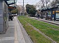
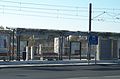
Since December 2021, the system consists of 59 tram stops: one additional stop, Akti Poseidonos on the western end of the Piraeus branch, is complete but not yet open. A majority of the stops are within the South and Central Athens regional units: thirteen are in Piraeus, and one is in Voula, an Athenian suburb in the East Attica regional unit. There are many proposals to extend the Athens Tram, but because many of the stops associated with the proposals are unconfirmed, they are not included here until construction begins.
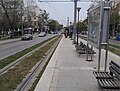
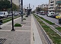
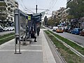
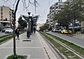
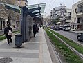
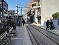
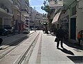
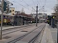
Unless indicated, the spelling of the tram stop names on this table, in English and Greek, are according to the signage.
† | Terminal station |
# | Interchange station |
The following is a list of tram stops on the Piraeus branch, from the junction of Poseidonos Avenue and Achilleos to Omiridou Skylitsi, via the Piraeus loop. [8]
Services on this branch were suspended from 16 March 2020 to 21 January 2021, due to realignment works associated with the Faliro Waterfront regeneration project: Tzitzifies, Kallithea and Moschato were also rebuilt during the realignment works. [9]
Stop English | Stop Greek | Image | Opened | Stop type | Interchanges and notes | Coordinates |
---|---|---|---|---|---|---|
To Asklipiio Voulas or Syntagma | ||||||
Batis | Μπάτης | 19 July 2004 [10] |
| 37°55′18″N23°41′46″E / 37.921595°N 23.696225°E | ||
Flisvos | Φλοίσβος |
| 37°55′24″N23°41′34″E / 37.923360°N 23.692890°E | |||
Parko Flisvou | Πάρκο Φλοίσβου |
| 37°55′40″N23°41′18″E / 37.927820°N 23.688380°E | |||
Trocadero | Τροκαντερό |
| 37°55′52″N23°41′14″E / 37.931215°N 23.687140°E | |||
Aghia Skepi | Αγία Σκέπη |
| 37°56′02″N23°41′38″E / 37.933810°N 23.693760°E | |||
Delta Falirou | Δέλτα Φαλήρου |
| 37°56′15″N23°41′32″E / 37.937450°N 23.692095°E | |||
Tzitzifies | Τζιτζιφιές |
| 37°56′27″N23°41′16″E / 37.940770°N 23.687915°E | |||
Kallithea | Καλλιθέα |
| The metro station of the same name is about 2.3 kilometres (1.4 miles) north north-east of the tram stop. | 37°56′33″N23°41′03″E / 37.942610°N 23.684220°E | ||
Moschato | Μοσχάτο |
| The metro station of the same name is about 1.2 kilometres (1,300 yards) north of the tram stop. | 37°56′39″N23°40′41″E / 37.944220°N 23.678130°E | ||
Neo Faliro | Νέο Φάληρο |
| The metro station of the same name is about 320 metres (350 yards) west of the tram stop. | 37°56′40″N23°40′08″E / 37.944565°N 23.668775°E | ||
Gipedo Karaiskaki # | Γήπεδο Καραϊσκάκη | 28 November 2019 [6] |
| Interchange with Athens Metro Line 1 at Faliro, via a pedestrian subway. | 37°56′40″N23°39′54″E / 37.944410°N 23.664965°E | |
Mikras Asias | Μικράς Ασίας | 15 December 2021 [7] |
| 37°56′45″N23°39′37″E / 37.945770°N 23.660180°E | ||
Lambraki | Λαμπράκη |
| 37°56′53″N23°39′22″E / 37.948050°N 23.656155°E | |||
Evangelistria | Ευαγγελίστρια |
| 37°56′42″N23°39′13″E / 37.944955°N 23.653520°E | |||
Plateia Deligianni | Πλατεία Δεληγιάννη |
| 37°56′30″N23°39′02″E / 37.941635°N 23.650670°E | |||
Dimarcheio # | Δημαρχείο |
| Interchange with Athens Metro Line 3 at Dimotiko Theatro. The tram stop is named after the nearby town hall of the Piraeus Municipality, and is located between the two halves of Korai Square. | 37°56′33″N23°38′51″E / 37.942485°N 23.647625°E | ||
Agia Triada † | Αγία Τριάδα |
| Agia Triada is named after the Holy Trinity Cathedral (Greek : Καθεδρικός Ναός Αγίας Τριάδος), and is currently the westernmost tram stop, located on the right side of Ethiki Antistaseos Street and directly in front of the cathedral. It is within walking distance of Themistokleous Square to the south, and the Port of Piraeus and Piraeus Tower to the west. | 37°56′41″N23°38′42″E / 37.944835°N 23.645100°E | ||
Plateia Ippodameias | Πλατεία Ιπποδαμείας |
| 37°56′51″N23°38′51″E / 37.947405°N 23.647450°E | |||
34 Syntagmatos Pezikou [lower-alpha 1] | 34ου Συντάγματος Πεζικού |
| 37°56′55″N23°39′07″E / 37.948510°N 23.652060°E | |||
Androutsou | Ανδρούτσου |
| 37°56′52″N23°39′21″E / 37.947820°N 23.655885°E | |||
Omiridou Skylitsi | Ομηρίδου Σκυλίτση |
| 37°56′42″N23°39′39″E / 37.945060°N 23.660780°E | |||
Stadio Irinis & Filias–S.E.F. # | Στάδιο Ειρήνης & Φιλίας–Σ.Ε.Φ. | 19 July 2004 [10] |
| Interchange with Athens Metro Line 1 at Faliro, via a footbridge over Poseidonos Avenue. SEF was the western terminus of the initial network for the 2004 Summer Olympics in Athens. [10] [4] It has a set of crossovers to the east, allowing trams to turn back in case of disruption on the Piraeus loop: the crossovers were also in regular use during SEF's time as a terminus. | 37°56′38″N23°39′50″E / 37.943780°N 23.664010°E |
The following is a list of tram stops on the Syntagma branch, from the junction of Poseidonos Avenue and Achilleos to Syntagma. [8]
The branch was cut back to Kassomouli from 19 October 2018 to 20 November 2020, due to concerns over subsidence in the underground riverbed of the Ilisos. [11] [12] [13]
Stop English | Stop Greek | Image | Opened | Stop type | Interchanges and notes | Coordinates |
---|---|---|---|---|---|---|
To Agia Triada or Asklipiio Voulas | ||||||
Mousson | Μουσών | 19 July 2004 [10] |
| Mousson is named after a residential street, which crosses Achilleos Street at the southern end of this tram stop. To the north, the tram line splits and wrap around the Holy Church of the Dormition of the Mother of God (Greek : Ιερός Ναός Κοιμήσεως Θεοτόκου), which is halfway between this tram stop and Panaghitsa. | 37°55′20″N23°41′59″E / 37.922105°N 23.699845°E | |
Panaghitsa | Παναγίτσα |
| 37°55′30″N23°42′06″E / 37.925070°N 23.701785°E | |||
Amfitheas | Αμφιθέας |
| Amfitheas is located at the junction of Achilleos Street and Dimokratias Street: the nortbound platform is on the eastern side, and the southbound platform to the west. | 37°55′41″N23°42′20″E / 37.928170°N 23.705490°E | ||
Achilleos | Αχιλλέως |
| 37°55′48″N23°42′35″E / 37.929870°N 23.709835°E | |||
Evangeliki Scholi | Ευαγγελική Σχολή |
| 37°55′59″N23°42′39″E / 37.933070°N 23.710810°E | |||
Medeas–Mykalis | Μηδείας–Μυκάλης |
| 37°56′13″N23°42′43″E / 37.936900°N 23.712015°E | |||
Aghia Paraskevi | Αγία Παρασκευή |
| Aghia Paraskevi is named after a Greek Orthodox church to the south, halfway between this tram stop and Medeas–Mykalis: the unrelated metro station of the same name is about 12.2 kilometres (7.6 miles) north east of the tram stop. | 37°56′24″N23°42′47″E / 37.940005°N 23.712990°E | ||
Megalou Alexandrou | Μεγάλου Αλεξάνδρου |
| 37°56′34″N23°42′50″E / 37.942775°N 23.713860°E | |||
Aghias Fotinis–Platia | Αγίας Φωτεινής–Πλατεία |
| Nea Smyrni | 37°56′48″N23°42′54″E / 37.946530°N 23.715015°E | ||
Aegeou | Αιγαίου |
| 37°57′01″N23°43′09″E / 37.950145°N 23.719050°E | |||
Baknana | Μπακνανά |
| 37°57′16″N23°43′26″E / 37.954465°N 23.723780°E | |||
Neos Kosmos # Northbound | Νέος Κόσμος Βόρεια |
| Interchange with Athens Metro Line 2. Although Neos Kosmos' platforms are about 93 metres (102 yards) apart, the southbound platform is on Gouveli Street, while the northbound platform is on Kasomouli Street. | 37°57′28″N23°43′38″E / 37.957830°N 23.727225°E | ||
Neos Kosmos # Southbound | Νέος Κόσμος Νότια | 37°57′25″N23°43′38″E / 37.957005°N 23.727085°E | ||||
Kassomouli | Κασομούλη |
| 37°57′37″N23°43′24″E / 37.960200°N 23.723470°E | |||
Fix # | Φίξ |
| Interchange with Athens Metro Line 2 at Fix. The stop is located on the northeastern side of the road junction with Kallirois Avenue and Irakleous Street. | 37°57′52″N23°43′39″E / 37.964555°N 23.727430°E | ||
Leoforos Vouliagmenis | Λεωφόρος Βουλιαγμένης |
| Leoforos Vouliagmenis was the northern terminus for Tram Lines 1 and 2, during the Olympic Games and until early-2005. [14] [15] The stop is located about 200 metres (220 yards) west of Vouliagmenis Avenue in the Neos Kosmos neighbourhood, at the junction with Kallirois Avenue and Vourvachi Street. There is a single crossover to the south of the tram stop, which allows trams to turn back in case of disruption. | 37°57′59″N23°43′54″E / 37.966520°N 23.731645°E | ||
Zappio Northbound | Ζάππειο Βόρεια |
| Zappio's platforms are about 164 metres (179 yards) apart, with the southbound platform on Vasilissis Olgas Avenue, in front of the Zappeion, and the northbound platform on Ardittou Avenue. Both platforms are within walking distance of both the Zappeion and the Panathenaic Stadium. | 37°58′07″N23°44′16″E / 37.968630°N 23.737915°E | ||
Zappio Southbound | Ζάππειο Νότια | 37°58′10″N23°44′11″E / 37.969310°N 23.736260°E | ||||
Syntagma †# | Σύνταγμα |
| Interchange with Athens Metro Lines 2 and 3. Syntagma was the northern terminus of the initial network for the 2004 Summer Olympics in Athens: [10] [4] the tram stop was a single-track terminus and a side platform until 10 December 2018, and reopened on 14 March 2018 with a dual-track layout and an island platform. [16] | 37°58′28″N23°44′07″E / 37.974505°N 23.735370°E |
The following is a list of tram stops on the Glyfada branch, from the junction of Poseidonos Avenue and Achilleos to Asklipiio Voulas: [8] tram stops between Edem and Kentro Istioploias are located west of Poseidonos Avenue.
Stop English | Stop Greek | Image | Opened | Stop type | Interchanges and notes | Coordinates |
---|---|---|---|---|---|---|
To Agia Triada or Syntagma | ||||||
Edem | Έδεμ | 19 July 2004 [10] |
| Edem is located about 100 metres (110 yards) north of the Pikrodafni stream, and next to a local beach of the same name (Greek : Παραλία Εδέμ). | 37°55′07″N23°42′03″E / 37.918560°N 23.700750°E | |
Pikrodafni † | Πικροδάφνη |
| Line 6 (from Syntagma) terminates on the middle track, while Line 7 (from Agia Triada and Asklepieio Voulas) uses the outer tracks. | 37°54′57″N23°42′20″E / 37.915770°N 23.705615°E | ||
Marina Alimou | Μαρίνα Αλίμου |
| 37°54′47″N23°42′31″E / 37.913120°N 23.708605°E | |||
Kalamaki | Καλαμάκι |
| 37°54′34″N23°42′47″E / 37.909560°N 23.713045°E | |||
Zefyros | Ζέφυρος |
| 37°54′24″N23°43′01″E / 37.906535°N 23.716890°E | |||
Loutra Alimou | Λουτρά Αλίμου |
| 37°54′08″N23°43′10″E / 37.902360°N 23.719530°E | |||
Elliniko | Ελληνικό |
| Elliniko is named after the former airport: the metro station of the same name is about 2.4 kilometres (1.5 miles) east of the tram stop. | 37°53′51″N23°43′13″E / 37.897370°N 23.720225°E | ||
1st Aghiou Kosma | 1η Αγίου Κοσμά |
| 37°53′40″N23°43′16″E / 37.894400°N 23.721115°E | |||
2nd Aghiou Kosma | 2η Αγίου Κοσμά |
| 37°53′27″N23°43′23″E / 37.890865°N 23.723105°E | |||
Aghios Alexandros | Άγιος Αλέξανδρος |
| 37°53′06″N23°43′37″E / 37.885115°N 23.726855°E | |||
Ellinon Olymbionikon | Ελλήνων Ολυμπιονικών |
| 37°52′51″N23°43′46″E / 37.880970°N 23.729550°E | |||
Kentro Istioploias | Κέντρο Ιστιοπλοΐας |
| 37°52′33″N23°43′55″E / 37.875760°N 23.731905°E | |||
Platia Vergoti | Πλατεία Βεργωτή |
| 37°52′18″N23°44′06″E / 37.871556°N 23.735055°E | |||
Paralia Glyfadas | Παραλία Γλυφάδας |
| 37°52′04″N23°44′19″E / 37.867640°N 23.738585°E | |||
Paleo Demarhio | Παλαιό Δημαρχείο |
| 37°51′52″N23°44′36″E / 37.864545°N 23.743370°E | |||
Platia Vaso Katraki | Πλατεία Βάσω Κατράκη |
| 37°51′48″N23°44′50″E / 37.863410°N 23.747320°E | |||
Aghelou Metaxa | Άγγελου Μεταξά |
| 37°51′46″N23°45′04″E / 37.862770°N 23.751175°E | |||
Platia Esperidon | Πλατεία Εσπερίδων |
| 37°51′37″N23°45′15″E / 37.860205°N 23.754140°E | |||
Kolymvitirio | Κολυμβητήριο |
| Kolymvitirio was the southern terminus of the initial network for the 2004 Summer Olympics in Athens. [10] [4] Named after a local swimming pool, the tram stop is located on the central reservation of Dimarchou Angelou Mextaxa, and serves a residential area in Glyfada. There is a crossover to the south of the tram stop, which allows trams to turn back in case of disruption at Asklepieio Voulas: the crossover was in regular use when Kolymvitirio was the terminus. | 37°51′22″N23°45′16″E / 37.856195°N 23.754320°E | ||
Asklipiio Voulas † | Ασκληπιείο Βούλας | 15 November 2007 [5] |
| Asklepieio Voulas is the only tram stop in the East Attica regional unit. The tram stop is located west of Konstantinou Karamanli Avenue, and is named after a nearby hospital. | 37°50′59″N23°45′09″E / 37.849745°N 23.752510°E | |
The following is a list of tram stops that are under construction: proposed tram stops are not included.
One tram stop on the western end of the Piraeus branch, Akti Poseidonos, is not yet open. [8]
Stop English | Stop Greek | Image | Opening | Stop type | Interchanges and notes | Coordinates |
---|---|---|---|---|---|---|
To Asklipiio Voulas or Syntagma | ||||||
Akti Poseidonos † | Ακτή Ποσειδώνος | Unknown |
| Akti Poseidonos will be the westernmost tram stop when it opens, and will be within walking distance of the Port of Piraeus to the south, and the Piraeus Tower to the east. | 37°56′41″N23°38′35″E / 37.944815°N 23.643140°E |
The Athens Metro is a rapid-transit system in Greece which serves the Athens urban area and parts of East Attica. Line 1 opened as a conventional steam railway in 1869 and electrified in 1904. In 1991, Attiko Metro S.A. constructed and extended Lines 2 and 3. It has significantly changed Athens by providing a much-needed solution to the city's traffic and air pollution problem, as well as revitalising many of the areas it serves. Extensions of existing lines are under development, as well as a new Line 4, whose central section began construction in October 2021. The Athens Metro is actively connected with the other means of public transport, such as buses, trolleys, the Athens Tram and the Athens Suburban Railway. The Athens Metro is hailed for its modernity and many of its stations feature works of art, exhibitions and displays of the archaeological remains found during its construction. Photography and video-taking is permitted across the whole network and street photographers often work in Athens Metro. This is the only metro system in Greece, until the Thessaloniki Metro begins operation in 2023.
Syntagma is a station on the Athens Metro, located at Syntagma Square in the center of Athens, Greece. It serves as the transfer point between Line 3, Line 2 and the Athens Tram. When the Metro first opened, on 28 January 2000, the station was the terminal station for both the new lines. The centerpiece of the city's metro network, it is a transportation hub for buses and the northern terminal for the Tram. It is the busiest station in the Athens transport system, located underneath Syntagma Square, the political centre of Athens. It serves Ermou Street, the Houses of Parliament, various government agencies, foreign embassies and the National Garden.
Piraeus is the name of two railway stations in Piraeus, Greece, approximately 9 km south-west of the centre of Athens. The southern building is an interchange station between Line 1 and Line 3 and is the present terminus of Athens Metro Line 1, formerly the Athens-Piraeus Railways Co that opened in 1869. The northern building is the railway terminus for standard gauge railway services of the Athens Suburban Railway to the Acharnes Railway Center and Chalcis.
Marousi, also known as Maroussi, is an Athens Metro station in Marousi, a northern suburb in Athens. The station is served by Line 1, and is 23.46 kilometres down the line from the southern terminus of Piraeus, between Nerantziotissa to the south and KAT to the north.
The Athens Tram is the modern public tram network system serving Athens, Greece. The system is owned and operated by STASY, which replaced Tram S.A. in June 2011.
Attiko Metro is a Greek public company who is responsible for the development and construction of the Athens Metro and the Thessaloniki Metro, as well as the Athens Tram.
Line 3 of the Athens Metro runs from Dimotiko Theatro to Athens Airport, via Syntagma, although most of the trains reverse at Doukissis Plakentias. The section from Dimotiko Theatro to the tunnel portal east of Doukissis Plakentias is underground, and the section from Doukissis Plakentias to Airport is shared with Athens Suburban Railway trains, implementing a form of the Karlsruhe model.
Faliro, also known as Neo Faliro on signage and maps, is a station on Athens Metro Line 1. It is near the Faliro Coastal Zone Olympic Complex. The station is also adjacent to a rolling stock depot.
Syngrou–Fix, also known as Sygrou–Fix on metro station signage, is an interchange station between Athens Metro Line 2 and the Athens Tram. The metro station opened on 15 November 2000, as part of the extension from Syntagma to Dafni, and the tram stop opened on 19 July 2004 as part of the initial scheme.
Neos Kosmos is an interchange station between Athens Metro Line 2 and the Athens Tram. The metro station opened on 15 November 2000, as part of the extension from Syntagma to Dafni, and the tram stop opened on 19 July 2004 as part of the initial scheme.
Pallini is a station located in the median strip of the Attiki Odos motorway west of the suburb of Pallini in Athens, East Attica. This station first opened to Athens Suburban Railway trains on 30 July 2004, with Athens Metro services calling at this station from September 2006.
Paiania–Kantza is a station located north east of the suburban town of Paiania in Athens, East Attica. located in the median strip of the Attiki Odos motorway. This station first opened to Athens Suburban Railway trains on 30 July 2004, with Athens Metro services calling at this station from 10 July 2006.
Koropi is an Athens Metro and Suburban Railway station situated at east of the town of Koropi, East Attica in Athens metropolitan area. located in the median strip of the Attiki Odos motorway. It opened to Athens Suburban Railway trains on 30 July 2004, with Athens Metro services calling at this station from 10 July 2006.
Elliniko is the current southern terminus on Athens Metro Line 2 since the Elliniko extension opened on 26 July 2013. With the opening of the station, travel time from Elliniko to Syntagma Square was reduced from 45 minutes to 20 minutes.
Trams in Athens have existed in two separate generations, the first from 1882 to 1960, and the second since 2004. There were no trams at all in Athens between 1960 and 2004, though the separate Piraeus-Perama light railway remained in operation between nearby Perama and Piraeus until 1977.
Public transport in Athens comprises a bus network, various rail systems, funiculars, and maritime services to serve the more than 4 million inhabitants of the city spread over an area of 2928 km2.
Athens Airport, also known as Athens International Airport on signage, is a railway station and metro station that serves the international airport of Athens, Greece. It operates on both the Athens Suburban Railway as well as Line 3 of the Athens Metro. It is the first and only train station in Greece that is not managed by GaiOSE. It is owned by the airport, which charges the train operating companies fees to use it.
Athens Riviera is the coastal area in the southern suburbs of Athens, Greece from Piraeus to Sounio and Lavrio. It is located about 16 km (9.9 mi) from downtown Athens stretching from the southern suburbs of Athens to the southernmost point of Attica, Cape Sounio.
Urban Rail Transport S.A., commonly abbreviated as STASY, is a Greek public transport operator of the Athens Metro and the Athens Tram. It is the metro and tram subsidiary of Transport for Athens (OASA), and is responsible for the operation and maintenance of the metro and tram network, including rolling stock, 59 tram stops, and 62 of the 66 metro stations.