
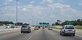
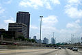
The following is a list of the freeways and tollways in the Dallas/Fort Worth, Texas area:
The following is a list of the freeways and tollways in the Dallas/Fort Worth, Texas area:
| | Interstate 20 Ronald Reagan Memorial Highway Lyndon B. Johnson Freeway | Interstate highway passing through the southern suburbs of Fort Worth, Arlington and sparsely populated south Dallas and its southern suburbs. The stretch of highway running along southern Tarrant County is known as the Ronald Reagan Memorial Highway. Throughout the majority of the city of Dallas it carries the name Lyndon B. Johnson Freeway, a name it shares with I-635, I-20 along with I-635 form a 3/4 loop around the city of Dallas and the suburbs. I-20 also completes a full loop around Fort Worth along with I-820. |
| | Interstate 820 Jim Wright Freeway Northeast Loop Airport Freeway | Interstate loop around Fort Worth (the southern leg is now I-20). It is signed as the Jim Wright Freeway between Benbrook and Haltom City, the Northeast Loop from Haltom City to North Richland Hills, the Airport Freeway (multiplexed with SH 121) in North Richland Hills, and unnamed for the remainder of its journey. Jim Wright is the former Speaker of the U.S. House. |
| | Interstate 30 West Freeway Tom Landry Freeway East R. L. Thornton Freeway | Interstate highway passing through Garland, Dallas, Grand Prairie, Arlington, and Fort Worth. It begins from I-20 just west of Fort Worth. Sometimes referred to by older residents as "the old Turnpike" since it previously was known as the Dallas-Fort Worth Turnpike. It is known as the West Freeway from I-20 to Downtown Fort Worth, the Tom Landry Freeway from Downtown Fort Worth to Downtown Dallas, and the East R. L. Thornton Freeway in Downtown and East Dallas. Tom Landry was the first head football coach of the Dallas Cowboys, leading the team for 29 years. |
| | Interstate 35E South R.L. Thornton Freeway Stemmons Freeway | An Interstate highway passing through Dallas and Denton, it begins at I-35/I-35E in Denton (north of the Metroplex) and terminates with the same roads in Hillsboro (south of the Metroplex). I-35 is parallel or concurrent to US-77 for most of its route. It carries the South R. L. Thornton Freeway name south of Dallas and the Stemmons Freeway name north of Dallas. I-35E is also noted as one of the most dangerous roads in Dallas and is responsible for many car accidents. |
| | Interstate 35W South Freeway North Freeway | Interstate highway passing through Fort Worth, terminates with I-35E/I-35 in Denton (north of the Metroplex) and Hillsboro (south of the Metroplex); it is known as the South Freeway south of I-30 and the North Freeway north of I-30. |
| | Interstate 635 Lyndon B. Johnson Freeway | Interstate half-loop around Dallas. Begins at I-20 in Balch Springs and ends at the International Parkway near Dallas/Fort Worth International Airport. |
| | Interstate 45 Julius Schepps Freeway | Interstate highway passing through sparsely populated southeast Dallas, terminating at the US 75/I-30 interchange in downtown Dallas; it is known throughout the central Dallas area as the Julius Schepps Freeway. |
| | Interstate 345 North Central Expressway | The small section between I-30 and the Woodall Rodgers Freeway (SH 366) along the eastern edge of downtown Dallas is officially I-345, but is signed as "To US 75" (from the south) or "To I-45" (from the north). |
| | U.S. Route 67 J. Elmer Weaver Freeway S.G. Alexander Freeway Marvin D. Love Freeway R.L. Thornton Freeway East R.L. Thornton Freeway | A freeway that begins in Midlothian and proceeds north towards Dallas. It is known as the J. Elmer Weaver Freeway in Cedar Hill, but quickly changes names to the S. G. Alexander Freeway in Duncanville. After its interchange with I-20, it changes names again to the Marvin D. Love Freeway. In Cedar Crest, it becomes multiplexed with I-35E and US 77, becoming the South R.L. Thornton Freeway. In Downtown Dallas, US 67 leaves to become multiplexed with I-30 (the East R.L. Thornton Freeway). The two stay concurrent until Hopkins County. |
| | U.S. Route 75 North Central Expressway | US 75 begins in Downtown Dallas at an interchange with the Woodall Rodgers Freeway and I-345, I-345 being an unsigned interstate leading to I-45. It proceeds north as the North Central Expressway through the most popular and affluent neighborhoods of Downtown Dallas. SH 121 is concurrent with US 75 in McKinney. Past McKinney, the highway continues north through rural areas towards northern Texas. |
| | U.S. Route 77 Dallas Highway R.L. Thornton Freeway Stemmons Freeway | A north-south freeway that is concurrent with I-35E, the R.L. Thornton Freeway and the Stemmons Freeway, (and is also multiplexed with US 67 for parts) between Red Oak and Denton. The freeway is in a trench for 6 miles (10 km). |
| | U.S. Route 80 | US 80 is freeway passing through Mesquite, beginning at I-30 in East Dallas. The freeway ends at Spur 557, but the U.S. highway continues east as Moore Avenue. US 80 formerly passed through Fort Worth, towards El Paso before being replaced by I-20. |
| | U.S. Route 175 S.M. Wright Freeway C.F. Hawn Freeway | US 175 begins at an interchange with I-45 in Downtown Dallas, proceeding south to an interchange with SH 310 (the South Central Expressway), and then continuing east towards Kaufman, now known as the C.F. Hawn Freeway. The freeway terminates just past Kaufman, but US 175 continues as a smaller highway. |
| | U.S. Route 287 Martin Luther King Jr. Freeway | Freeway passing through southeast Fort Worth, southwest Arlington, and Mansfield. The freeway begins in Downtown Fort Worth and proceeds southeast away from Fort Worth. Part of the freeway is multiplexed with I-820 and I-20. |
| | State Highway 114 John W. Carpenter Freeway | Freeway passing through Southlake, Grapevine, the DFW airport, the Las Colinas business district in Irving, and heading into Dallas before merging with SH 183. |
| | State Highway 121 Airport Freeway | Freeway passing through Grapevine and northeast Fort Worth. See below for information on the tolled stretch of 121, which extends from Grapevine to US 75. |
| | State Highway 161 | Freeway/tollway passing between Dallas/Fort Worth International Airport and Irving, will eventually connect to State Highway 190 on the north, with plans to extend south to Interstate 20. Part of the President George Bush Turnpike (see below). |
| | State Highway 170 Alliance Gateway Freeway | Freeway running from Interstate 35W in northern Fort Worth, connecting with Highway 114 in Westlake. |
| | State Highway 183 Airport Freeway John W. Carpenter Freeway Southwest Boulevard | Freeway passing through Irving and the "Mid-Cities", a 3 miles (5 km) section of State Highway 183 in southwest Fort Worth is a freeway. |
| | State Highway 190 | Originally planned as the designation for a northern outer-loop freeway, but a tollway was built instead and State Highway 190 was retained as the designation of the frontage roads of the President George Bush Turnpike (see below). |
| | State Highway 310 S. M. Wright Freeway | Freeway in South Dallas parallel to I-45. Covering 3 miles (5 km) the remnants of the old Central Expressway, SH 310 starts at US 175 as a freeway and continues as a smaller highway to I-45 near the interchange with I-20 in Hutchins. |
| | State Highway 360 Angus G. Wynne Freeway Watson Road | A freeway passing relatively along the border of Arlington and Grand Prairie, also named after the founder of Six Flags Over Texas, which SH 360 passes by. |
| | Loop 12 Walton Walker Boulevard | A freeway passing through west Dallas and Irving, connecting to Spur 408 in the south, and connecting to I-35E in Dallas, it also passed by Texas Stadium when this article was written over a decade ago. |
| | Loop 288 | A freeway passing through north Denton, connecting to I-35 on the north, freeway terminates at US 380/377 and continues as an expressway to I-35E. Together both sections bypass the central business district. Future plans call for an extensions west to US 380 before continuing south to I-35W. |
| | Spur 97 International Parkway (part) | Part of the International Parkway, a tollway passing through Dallas/Fort Worth International Airport. |
| | Spur 280 | A brief spur freeway connecting US 287 to downtown Fort Worth. |
| | Spur 347 Belknap Street Weatherford Street | A short spur freeway from the SH 121 / I-35W interchange into downtown Fort Worth. |
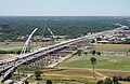
| | Spur 366 Woodall Rodgers Freeway | A freeway passing along the northern boundary of downtown Dallas. Originally connected I-35E to US 75/I-345, now extended across the Margaret Hunt Hill Bridge to Singleton Blvd. in west Dallas. |
| | Spur 399 Sam Rayburn Tollway (part) | A short spur freeway traveling from SH 121-Central Expressway (US 75) interchange to SH 5 south of downtown McKinney. Soon to become part of Sam Rayburn Tollway. [30] |
| | Spur 408 Patriot Parkway | A freeway passing through semi-rural southwest Dallas, connecting to Loop 12 on the north and terminating at I-20 in the south. |
| | Spur 482 Storey Lane | A spur freeway connecting SH 183/114 to Loop 12 (Northwest Highway), passes by former site of Texas Stadium. |
| | Dallas North Tollway (DNT) | A tollway extending northward out of downtown Dallas and passing along and through most affluent neighborhoods and shopping/dining areas in Dallas, passing through Plano, and into Frisco. Its free frontage roads (which don't exist south of I-635) are known as the Dallas Parkway. The Tollway currently extends to the northern edge of Frisco, terminating at U.S. Highway 380, and is under construction to extend it farther north. |
| | International Parkway | The International Parkway is a tolled road that passes from SH 121 in Euless to the southern end of the Sam Rayburn Tollway, passing through DFW Airport. It is only tolled within the DFW airport grounds. |
| | President George Bush Turnpike (PGBT) | A tollway named for former president George H. W. Bush; passes through northern Dallas suburbs, currently terminating at State Highway 161 in Irving in the west and at I-30 in the east, forming a northern loop around Dallas. In between, it forms the boundary between Plano to the north and Dallas and Richardson to the south. The Turnpike's free frontage roads are signed as State Highway 190. |
| | Sam Rayburn Tollway (SRT) | A tollway beginning at the northern end of the International Parkway in Grapevine and proceeding northeast to just south of McKinney. The tollway's free frontage roads are signed as State Highway 121. |
| | Chisholm Trail Parkway (CTP) | A tollway beginning in Tarrant and Johnson counties connecting the central business district of the city of Fort Worth at Interstate 30 to US 67 in Cleburne. |
| | 360 Tollway | The tolled portion of State Highway 360 beginning at I-20 in southern Arlington and ending at US 287 in Mansfield |


U.S. Route 75 is a north–south U.S. Highway that runs 1,239 miles (1,994 km) in the central United States. The highway's northern terminus is located at the Canadian border near Noyes, Minnesota, at a now-closed border crossing. From this point, the highway once continued farther north as Manitoba Highway 75. Its southern terminus is located at Interstate 30 (I-30) and I-45 in Dallas, Texas, where US 75 is known as North Central Expressway.

State Highway 121 is a state highway angling from southwest to northeast through north central Texas. It runs from Cleburne, Texas at US 67 to SH 78 in Bonham, Texas, just north of a junction with US 82.

State Highway 35 is a 206.5-mile (332.3 km) state highway near the southeastern edge of Texas, United States, that is maintained by the Texas Department of Transportation (TxDOT). It runs primarily south–north, paralleling the Gulf of Mexico for much of its length, from a junction with Interstate 37 in Corpus Christi to Interstate 45 in southeastern Houston.
The President George Bush Turnpike (PGBT) is a 52-mile (84 km) controlled-access toll road running through the northern, northeastern and western suburbs, forming a partial beltway around Dallas, Texas, United States. It is named for the late George H. W. Bush, the 41st president of the United States. At its west end near Belt Line Road in Irving, State Highway 161 continues southwest to I-20 in Grand Prairie. The discontinuous free frontage roads along the turnpike from I-35E in Carrollton east to its end at I-30 in Garland are assigned the State Highway 190 designation. SH 190 signage appears only along the Rowlett, Garland, Richardson, Plano, and Carrollton sections of the frontage road with the undersign "frontage road only". At intersections with city streets, only the Bush Turnpike signs are displayed, not the SH 190 signage. Prior to the construction of the main lanes as a tollway, SH 190 was used as the name of the planned main lanes too. Similarly, the part west of I-35E was planned as part of SH 161. Bush Turnpike is signed as a north–south road from I-20 to I-35E, an east–west road from I-35E to the Merritt Main Lane Gantry and as a north–south road from the Merritt Main Lane Gantry to I-30, as Bush Turnpike makes a nearly 90-degree curve in both places.
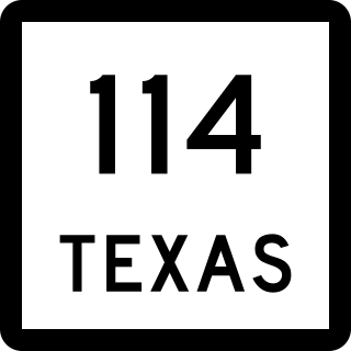
State Highway 114 is a state highway that runs from the Dallas-Fort Worth Metroplex westward across Texas to the New Mexico state line, where it becomes New Mexico State Road 114, which eventually ends at Elida, New Mexico at US 70 / NM 330.

Interstate 635 (I-635) is a 37-mile-long (60 km) partial loop around Dallas, Texas, in the United States between I-20 in Balch Springs and SH 121 at the north entrance of the DFW Airport in Grapevine. It intersects I-35E at exits 27B and 27C but does not connect with I-35W. I-635 and a part of I-20 are collectively designated as the Lyndon B. Johnson Freeway; known locally as the LBJ Freeway, or simply LBJ. The roadway is named after Lyndon B. Johnson, the former U.S. senator from Texas and the 37th vice-president and 36th president of the U.S. Where I-635 ends at I-20, I-20 continues the LBJ Freeway designation heading west. Since the portion of I-20 between Spur 408 to I-635 retains the same names as I-635, the two highways are considered three-quarters of the beltway around Dallas. Together with Spur 408, a portion of Loop 12, and a portion of I-35E, I-635 and I-20 complete the beltway.

State Highway 71 is a Texas state highway that runs 253 miles (407 km). The western terminus is at US 87 and US 377 south of Brady and its eastern terminus is at SH 35 near Blessing. This highway is designated the "10th Mountain Division Highway" from SH 95 to Interstate 35.
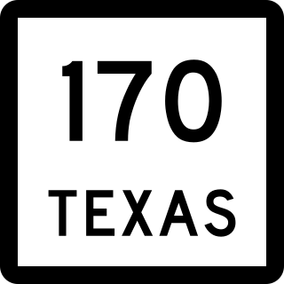
State Highway 170 (SH 170), also known as the Alliance Gateway Freeway, is a Texas state highway in the northern suburbs of Fort Worth in the Alliance area. The highway was designated in 1988.
U.S. Highway 75 (US 75) is a part of the U.S. Highway System that travels from Interstate 345 (I-345) in Dallas, Texas northward to the Canadian border in Noyes, Minnesota. In the state of Texas it runs from I-345 in Dallas and heads north to the Oklahoma state line, a distance of about 75.3 miles (121.2 km).
The following special routes exist or existed parallel to U.S. Route 87 (US 87) in Texas, primarily along former alignments. They are varyingly designated by the Texas Department of Transportation (TxDOT) as business routes of US 87, state highway loops and spurs, and business loops of Interstate 27 (I-27).
There are approximately 25 current toll roads in the state of Texas. Toll roads are more common in Texas than in many other U.S. states, since the relatively low revenues from the state's gasoline tax limits highway planners' means to fund the construction and operation of highways.
All of the business loops within Texas are maintained by the Texas Department of Transportation (TxDOT). Interstate 20 (I-20) has 15 business loops in the state, all located in western Texas. Along I-20, TxDOT identifies each business route as Business Interstate 20 followed by an alphabetic suffix. Along Texas Interstates, the alphabetic suffixes on business route names ascend eastward and northward. There are gaps in the alphabetic values to allow for future system expansion. The alphabetic naming suffixes are included as small letters on the bottom of route shields.

All of the business loops are maintained by the Texas Department of Transportation (TxDOT). Interstate 45 (I-45) has four business loops in the state, all located in northern Texas. Along I-45, TxDOT identifies each business route as Business Interstate 45 followed by an alphabetic suffix. Along Texas Interstates, the alphabetic suffixes on business route names ascend eastward and northward. There are gaps in the alphabetic values to allow for future system expansion. The alphabetic naming suffixes are included as small letters on the bottom of route shields.