List of New York State Historic Markers in Greene County, New York

Last updated

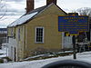
This is an incomplete list of New York State Historic Markers in Greene County, New York. [1]

Contents

Listings county-wide

Marker name [1] ImageDate designatedLocationCity or TownCoordsMarker text
1 EARLY CHURCH On NYS 23 about 12 mile east of East Ashland Ashland, Town Of, New York First Congregational Church of Ashland Built Here in Old Windham 1799
2 TRINITY On NYS 23 at East Ashland Ashland, Town Of, New York 42°17′53″N74°17′54″W / 42.29806°N 74.29833°W / 42.29806; -74.29833 Church Inc. May 20, 1799, Earliest Episcopal Organization of Old Town of Windham
3 A. VAN LOON AVanLoonHouse.JPG On NYS 385 at Athens Athens, Town Of, New York 42°16′01″N73°48′19″W / 42.266946°N 73.805299°W / 42.266946; -73.805299 House Built 1724 By Albertus Van Loon Occupied as Residence Since Date of Erection
4 BLACK HORSE On US 9W about 3 mi NW of Athens Athens, Town Of, New York Inn Built in 1791 by Isaac Hallenbeck
5 JAN VAN LOON JanVanLoonHouse.JPG On NYS 385 at Athens Athens, Town Of, New York House Built 1706 by Jan Van Loon Chief Holder Loonenburgh Pat. 1688. Athens Village First Called Loonenburgh
6 NORTHUP On NYS 385 at Athens Athens, Town Of, New York House Built 1803 Home of Isaac Northup Founder of Athens Village Incorporated 1805
7BELL FACTORYOn NYS 23 & NYS 145, South Cairo Cairo, Town of, New York of William Barton Earliest American Maker of Sleigh Bells Stood on This Stream 1828
8IRON FORGEOn County Road at Purling Cairo, Town Of, New York Of Enoch Hyde And Benjamin Hall Stood at First Fall 1788 First in Greene County
9MASSACRE 1780On Town Road about 1+12 miles Southwest of Purling Cairo, Town Of, New York Johannes Strope & Wife Killed by Indians Frederick Schermerhorn Carried Captive to Canada
10 WOODSTOCK On NYS 32 about 1-mile (1.6 km) north of Cairo Cairo, Town of, New York First Settlement in Town of Cairo by James Barker and Tenantry in 1791
11"UNCLE SAM"On West Bridge Street, Catskill Catskill, Town of, New York Bridge Samuel Wilson, Whose Name Inspired National Symbol "Uncle Sam" Lived Nearby From 1817-1822
12100 RODS NORTH U+2192.svg On Water Street, Catskill Catskill, Town of, New York Stood the First Grist Mill in Greene County Built in 1675 by Dirck T. Van Vechten
13 CATSKILL At intersection Green & Main Streets Catskill Catskill, Town of, New York Packet First Newspaper in County Printed on This Site by Mackay Croswell & Co. August 6, 1792
14 HOME OF On Town Road, Jefferson Heights Catskill, Town of, New York Rev. Johannes Schuneman "Dutch Dominie Of The Catskills" Built 1792
15HOP-O-NOSE Historical marker Hop-O-Nose.jpg On Main Street, Catskill Catskill, Town of, New York 42°12′42″N73°51′28″W / 42.21167°N 73.85778°W / 42.21167; -73.85778 Site of Indian Village Purchased from Indians in 1682 Loveridge Patent
16 MARTIN On West Main Street, Catskill Catskill, Town of, New York Van Buren 8th President of the U.S. was Married in This House to Hannah Hoes in 1807. House Built in 1797.
17 OLD KATSKILL On Town Road about 12 mile south of Leeds Catskill, Town of, New York 42°15′2.12″N73°54′28.08″W / 42.2505889°N 73.9078000°W / 42.2505889; -73.9078000 U+2192.svg Reformed Dutch Church of Katskill Kockshackie Stood on This Hill Built 1733
18 OLD KATSKILL On County Road about 12 mile south of Leeds Catskill, Town of, New York House Built in 1729 by Garret Van Bergen. Barn Built 1680 by Marte Gerretse Van Bergen. Formerly Indian Village Site.
19PAPER MILL NYS 23 & NYS 145, Jefferson Heights Catskill, Town of, New York First in Greene County ¼ Mile at Foot of Hill Built in 1800 By Nathan Benjamin
20PIETER SOUSER'S INNOn NYS 23 & NYS 145 at Jefferson Heights Catskill, Town of, New York Place Where Political Meetings were Held Before 1797 Racetrack of the Pioneers Near by
21SITE OFOn NYS 23 & NYS 145, Leeds Catskill, Town of, New York 42°15′20.88″N73°54′12.64″W / 42.2558000°N 73.9035111°W / 42.2558000; -73.9035111 First Log House in This Village Built in 1675 Stood 100 Feet South Along Road to Fording Place
22 STONE HOUSE CatskillStoneHouseRear.JPG On West Main Street, Catskill Catskill, Town of, New York 42°13′9″N73°52′11″W / 42.21917°N 73.86972°W / 42.21917; -73.86972 Built in 1762 by Lieut. Col. Cornelius Dubois. Surrender of Cornwallis Celebrated Here.
STONE BRIDGE Stone Bridge East Durham NY Susquehannah Turnpike.jpg On Route 145, East Durham, New York East Durham, New York 42°22′58″N74°07′06″W / 42.38278°N 74.11833°W / 42.38278; -74.11833 STONE BRIDGE - Built 1800 as part of the Susquehannah Turnpike.
23 U+2192.svg On NYS 23 & NYS 145, Leeds Catskill, Town of, New York 42°15′17.89″N73°54′2.81″W / 42.2549694°N 73.9007806°W / 42.2549694; -73.9007806 Old Inn of Martin G. Schuneman Built 1796
24 U+2192.svg On NYS 23A about 1-mile (1.6 km) east of Kiskatom Catskill, Town of, New York Abeel House Built About 1721 in the Back-oven Rebuilt About 1752 David and Anthony Abeel Captured by Indians 1780
25 U+2192.svg On NYS 23A & NYS 32A about 12 mile west of Palenville Catskill, Town of, New York Indian Trail to Fort on Round Top Now Kaaterskill Clove
26 U+2192.svg On NYS 23, & NYS 145, Leeds Catskill, Town of, New York 42°15′23.83″N73°54′24.91″W / 42.2566194°N 73.9069194°W / 42.2566194; -73.9069194 Pachquiack "Open Country" Purchased from Indians by Jan Bronk, 1675 Formerly Madison, Now Leeds
27 U+2192.svg On NYS 23 & NYS 145 at Jefferson Heights Catskill, Town of, New York 42°14′8.59″N73°53′4.6″W / 42.2357194°N 73.884611°W / 42.2357194; -73.884611 Footpath from Old Indian Fort Called Casteel Hoogte to Coxsackie
28 U+2192.svg NYS 23 & NYS 145, Jefferson Heights Catskill, Town of, New York House Built in 1814 by Capt. Jos. Allen Sea Captain During Revolution
29"FIRST HOUSE ON THE HILL"On Ely Street, Coxsackie Coxsackie, Town of, New York Built by Dr. John Ely of Newry, Albany County, About the Year 1800.
30 BRONCK HOUSE Bronck-house.jpg On Private Road 300 feet (91 m) off US 9W, 1+12 mile south of Coxsackie Coxsackie, Town of, New York 42°20′31″N73°50′55″W / 42.34194°N 73.84861°W / 42.34194; -73.84861 Oldest House Used as Such in Greene County Built by Pieter Bronck 1663
3112 MILE TO U+2192.svg On NYS 145, Durham Durham, Town Of, New York Meeting House Hill Bronze Tablet and Boulder Mark the Site of First Presbyterian Church, Durham Organized November 8, 1792
32 R.R. DISASTER On NYS 145 about 2 miles west of Village of East Durham, at Durham Center Museum Durham, Town Of, New York 42°23′22.42″N74°07′42.67″W / 42.3895611°N 74.1285194°W / 42.3895611; -74.1285194 )In 1840 One Half Mile East Train Plunged Through Trestle into Creek at High Rock Ended Career of Canajoharie-Catskill Railroad
33BENJAMIN SPEESOn NYS 32 at Greenville Greenville, Town of, New York Settled Here in 1781 in a Log Cabin Built by a Tory
34 DR. JOHN ELY On County Road about 2 miles (3.2 km) north of East Greenville Greenville, Town of, New York First Physician in Town of Greenville Lived in This House
35EARLY SAWMILLOn NYS 32 about 3 miles (4.8 km) south of Greenville Greenville, Town of, New York Owned and Operated by Eleazer Knowles Stood on This Site
36FIRST SCHOOLOn NYS 32 at Greenville Greenville, Town of, New York A Cabin Built of Logs Stood on This Site First Teacher was a Son of Rev. Eleazer Hotchkin
37 GREENVILLE At intersection of NYS 32 & NYS 81 at Greenville Greenville, Town of, New York 1803 Town Taken from Freehold and Coxsackie Called Greenfield, First Town Meeting Held 1809 Named Greenville
38SITE OFOn County Road about 2 miles (3.2 km) north of East Greenville Greenville, Town of, New York Early Tannery Owned by Daniel Miller Who Came from East Hampton, L.I.
39SITE OF LOG CABIN OFOn NYS 145 about 2+12 miles west of Village of East Durham Greenville, Town of, New York Edward Lake Pioneer Who Settled Here in 1781 on a 600 Acre Lot
40SITE OF LOG CABIN OFOn NYS 32 about 1-mile (1.6 km) south of Greenville Greenville, Town of, New York Eleazer Knowles Pioneer Who Settled Here in 1781 on a 600 Acre Lot
41 REFORMED On NYS 23 at Prattsville Prattsville, Town Of, New York Church First in Mountain Towns of Greene County Organized in 1798 Built in 1804
42 U+2192.svg On NYS 23 at Hensonville Windham, Town Of, New York First Log House Built Here in 1818 by John Henson Founder of Hensonville
43 U+2192.svg On NYS 23 at Windham Windham, Town Of, New York Against This Rock George Stimson First Settler of the Town of Windham Built his Log Cabin in 1785
441808 Sayre Home 1808 Sayre Home.jpg On Jerome Avenue in Cairo Cairo, New York

42°18′10.7″N74°00′11.3″W / 42.302972°N 74.003139°W / 42.302972; -74.003139

1808 Sayre Home

Daniel Sayre purchased 100 acres along Shingle Kill 1794 Shoemaker, Justice 1800-1819 1st Town Supervisor 1803 Elected State Assembly 1804

See also

Related Research Articles

<span class="mw-page-title-main">Perrine's Bridge</span> Bridge

Perrine's Bridge is the second oldest covered bridge in the State of New York, after the Hyde Hall Bridge in East Springfield. Once located in the hamlet called Perrines Bridge between 1850 and 1861. It is located in the modern day town of Esopus-Rosendale, New York just a few hundred feet to the east of Interstate 87 crossing of the Wallkill River in Ulster County, New York. Originally built to aid in the movement of trade between the towns of Rifton and Rosendale, the bridge is about 90 miles north of New York city between mile markers 81 and 82 on the New York State Thruway. In May 1834 the State of New York authorized and provided money ($700) to Ulster county, NY, to build the bridge. In 1835, the bridge was built by Benjamin Wood, the one-lane wooden covered bridge has been closed to vehicular traffic since 1930. The Bridge derives its name from James W. Perrine, a descendant of Daniel Perrin "The Huguenot", who was a tavern keeper that opened an inn on the east side of that future bridge in 1820. Perrine's son was hired each winter as the "snower". He would spread snow the length of the structure so horse-drawn sleighs could cross.

<span class="mw-page-title-main">United States National Register of Historic Places listings</span> Register for landmarks in the United States

The National Register of Historic Places in the United States is a register including buildings, sites, structures, districts, and objects. The Register automatically includes all National Historic Landmarks as well as all historic areas administered by the U.S. National Park Service. Since its introduction in 1966, more than 90,000 separate listings have been added to the register.

<span class="mw-page-title-main">Commemorative plaque</span> Historical marker

A commemorative plaque, or simply plaque, or in other places referred to as a historical marker, historic marker, or historic plaque, is a plate of metal, ceramic, stone, wood, or other material, typically attached to a wall, stone, or other vertical surface, and bearing text or an image in relief, or both, to commemorate one or more persons, an event, a former use of the place, or some other thing. Many modern plaques and markers are used to associate the location where the plaque or marker is installed with the person, event, or item commemorated as a place worthy of visit. A monumental plaque or tablet commemorating a deceased person or persons, can be a simple form of church monument. Most modern plaques affixed in this way are commemorative of something, but this is not always the case, and there are purely religious plaques, or those signifying ownership or affiliation of some sort. A plaquette is a small plaque, but in English, unlike many European languages, the term is not typically used for outdoor plaques fixed to walls.

<span class="mw-page-title-main">National Register of Historic Places listings in Massachusetts</span>

This is a list of properties and districts in Massachusetts listed on the National Register of Historic Places. There are over 4,300 listings in the state, representing about 5% of all NRHP listings nationwide and the second-most of any U.S. state, behind only New York. Listings appear in all 14 Massachusetts counties.

<span class="mw-page-title-main">National Register of Historic Places listings in Virginia</span>

Buildings, sites, districts, and objects in Virginia listed on the National Register of Historic Places:

<span class="mw-page-title-main">Steuben Memorial State Historic Site</span> United States historic place

The Steuben Memorial State Historic Site is a historic location in the eastern part of Steuben, Oneida County, New York, that honors Baron von Steuben, the "Drillmaster of the American Revolution". The land in this part of Oneida County was part of a 16,000-acre (6,500 ha) land grant made to von Steuben for his services to the United States. He used the land for his summer residence, and is buried at the memorial, a "Sacred Grove".

<span class="mw-page-title-main">National Register of Historic Places listings in Albany County, New York</span>

National Register of Historic Places listings in Albany County, New York exclusive of the City of Albany: This is intended to be a complete list of properties and districts listed on the National Register of Historic Places in Albany County, New York, besides those in the City of Albany, itself.

<span class="mw-page-title-main">National Register of Historic Places listings in Delaware County, New York</span>

List of the National Register of Historic Places listings in Delaware County, New York

<span class="mw-page-title-main">National Register of Historic Places listings in Suffolk County, New York</span>

List of the National Register of Historic Places listings in Suffolk County, New York.

<span class="mw-page-title-main">National Register of Historic Places listings in Tioga County, New York</span>

List of the National Register of Historic Places listings in Tioga County, New York

<span class="mw-page-title-main">Grant Cottage State Historic Site</span> United States historic place

Grant Cottage State Historic Site is an Adirondack mountain cottage on the slope of Mount McGregor in the town of Moreau, New York. Ulysses S. Grant, the 18th President of the United States, died of throat cancer at the cottage on July 23, 1885. The house was maintained as a shrine to U.S. Grant following his death by the Mount McGregor Memorial Association and a series of live-in caretakers. The building became a New York State Historic Site in 1957 and was added to the National Register of Historic Places in 1971. The Historic Site was designated a National Historic Landmark by the National Park Service in 2021.

<span class="mw-page-title-main">Hadley Mountain</span> Mountain in New York, United States

Hadley Mountain is a mountain located in the southern Adirondacks in the U.S. state of New York and is the second-highest peak in Saratoga County after neighboring Tenant Mountain. The Hadley Mountain Fire Observation Station was listed on the National Register of Historic Places on September 23, 2001 for its role as a Fire lookout tower with the New York State Forest Preserve. Hadley Mountain is the highest of the three peaks that form the West Mountain ridge.

References

  1. 1 2 "New York State Historic Markers". New York Museum. 2009-07-15. Archived from the original on 2013-03-24.