
State Route 87, known as the Guadalupe Freeway or referred to by the locals as Highway 87, is a north–south state highway in San Jose, California, United States. Before being upgraded to a freeway, it was Guadalupe Parkway.
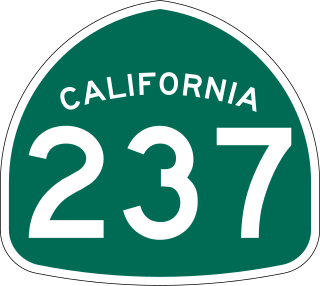
State Route 237 is a state highway in the U.S. state of California that runs from El Camino Real in Mountain View to Interstate 680 in Milpitas. Known as the Southbay Freeway for most of its length, SR 237 runs south of the San Francisco Bay, connecting the East Bay to the Peninsula.

State Route 52 (SR 52) is a state highway in San Diego County, California, that extends from La Jolla Parkway at Interstate 5 (I-5) in La Jolla, San Diego, to SR 67 in Santee. It is a freeway for its entire length and serves as a major east–west route through the northern part of the city of San Diego. The road connects the major north–south freeways of the county, including I-5, I-805, SR 163, I-15, SR 125, and SR 67. SR 52 passes north of the Rose Canyon Fault before traversing Marine Corps Air Station Miramar. East of Santo Road and west of SR 125, the highway goes through Mission Trails Regional Park, a large open preserve. SR 52 is also known as the Soledad Freeway and the San Clemente Canyon Freeway.

The Marvin Braude Bike Trail is a 22-mile (35 km) paved bicycle path that runs mostly along the shoreline of Santa Monica Bay in Los Angeles County, California. The coastal bike trail is widely acknowledged as Los Angeles' "most popular bike path."
The Coyote Creek bikeway is a Class 1 bike path in Los Angeles County that runs adjacent to the Coyote Creek flood control channel for approximately 9.5 miles. The bike path is controlled by Caltrans. The path begins in Santa Fe Springs on the North fork of the Coyote Creek and extends south into Long Beach where it joins the San Gabriel River bicycle path at the trail bridge just South of Willow Street/Katella Avenue.

The San Gabriel River Trail is a 28-mile (45 km) bike path along the San Gabriel River through El Dorado Regional Park and onto street bike trails near the Alamitos Bay Marina in Los Angeles County, California. The South end is Seal Beach. The northern segment begins near Whittier Narrows Recreation Area.
The San Diego Creek bicycle path is a cycling route in the city of Irvine, California. The path connects major points such as Newport Beach, University of California, Irvine, Boomers Irvine, Colonel Bill Barber Park, Irvine Civic Center, Irvine Crossroads shopping center, Woodbridge High School, Woodbridge Community Park, Atria Senior Residential Area, Windrow Community Park and Irvine Medical Complex, before reaching Irvine Spectrum Center. It also runs through the majority of Irvine's neighborhoods such as Westpark, Woodbridge, and Oak Creek. The path begins where the San Diego Creek empties into Upper Newport Bay.

U.S. Route 101 (US 101) is a major north–south United States Numbered Highway, stretching from Los Angeles, California, to Tumwater, Washington. The California portion of US 101 is one of the last remaining and longest U.S. Routes still active in the state, and the longest highway of any kind in California. US 101 was also one of the original national routes established in 1926. Significant portions of US 101 between the Los Angeles area and the San Francisco Bay Area follow El Camino Real, the commemorative route connecting the former Alta California's 21 missions.

The following is a list of transportation options in San Diego County, California.
Silver Strand bikeway 9-mile (14 km) bicycle and pedestrian path in the San Diego area of California. it is part of the larger Bayshore Bikeway which begins at the USS Midway Museum. The bikeway travels from Ferry Landing Marketplace to Imperial Beach at sea level with no elevation gain, providing a relatively easy ride. An entry point and parking area is located at Ferry Landing Marketplace.
The Guadalupe River Trail is an 11-mile (18 km) pedestrian and bicycle path in the city of San Jose, California. The path runs along the banks of the Guadalupe River. The trail is currently composed of two discontinuous segments: a shorter "upper" segment in the Almaden Valley neighborhood of San Jose and a longer "lower" segment through Downtown San Jose to Alviso. This trail is heavily used for both recreation and commuting, as it provides direct access to Downtown San Jose from many of the outlying neighborhoods. The trail is paved.
There are 34 routes assigned to the "S" zone of the California Route Marker Program, which designates county routes in California. The "S" zone includes county highways in Imperial, Orange, Riverside, San Diego, and Santa Barbara counties.

Egger Highlands is a residential neighborhood in the southern section of San Diego, California. It neighbors Palm City and Nestor to the east, San Diego Bay to the north, Imperial Beach to the southwest and Chula Vista to the northeast. Major thoroughfares include Coronado Avenue, Saturn Boulevard, and Palm Avenue.

The Los Angeles River bicycle path is a Class I bicycle and pedestrian path in the Greater Los Angeles area running from north to east along the Los Angeles River through Griffith Park in an area known as the Glendale Narrows. The 7.4 mile section of bikeway through the Glendale Narrows is known as the Elysian Valley Bicycle & Pedestrian Path. The bike path also runs from the city of Vernon to Long Beach, California. This section is referred to as LARIO, or more formally, the Los Angeles River Bikeway.
The Shoreline Pedestrian Bikepath also known as the Long Beach Bike Path is a 4.5-mile (7.2 km) path along the Pacific Ocean from Shoreline Village in downtown Long Beach, California to Belmont Shore, Los Angeles County. It was completed in 1988 and is used by walkers, joggers, and skaters. In 2013 the California Coastal Commission approved a second path for pedestrians to run parallel to the path used primarily by bicyclists.

The Expo Bike Path is a 12-mile-long (19 km) rail with trail bicycle path and pedestrian route in Los Angeles County, California that travels roughly parallel to the Los Angeles Metro Rail's E Line between La Cienega/Jefferson and 17th Street/SMC stations. The Expo Bike Path is one of two major bicycle routes in Los Angeles that share dedicated rights-of-way with public transport, the other being the G Line Bikeway in the San Fernando Valley.
Browns Creek Bike Path is a Class I bike path that is “tucked away from the surrounding hustle and bustle” of the San Fernando Valley, “hugging the side” of the Browns Canyon Wash.

The Tujunga Wash Greenway and Bike Path is a trail and stormwater mitigation project in the Valley Village and Valley Glen neighborhoods of California’s San Fernando Valley.