List of Los Angeles bike paths

Last updated
San Gabriel River Bike Trail in Long Beach Bicycling on the San Gabriel River Trail, Long Beach, Calif. - panoramio.jpg
San Gabriel River Bike Trail in Long Beach

This is a list of bike paths in Los Angeles County, California, United States.

Contents

Paths

Cyclist on Ballona Creek Bike Path near Sepulveda Blvd. Cyclist using Ballona Creek Bike Path near Sepulveda gate.jpg
Cyclist on Ballona Creek Bike Path near Sepulveda Blvd.
Chandler bike path, evening, Burbank Chandler bike path evening burbank.jpg
Chandler bike path, evening, Burbank
Baum Bicycle Bridge at Los Feliz Boulevard, part of the Los Angeles River Greenway. Alex Baum Bicycle Bridge looking south at night 2015-09-27.jpg
Baum Bicycle Bridge at Los Feliz Boulevard, part of the Los Angeles River Greenway.
Bike and pedestrian paths on Santa Monica beach Santa Monica Beach (8357676906).jpg
Bike and pedestrian paths on Santa Monica beach
Santa Clara River trail Santa Clara River Truss Bridge with signpost.jpg
Santa Clara River trail
Whittier Greenway Trail, pedestrian crossing at Hadley Street Whittier Greenway Trail, Ped Xing, Hadley St.jpg
Whittier Greenway Trail, pedestrian crossing at Hadley Street

Bike trails by watershed

Initial “river trails” organization framework created by Loren MacArthur in 1985. [31]

LA river bike path entrance in Cypress Park Cypress Park, Los Angeles- LA River Bike Path Entrance.jpg
LA river bike path entrance in Cypress Park

NOTE: Legg Lake Loop at Whittier Narrows Recreation Area is a bridge point linking the Los Angeles River and the San Gabriel River watersheds.

I. LOS ANGELES RIVER

“The river goes east-west through the Valley, then turns north-south in downtown L.A., flowing into the Pacific in Long Beach. There are bikeways along only about half of the length of the river currently [2022].” [32]

A. Upper Rio Hondo Bike Trail

  1. Santa Anita Wash Trail to Peck Road Water Conservation Park
  2. Peck Road Water Conservation Park to Whittier Narrows Recreation Area
  3. Whittier Narrows Recreation Area to Grant Rea Park (Montebello)

B. Lario Trail

  1. Whittier Narrows Dam to Hollydale Park (South Gate)
  2. Hollydale Park to Long Beach Harbor

C. Los Angeles River Bike Trail

D. Remoter tributaries of the Los Angeles River

1. Los Angeles Basin

a. Arroyo Seco (Pasadena area, northeast of downtown Los Angeles)

i. Arroyo Seco Bike Path

ii. Kenneth Newell Bike Path

b. Compton Creek Bike Path

2. San Fernando Valley

a. Browns Creek Bike Path

b. Tujunga Wash Bike Path

II. SAN GABRIEL RIVER

A. West Fork Bike Path

B. San Gabriel River Trail

  1. San Gabriel Mountains to Santa Fe Dam
  2. Santa Fe Dam to Legg Lake
  3. Whittier Narrows Dam to Wilderness Park
  4. Wilderness Park to El Dorado Park
  5. El Dorado Park to the Pacific Ocean

C. San Jose Creek bike path

D. Coyote Creek Bike Path

E. Billie Boswell Bike Path at El Dorado Park (confluence of San Gabriel River and Coyote Creek)

III. Other LA or SG river-adjacent bike loops or paths

A. Sepulveda Basin Bikeway (loop intersected by Los Angeles River)

B. Long Beach Bike Path (begins at Los Angeles River outlet/estuary in Long Beach)

C. Griffith Park (near Los Angeles River)

  1. Mineral Wells Loop
  2. Crystal Springs Loop

IV. Separate watersheds [33] (Bike trails in Los Angeles County adjacent to watercourses that are not connected to the San Gabriel or Los Angeles Rivers; listed roughly north to south.)

A. Santa Clara River Trail

1. San Francisquito Trail

2. South Fork Trail

B. Ballona Creek Bike Path

C. Dominguez Channel Bike Path

D. Wilmington Drain and Ken Malloy Harbor Regional Park loop

Rosecrans & Crenshaw Dominguez Creek Bike Route gate.jpg
Rosecrans & Crenshaw

Resources

Up-to-date bicycle tourbooks for Los Angeles County have been written by the following authors:

G Line Bikeway through the San Fernando Valley Orange Line Bikeway 2022-08d.jpg
G Line Bikeway through the San Fernando Valley

Legalities

Bike path sharing E Line right-of-way Expo Line Bikeway sign with directional arrows.jpg
Bike path sharing E Line right-of-way

Bike paths in Los Angeles County are maintained by various government organizations.

California Bike Paths are explicitly defined in Chapter 1000 of the Highway Design Manual (HDM) published by the California Department of Transportation (Caltrans).

Bike paths are uncovered by any warranties as to fitness for safe cycling. This is in direct contrast to ordinary city streets. There are two pieces of case law which establish this clearly, one of them being Prokop v. City of Los Angeles. [34]

It is legal in the City of Los Angeles to ride on sidewalks as long as riders do not show "wanton disregard" for the safety of other sidewalk users. [35] This does not apply to all areas of Los Angeles County. In California, when mounted and riding on the road, cyclists are required to "behave like vehicles" when it comes to obeying signals, signage, and lane restrictions. [36]

See also

Related Research Articles

<span class="mw-page-title-main">Sepulveda Dam</span> Dam in San Fernando Valley, California

The Sepulveda Dam is a dry dam constructed by the U.S. Army Corps of Engineers to withhold winter flood waters along the Los Angeles River. Completed in 1941, at a cost of $6,650,561, it is located south of center in the San Fernando Valley, approximately eight miles (13 km) east of the river's source in the western end of the Valley, in Los Angeles, California.

<span class="mw-page-title-main">Rio Hondo (California)</span> River in California, United States

The Rio Hondo is a tributary of the Los Angeles River in Los Angeles County, California, approximately 16.4 miles (26.4 km) long. As a named river, it begins in Irwindale and flows southwest to its confluence in South Gate, passing through several cities. Above Irwindale its main stem is known as Santa Anita Creek, which extends another 10 miles (16 km) northwards into the San Gabriel Mountains where the source, or headwaters, of the river are found.

<span class="mw-page-title-main">Los Gatos Creek Trail</span> Pedestrian and bicycle trail in Santa Clara County, CA

The main segment of the Los Gatos Creek Trail is a 9.7-mile (15.6 km) pedestrian and bicycle trail that runs through western Santa Clara County in California. It runs from Lexington Reservoir in Los Gatos, California through Campbell, California to Meridian Avenue in San Jose, California alongside Los Gatos Creek.

<span class="mw-page-title-main">Marvin Braude Bike Trail</span> Bike path in Los Angeles County, California, United States

The Marvin Braude Bike Trail is a 22-mile (35 km) paved bicycle path that runs mostly along the shoreline of Santa Monica Bay in Los Angeles County, California. The coastal bike trail is widely acknowledged as Los Angeles’ “most popular bike path.”
<span class="mw-page-title-main">Coyote Creek bicycle path</span> Cycling route in California, US

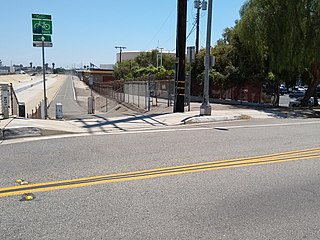
The Coyote Creek bikeway is a Class 1 bike path in Los Angeles County that runs adjacent to the Coyote Creek flood control channel for approximately 9.5 miles. The bike path is controlled by Caltrans. The path begins in Santa Fe Springs on the North fork of the Coyote Creek and extends south into Long Beach where it joins the San Gabriel River bicycle path at the trail bridge just South of Willow Street/Katella Avenue.

<span class="mw-page-title-main">San Gabriel River Bike Trail</span> Cycling route in Southern California, USA

The San Gabriel River Trail is a 28-mile (45 km) bike path along the San Gabriel River through El Dorado Regional Park and onto street bike trails near the Alamitos Bay Marina in Los Angeles County, California. The South end is Seal Beach. The northern segment begins near Whittier Narrows Recreation Area.

<span class="mw-page-title-main">Arroyo Seco bicycle path</span> Cycling route in California, USA

The Arroyo Seco Bicycle Path is an approximately 2-mile (3.2 km) long Class I bicycle path along the Arroyo Seco river channel and canyon in the Northeast Los Angeles region of Los Angeles County, California. It parallels the Arroyo Seco Parkway, which is also a part of the canyon.
<span class="mw-page-title-main">Ballona Creek Bike Path</span> Cycling route in Los Angeles County, California

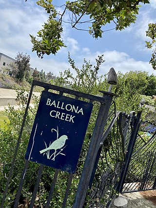
The Ballona Creek Bike Path is a 6.7-mile (10.8 km) Class I bicycle path and pedestrian route in California. The bike path follows the north bank of Ballona Creek until it reaches Santa Monica Bay at the Pacific Ocean. The route is defined by, and recognized for, the dramatic contrast between the channelized waterway’s stark cement geometry and the abundant wildlife of the verdant Ballona Wetlands.
<span class="mw-page-title-main">Culver Boulevard Median Bike Path</span> Rail-trail cycle route in California, United States

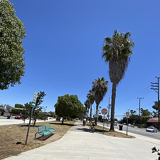
The Culver Boulevard Median Bike Path is Class I rail trail bicycle path, walk route and linear park on Culver Boulevard in western Los Angeles County, California.

<span class="mw-page-title-main">Santa Ana River Trail</span> Multi-use trail in Southern California, US

The Santa Ana River Trail is a multi-use trail complex that runs alongside the Santa Ana River in southern California. The trail stretches 30 miles (48 km) from the Pacific Ocean at Huntington Beach along the Santa Ana River to the Orange–Riverside county line. Planned extensions of the trail reach to Big Bear Lake in San Bernardino County. When completed, it will be the longest multi-use trail in Southern California, at approximately 100 miles (160 km). In 1989, the Los Angeles Times described the path as "a veritable freeway for bicycles".

<span class="mw-page-title-main">Los Angeles River bicycle path</span> Cycling route in California, USA

The Los Angeles River bicycle path is a Class I bicycle and pedestrian path in the Greater Los Angeles area running from north to east along the Los Angeles River through Griffith Park in an area known as the Glendale Narrows. The 7.4 mile section of bikeway through the Glendale Narrows is known as the Elysian Valley Bicycle & Pedestrian Path. The bike path also runs from the city of Vernon to Long Beach, California. This section is referred to as LARIO, or more formally, the Los Angeles River Bikeway.
<span class="mw-page-title-main">Shoreline Pedestrian Bikepath</span> Bike Path and walk route in Long Beach, California


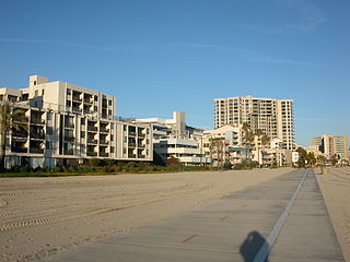
The Shoreline Pedestrian Bikepath also known as the Long Beach Bike Path is a 4.5-mile (7.2 km) path along the Pacific Ocean from Shoreline Village in downtown Long Beach, California to Belmont Shore, Los Angeles County. It was completed in 1988 and is used by walkers, joggers, and skaters. In 2013 the California Coastal Commission approved a second path for pedestrians to run parallel to the path used primarily by bicyclists.

<span class="mw-page-title-main">Los Angeles River Bikeway</span> Cycling route in California, US

Los Angeles River Bikeway, also known as LARIO, is a 29.1 mi (46.8 km) bikeway along the lower Los Angeles River in southern Los Angeles County, California. It is one of the completed sections of the Los Angeles River Bicycle Path planned to run along the entire 51 miles (82 km) length of the LA River.

<span class="mw-page-title-main">Expo Bike Path</span> Rail with trail bicycle path in Los Angeles County, California

The Expo Bike Path is a 12-mile-long (19 km) rail with trail bicycle path and pedestrian route in Los Angeles County, California that travels roughly parallel to the Los Angeles Metro Rail's E Line between La Cienega/Jefferson and 17th Street/SMC stations. The Expo Bike Path is one of two major bicycle routes in Los Angeles that share dedicated rights-of-way with public transport, the other being the G Line Bikeway in the San Fernando Valley.

Browns Creek Bike Path is a Class I bike path that is “tucked away from the surrounding hustle and bustle” of the San Fernando Valley, “hugging the side” of the Browns Canyon Wash.

<span class="mw-page-title-main">Tujunga Wash Greenway</span> Cycling route in California, USA

The Tujunga Wash Greenway and Bike Path is a trail and stormwater mitigation project in the Valley Village and Valley Glen neighborhoods of California’s San Fernando Valley.
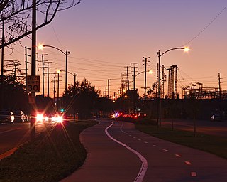
<span class="mw-page-title-main">Chandler Boulevard Bike Path</span> Cycling route in San Fernando Valley, California, USA

The Chandler Boulevard Bike Path is a Class I rail trail off-street bike route that runs from North Hollywood to Burbank in Los Angeles County, California.

<span class="mw-page-title-main">G Line Bikeway</span> Cycle route in Los Angeles County, California

The G Line Bikeway is a cycle route in Los Angeles County, California, that runs for 17.9 miles (28.8 km) and “spans the lengths of the San Fernando Valley’s major communities” from Chatsworth to Valley Glen, “connecting such places as Pierce College, the Sepulveda Basin Recreation Area, the Van Nuys Government Center and Valley College.”

References

  1. 1 2 3 4 5 6 7 8 9 10 11 12 13 14 15 16 17 18 19 20 21 22 23 24 25 26 27 28 "Bicycle Maps". LADOT Bicycle Services. Los Angeles Department of Transportation. Archived from the original on 15 April 2013. Retrieved 27 April 2013.
  2. "Bicycle Master Plan". City of Burbank. Archived from the original on 26 June 2013. Retrieved 28 April 2013.
  3. "Chandler Bikeway Burbank". Friends of Chandler Bikeway. Archived from the original on 4 April 2013. Retrieved 27 April 2013.
  4. "Biking: Compton Creek Paths". KCET. Archived from the original on 27 May 2013. Retrieved 13 May 2013.
  5. "Bikeways Map". Los Angeles County Department of Public Works. Archived from the original on 21 July 2013. Retrieved 13 May 2013.
  6. "Projects". County of Los Angeles Department of Public Works. Archived from the original on 21 July 2013. Retrieved 13 May 2013.
  7. "Duarte Bike Trail (Duarte Multipurpose Trail)". TrailLink. Rails-to-Trails Conservancy. Archived from the original on 21 April 2013. Retrieved 30 April 2013.
  8. 1 2 3 4 "City of Long Beach Bike Paths". Parks, Recreation and Marine. City of Long Beach. Archived from the original on 15 March 2013. Retrieved 28 April 2013.
  9. 1 2 3 "Bicycle Master Plan" (PDF). County of Los Angeles. Archived (PDF) from the original on 14 July 2014. Retrieved 13 May 2013.
  10. "Los Angeles River". Los Angeles River Revitalization Corporation. Archived from the original on 7 May 2013. Retrieved 14 May 2013.
  11. Jao, Carren. "NBCUniversal Puts $13.5 Million Toward L.A. River Bikeway". KCET. Archived from the original on 15 May 2013. Retrieved 14 May 2013.
  12. "Bicycle Master Plan" (PDF). County of Los Angeles. Archived (PDF) from the original on 14 July 2014. Retrieved 14 May 2013.
  13. "Whittier Narrows Recreation Area". County of Los Angeles Department of Parks and Recreation. Archived from the original on 2 July 2013. Retrieved 30 April 2013.
  14. Echeverry, Sebastian (2021-07-17). "'A great honor': Family, friends of the late Mark Bixby tour new bike path named in his honor • Long Beach Post News". Long Beach Post. Retrieved 2022-09-25.
  15. "Marvin Braude Coastal Trail Bike Map" (PDF). Marina Del Rey Convention and Visitors Bureau. Archived from the original (PDF) on 1 April 2013. Retrieved 28 April 2013.
  16. "Trail Features and Improvements". City of Rancho Cucamonga. Archived from the original on 29 June 2013. Retrieved 13 May 2013.
  17. "The Pacific Electric Inland Empire Trail". City of Rancho Cucamonga. Archived from the original on 21 April 2013. Retrieved 13 May 2013.
  18. "Bicycle Around Puddingstone Reservoir". Weekend Sherpa. Archived from the original on 10 March 2013. Retrieved 28 April 2013.
  19. "Puddingstone Reservoir". Los Angeles Bike Paths. Scott Hendison. Archived from the original on 13 May 2013. Retrieved 28 April 2013.
  20. 1 2 "Bikeways map". Los Angeles County Department of Public Works. Archived from the original on 21 July 2013. Retrieved 1 May 2013.
  21. "San Francisquito Trail". TrailLink. Rails-to-Trails Conservancy. Archived from the original on 2022-09-14. Retrieved 2013-05-13.
  22. "San Fernando Road Bike Path: Phase 2 Now Open!". LADOT Bike Blog. LADOT. Archived from the original on 2015-10-16. Retrieved 2015-09-14.
  23. "PROJECT TRAIL:San Fernando Road Metrolink Bike Path". TrailLink. Rails-to-Trails Conservancy. Archived from the original on 1 May 2013. Retrieved 13 May 2013.
  24. "More bike lanes, paths planned for county; three key projects planned for San Gabriel Valley". Whittier Daily News. Archived from the original on 18 April 2012. Retrieved 13 May 2013.
  25. "TrailLink". Rails-to-Trails Conservancy. Archived from the original on 21 May 2013. Retrieved 1 May 2013.
  26. "Sierra Highway Bike Path". TrailLink. Rails-to-Trails Conservancy. Archived from the original on 21 May 2013. Retrieved 13 May 2013.
  27. "South Fork Trail". TrailLink. Rails-to-Trails Conservancy. Archived from the original on 14 September 2022. Retrieved 13 May 2013.
  28. "Parks". City of Claremont. Archived from the original on 29 August 2013. Retrieved 4 May 2013.
  29. "Watts Towers Crescent Greenway". TrailLink. Rails-to-Trails Conservancy. Archived from the original on 21 May 2013. Retrieved 4 May 2013.
  30. "Whittier Greenway Trail". TrailLink. Rails-to-Trails Conservancy. Archived from the original on 14 September 2022. Retrieved 13 May 2013.
  31. MacArthur, Loren (1985). L.A. Bike Rides: A Guide to 37 Specially Selected Bike Routes in Los Angeles County. San Francisco, Calif.: Chronicle Books. ISBN   0-87701-316-0.
  32. Linton, Joe (2022-04-21). "Councilmember Blumenfield Opens New L.A. River Headwaters Bike/Walk Path". Streetsblog Los Angeles. Archived from the original on 2022-08-14. Retrieved 2022-08-14.
  33. "Ballona Creek and other urban watersheds" (PDF). Archived (PDF) from the original on 2022-07-09. Retrieved 2022-07-22.
  34. "City Has Absolute Immunity From Liability For Injuries Suffered On City Bike Path". Kronick Moskovitz Tiedemann & Girard. Archived from the original on 4 March 2016. Retrieved 28 April 2013.
  35. "Bicycles & The Law". Bike Blog. Los Angeles Department of Transportation. Archived from the original on 15 April 2013. Retrieved 27 April 2013.
  36. "California Driver Handbook". Archived from the original on 2005-11-20. Retrieved 2005-11-22.

TRAIL MAPS

Older PDF maps

INFRASTRUCTURE DEVELOPMENT

MISC.