
Protected areas of South Australia consists of protected areas located within South Australia and its immediate onshore waters and which are managed by South Australian Government agencies. As of March 2018, South Australia contains 359 separate protected areas declared under the National Parks and Wildlife Act 1972, the Crown Land Management Act 2009 and the Wilderness Protection Act 1992 which have a total land area of 211,387.48 km2 (81,617.16 sq mi) or 21.5% of the state's area.
The Pee Dee River, also known as the Great Pee Dee River, is a river in the Carolinas of the United States. It originates in the Appalachian Mountains in North Carolina, where its upper course, above the mouth of the Uwharrie River, is known as the Yadkin River. The lower part of the river is named Pee Dee after the Pee Dee Indian Tribe. The Pee Dee region of South Carolina, composed of the northeastern counties of the state, was also named after the tribe. In fact, today the Pee Dee Indian Tribe still occupies some of their ancestral lands, although the tribe only consists of just over 200 enrolled members. The first Europeans believed to have navigated part of the river was a party sent by Lucas Vázquez de Ayllón in 1521. They named it "River of St. John the Baptist."

The Catawba River originates in Western North Carolina and flows into South Carolina, where it is known as the Wateree River. The river is approximately 220 miles (350 km) long. It rises in the Appalachian Mountains and drains into the Piedmont, where it has been impounded through a series of reservoirs for flood control and generation of hydroelectricity. The river is named after the Catawba tribe of Native Americans, which lives on its banks. In their language, they call themselves "yeh is-WAH h’reh", meaning "people of the river."

The Waccamaw River is a river, approximately 140 miles (225 km) long, in southeastern North Carolina and eastern South Carolina in the United States. It drains an area of approximately 1,110 square miles (2886 km²) in the coastal plain along the eastern border between the two states into the Atlantic Ocean. Along its upper course, it is a slow-moving, blackwater river surrounded by vast wetlands, passable only by shallow-draft watercraft such as canoe. Along its lower course, it is lined by sandy banks and old plantation houses, providing an important navigation channel with a unique geography, flowing roughly parallel to the coast.
The Little Pee Dee River is a 116-mile-long (187 km) tributary of the Pee Dee River. The Little Pee Dee technically arises near Laurinburg, North Carolina as Gum Swamp, which flows southward, receiving several small tributaries, across the South Carolina border into Red Bluff Lake, near McColl, South Carolina. The lake is at an elevation of 135 feet (41 m) above sea level, and from the outlet of the lake, the flow is called the Little Pee Dee River. The Little Pee Dee River is named after the Pee Dee Indian Tribe. In fact, today the Pee Dee Indian Tribe still occupies some of their ancestral lands, although the tribe only consists of just over 200 enrolled members.

The Severn River is a tidal estuary 14 miles (23 km) long, located in Anne Arundel County in the U.S. state of Maryland, south of the Magothy River and north of the South River.

Carolina Forest is an unincorporated community in Horry County, South Carolina, United States. It is located west of Myrtle Beach and east of Conway in an area planned by International Paper in the late 1990s. Most of the development follows the Carolina Forest Master Plan, developed cooperatively between International Paper and the Horry County Government.

The Pee Dee people, also Pedee and Peedee, are American Indians of the Southeast United States. Historically, their population has been concentrated in the Piedmont of present-day South Carolina. In the 17th and 18th centuries, English colonists named the Pee Dee River and the Pee Dee region of South Carolina for the tribe.

The Lumber River is a 133-mile-long (214 km) river in south-central North Carolina in the flat Coastal Plain. European settlers first called the river Drowning Creek, which still is the name of its headwater. The waterway known as the Lumber River extends downstream from the Scotland County-Hoke County border to the North Carolina-South Carolina border. Soon after crossing into South Carolina, the Lumber River flows into the Little Pee Dee River, which flows into the Pee Dee River, or Great Pee Dee River. Finally, the combined waters flow into Winyah Bay and the Atlantic Ocean.

The Cheraw people, also known as the Saraw or Saura, were a Siouan-speaking tribe of indigenous people of the Southeastern Woodlands, in the Piedmont area of North Carolina near the Sauratown Mountains, east of Pilot Mountain and north of the Yadkin River. They lived in villages near the Catawba River. Their first European and African contact was with the Hernando De Soto Expedition in 1540. The early explorer John Lawson included them in the larger eastern-Siouan confederacy, which he called "the Esaw Nation."
The Office of Kentucky Nature Preserves is an agency of the Commonwealth of Kentucky in the United States dedicated to the protection of Kentucky's natural heritage. It oversees a statewide program of nature preserves, the Kentucky Wild Rivers Program, and the "Nature's Finest" license plate program of the Kentucky Heritage Land Conservation Fund Board. The program was formerly known as the "Kentucky State Nature Preserves Commission", from 1976 until a reorganization in 2018.
Sandy Island is the name of a small unincorporated community in Georgetown County, South Carolina, United States, and a larger island between the Pee Dee and Waccamaw Rivers that has been preserved as a refuge and nature center.

Town Creek Indian Mound is a prehistoric Native American archaeological site located near present-day Mount Gilead, Montgomery County, North Carolina, in the United States. The site, whose main features are a platform mound with a surrounding village and wooden defensive palisade, was built by the Pee Dee, a South Appalachian Mississippian culture people that developed in the region as early as 980 CE. They thrived in the Pee Dee River region of North and South Carolina during the Pre-Columbian era. The Town Creek site was an important ceremonial site occupied from about 1150—1400 CE. It was abandoned for unknown reasons. It is the only ceremonial mound and village center of the Pee Dee located within North Carolina.

The Bay Circuit Trail and Greenway or Bay Circuit is a Massachusetts rail trail and greenway connecting the outlying suburbs of Boston from Plum Island in Newburyport to Kingston Bay in Duxbury, a distance of 200 miles (320 km).

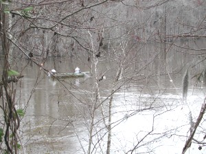
Snow's Island is an area of swampy lowlands along the Pee Dee River in Florence County, South Carolina. The area is historically significant as the headquarters during the American Revolutionary War for forces led by Francis Marion (1732-1795), a South Carolina militia officer who is celebrated as the "Swamp Fox." Employing guerrilla war tactics, Marion significantly contributed to the American war effort by conducting numerous raids on British outposts." The site was declared a National Historic Landmark in 1974.

Strawberry Chapel is a parochial chapel of ease in the lower part of St. John's, Berkeley Parish in Berkeley County, South Carolina that was built in 1725. It is on Strawberry Chapel Road between South Carolina State Highway 8-44 and the West Branch of the Cooper River. Bordering Strawberry's property is the South Carolina State owned historic site of the “Town of Childsbury.” It was a planned community that was settled in 1707. The town no longer exists. They were named to the National Register of Historic Places on April 26, 1972.
The Yadkin–Pee Dee River Basin is a large river basin in the eastern United States, covering around 7,221 square miles, making it the second largest in the state of North Carolina. Its headwaters rise near Blowing Rock, North Carolina, and the basin drains to the Atlantic Ocean in Winyah Bay, east of Georgetown, South Carolina.

Botany Bay Plantation Wildlife Management Area is a state preserve on Edisto Island, South Carolina. Botany Bay Plantation was formed in the 1930s from the merger of the Colonial-era Sea Cloud Plantation and Bleak Hall Plantation. In 1977, it was bequeathed to the state as a wildlife preserve; it was opened to the public in 2008. The preserve includes a number of registered historic sites, including two listed in the National Register of Historic Places: a set of three surviving 1840s outbuildings from Bleak Hall Plantation, and the prehistoric Fig Island shell rings.