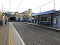
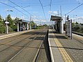
The West Midlands Metro is a light-rail/tram line in the West Midlands of England operating between Birmingham and Wolverhampton via West Bromwich and Wednesbury. It is owned and operated by Transport for West Midlands.
It opened on 30 May 1999, mostly using the former disused Birmingham Snow Hill to Wolverhampton Low Level Line. An extension into Birmingham City Centre was approved in 2012, and is now fully operational.
| Station | Photo | Co-ordinates (Links to map resources) | Notes | Usage |
|---|---|---|---|---|
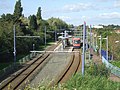
| Snow Hill |  | 52°28′59″N1°53′56″W / 52.483°N 1.899°W | Closed 24 October 2015 Replaced by St Chads |