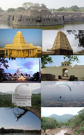
Vellore, also natively spelt as Velur, is a sprawling city and the administrative headquarters of Vellore district in the Indian state of Tamil Nadu. It is located on the banks of the Palar River in the northeastern part of Tamil Nadu and is separated into four zones that are further subdivided into 60 wards, covering an area of 87.915 km2 and housing a population of 423,425 as reported by the 2001 census. It is located about 137.20 kilometres (85 mi) west of Chennai, and about 213.20 kilometres (132 mi) east of Bangalore. Vellore is located on the Mumbai–Chennai arm of the Golden Quadrilateral. Vellore is governed under a mayor and the Vellore Municipal Corporation. It is a part of both the Lok Sabha and state assembly constituencies of Vellore.

Walajapet is a town or first municipality of Tamil Nadu and a part of Ranipet district, Vellore Metropolitan Area, in the state of Tamil Nadu. The streets in the town form a square shape which is a unique feature of the town. It will be easy for you to reach any part of the town with this kind of infrastructure. The streets are wide and nicely structured. As of 2024, the town had a population of 64,000.

Sholinghur is a municipality under Sholinghur taluk in Ranipet District of Tamil Nadu, India. The town is famous in Tamil Nadu and other neighboring states for the Lakshmi Narasimha Swamy temple.

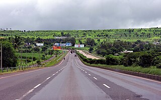
National Highway 4 was a major National Highway before National Highway renumbering in Western and Southern India. NH 4 linked four of the 10 most populous Indian cities – Mumbai, Pune, Bangalore, and Chennai. NH 4 was 1,235 km (767 mi) in length and passed through the states of Maharashtra, Karnataka b'lore and Tamil Nadu. It is now numbered as National Highway 48 (India). National Highway 4 was known as P.B.Road in many parts of Maharashtra and Karnataka states before it was renumbered.
Gandhinagar is locality in Vellore, India, located on the northern bank of the Palar River.It is divided into Gandhi Nagar East and Gandhi Nagar West, it is one of the posh residential and commercial localities in Vellore city.

Jolarpettai is a railway town in Tirupattur district, Tamil Nadu, India. It is a commuter rail hub in Southern Railway, which is one of the largest Railway Junction in Tamil nadu. It is 7 km from district headquarter Tirupattur and 18 km from Vaniyambadi.
Kaveripakkam is a town panchayat in Ranipet district in the Indian state of Tamil Nadu.
Thorapadi is a part of Vellore Corporation. It is a prominent area in the city of Vellore.

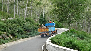
National Highway 46 was a national highway in the Indian state of Tamil Nadu. It ran from Krishnagiri to Walajapet in the state. It passed through Vellore and it was a highly important connecting road for vehicles travelling between Chennai and Bangalore. The total Length of NH 46 was 148 km (92 mi). The Krishnagiri-Walajapet section is being upgraded to six lanes by L&T on a build-operate-transfer basis.
The Walajapet block is a revenue block in the Ranipet district of Tamil Nadu, India. It has a total of 36 panchayat villages.
Arakkonam division is a revenue division in the Ranipet district of Tamil Nadu, India. It comprises the taluks of Arakkonam, Nemili, Walajapet, and Arcot.

Vellore Corporation is a civic body that governs the city of Vellore, Tamil Nadu, India. Vellore corporation consist of 60 wards and is headed by a mayor who presides over a Deputy Mayor and 60 Councillors who represent each wards in the city.
Thandalam is an emerging location of the Chennai city in the Sriperumbudur taluk of Kancheepuram district, Tamil Nadu, India. It is in the National Highway 4 (NH-4) or State Highway 84 (SH-84) at Sira Bypass. It is the village near the Chembarambakkam lake. The village is the birthplace of Tamil Thendral Thiru. V. Kalyanasundaram
Manimaran is an Indian film director, working in the Tamil film industry.

Tamil Nadu Untouchability Eradication Front (TNUEF) is one of the organisations of the Communist Party of India (Marxist). It works to eradicate the untouchability and other forms of caste oppression. It was the key organisation which worked in razing the untouchability wall at Uthapuram.
Karivedu is famed village is located in Ranipet district, Tamil Nadu. The initial present in the name of the village literally signifies the town Kalavai which is present nearby to the village. To discriminate karivedu from Vellore district the name is used by Karivelangadu. Karivedu is situated in between Arcot and Kalavai road. It is 15 km from Arcot and 8 km from Kalavai. It belongs to Arcot municipality and taluk. The postal pincode is 632506.
Sakkaramallur is an Indian village panchayat located in Arcot Taluk of Vellore District in the state of Tamil Nadu. Sakkaramallur is located on Right Bank of Palar River.

National Highway 48 is a major National Highway of India that starts at Delhi and terminates at Chennai traversing through seven states of India. It has a total length of 2807 km. NH 48 passes through the states of Delhi, Haryana, Rajasthan, Gujarat, Maharashtra, Karnataka and Tamil Nadu. The stretch between Pune and Bengaluru was known as P.B. Road in olden days.

Ranipet district is one of the 38 districts of Tamil Nadu, India, formed by trifurcating Vellore district. The Government of Tamil Nadu has announced its proposal on 15 August 2019, together with Tirupattur district. However, it was officially declared on 28 November 2019 by Tamil Nadu Government. The town of Ranipet would serve as the district headquarters.
Kasiviswanathar Temple is a historical Hindu temple dedicated to Lord Shiva, situated in Walajapet neighbourhood, Ranipet in the state of Tamil Nadu in the peninsular India. This temple is built around 300 years ago.


